Louer un logement

Condos à louer

Maisons à louer

Villas à louer

Appartements à louer

Acheter un logement

Condos à vendre

Maisons à vendre

Villas à vendre

Terrains à vendre

Explorer

Zones

Utilisez la carte interactive pour passer de 77 provinces à 928 districts et 7 425 sous-districts, puis comparez logements, prix, projets et guides locaux.

Parcourir les projets

Recherchez des copropriétés, lotissements et programmes immobiliers avec des annonces actives

Logements près des transports, écoles et sites d’intérêt

Choisissez un lieu important pour votre quotidien, puis comparez les locations et biens à vendre à proximité. Chaque lieu ci-dessous dispose d’annonces actives dans sa zone de recherche.

Opportunités approuvées par les propriétaires

Explorez les biens dont les propriétaires ont confirmé un prix et sont ouverts à une discussion, y compris ceux qui ne sont pas pressés de vendre.

Trouvez un agent près de chez vous

Parcourez des agents et agences immobilières vérifiés par province, avec leurs annonces actives et avis.

Ressources

Guides et analyses

Rapport sur le marché immobilier en Thaïlande

Les provinces comptant le plus d'annonces actives sur le réseau. Cliquez sur une province pour consulter son rapport de marché complet.

Meilleurs guides

Sélection des meilleures zones où acheter, louer et vivre en Thaïlande

Opportunités de visa

Types de visas, extensions et démarches en Thaïlande

Droit immobilier en Thaïlande

Des guides clairs du droit immobilier thaïlandais, vérifiés auprès de sources officielles — pour les acheteurs étrangers, les acheteurs thaïlandais et les locataires.

Carte de l'historique des inondations en Thaïlande

Outil gratuit : vérifiez si une adresse, un soi ou un projet de condo en Thaïlande a déjà été inondé, à partir d'observations satellitaires historiques (SAR) des inondations.

Actualités immobilières

Les dernières évolutions des visas, de la fiscalité et du droit immobilier en Thaïlande, vérifiées auprès de sources officielles.

Tous les articles

Conseils, analyses de marché et guides immobiliers

Outils

Calculateur de prêt immobilier en Thaïlande

Estimez la mensualité d'un prêt immobilier à partir du prix, de l'apport, du taux annuel et de la durée que vous saisissez.

Calculateur de frais de transfert

Estimez les taxes et frais liés aux transferts de propriété en Thaïlande

Conversion d'unités

Convertissez les unités de surface thaïlandaises et internationales

  • Condos à louer
  • Maisons à louer
  • Villas à louer
  • Appartements à louer
  • Condos à vendre
  • Maisons à vendre
  • Villas à vendre
  • Terrains à vendre
  • Zones
  • Parcourir les projets
  • Logements près des transports, écoles et sites d’intérêt
  • Opportunités approuvées par les propriétaires
  • Trouvez un agent près de chez vous
  • Rapport sur le marché immobilier en Thaïlande
  • Meilleurs guides
  • Opportunités de visa
  • Droit immobilier en Thaïlande
  • Carte de l'historique des inondations en Thaïlande
  • Actualités immobilières
  • Tous les articles
  • Calculateur de prêt immobilier en Thaïlande
  • Calculateur de frais de transfert
  • Conversion d'unités

Pourquoi BaanMe ?

Agents vérifiés par pièce d'identité

Chaque agent BaanMe est vérifié à l'aide d'une pièce d'identité officielle thaïlandaise avant de pouvoir publier la moindre annonce — vous savez donc toujours exactement à qui vous avez affaire, et les personnes malveillantes sont bannies définitivement.

Messagerie sécurisée (à venir)

Nous développons la messagerie intégrée. En attendant, les moyens de contact dépendent de l’agent et de l’annonce.

Protection de la caution (bientôt disponible)

Bientôt, BaanMe conservera votre caution en dépôt fiduciaire et examinera chaque réclamation nous-mêmes — pour que les retenues injustes et les propriétaires disparus appartiennent au passé.

Accompagnement contractuel

Avant de signer, demandez à votre agent quelles langues et conditions contractuelles sont disponibles.

Impact environnemental

Nous nous soucions de votre environnement, du nôtre et de celui de tous. C'est pourquoi nous nous sommes engagés à reboiser la forêt tropicale de Pai, en Thaïlande, avec l'aide de Conserve Natural Forests, une ONG locale dédiée à la restauration forestière à Pai et ses environs.

Régions

  • Logements à Bangkok
  • Logements à Chiang Mai
  • Logements à Samut Prakan
  • Logements à Phetchabun
  • Logements à Lamphun
  • Logements à Nonthaburi
  • Logements à Chiang Rai
  • Logements à Chon Buri

Parcourir les biens

  • Condos à louer à Bangkok
  • Appartements à louer à Bangkok
  • Maisons à louer à Chiang Mai
  • Bureaux à louer à Bangkok
  • Entrepôts à louer à Bangkok
  • Maisons à louer à Koh Samui
  • Tous les biens →

FAQ

  • Thailand Property Market Trends 2026: A Selective Recovery
  • Plus →

BaanMe

  • À propos de BaanMe
  • Demandes presse
  • Ressources de marque
  • Politique de confidentialité
  • Conditions générales
  • Crédits cartographiques
  • Aide
  • Ajouter BaanMe comme source préférée sur Google
  • Supprimer le compte

© Niklas Benjamin Muegge, 2026

  1. Accueil
  2. Baan Aya
Baan Aya
AperçuÉquipementsFaits & ChiffresEmplacementAvisCondos disponiblesProjets à proximité

Baan Aya

Voir les condos disponibles
Dans Baan Aya
Équipements
  • Place de parking
  • Vidéosurveillance
Faits et statistiques

2008

Achèvement

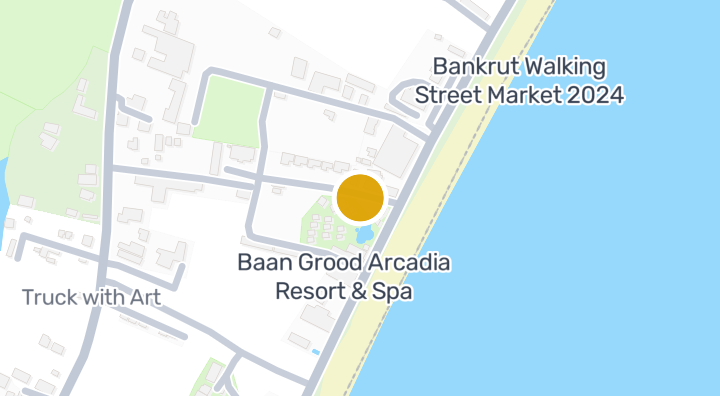
Emplacement

Prachuap Khiri Khan

Susceptibilité aux effondrements (DMR) : baanme.areaPage.governmentStats.flood.sinkholeBand.potential

81 min

vers Prachuap Khiri Khan Military Airport

trajet

10 min

Prachuap Khiri Khan

Vérifiez votre trajet

Enregistrez des lieux et comparez les temps de trajet depuis ce logement.

Quartier
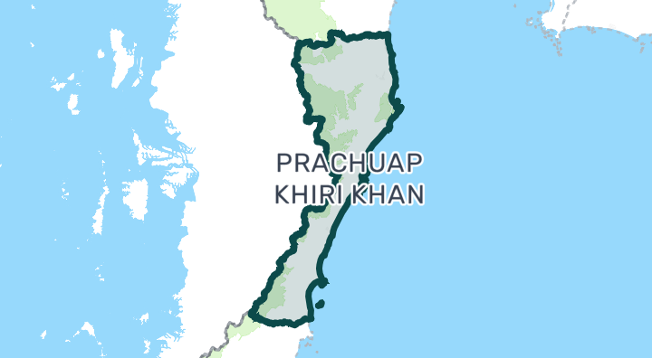
Prachuap Khiri Khan

Prachuap Khiri Khan

Prachuap Khiri Khan province is best known for Hua Hin, Thailand's oldest seaside resort and a favorite of the Thai royal family. Unlike Phuket or Pattaya, Hua Hin has a distinctly Thai character with a growing international community. The region offers long sandy beaches, world-class golf courses, and a relaxed pace of life — all within driving distance of Bangkok. It's particularly popular with Scandinavian and European retirees, and Bangkok families seeking weekend homes. Hua Hin — The main town. Night markets, beaches, Bluport and Market Village malls, and a walkable town center. Condos line the beachfront; housing estates spread west toward the hills. Well-established expat infrastructure with international restaurants, hospitals, and English-speaking services. Pran Buri / Pak Nam Pran — 30 minutes south of Hua Hin. Quieter, more boutique-oriented. Popular for stylish beachfront homes and eco-resorts. Less developed infrastructure but growing fast. Cha-am — Just north of Hua Hin (technically in Phetchaburi province but part of the same market). More affordable beachfront condos. Popular with Thai weekenders. Retirees — Large European expat community, excellent hospitals, golf courses, mild pace of life Bangkok weekenders — 2.5-hour drive makes it Thailand's most accessible beach market from the capital Golf enthusiasts — 10+ championship courses including Black Mountain, Banyan, and Royal Hua Hin Value seekers — Beachfront living at a fraction of Phuket or Samui prices Hua Hin condos range from 40,000–100,000 THB/sqm, significantly below Bangkok or Phuket. Beachfront 1-bed condos start around 2–4 million THB. Pool villas in housing estates go for 5–15 million THB. Larger beachfront properties reach 20–50+ million THB. Rentals are affordable — 10,000–25,000 THB/month for a condo, 20,000–60,000 THB for a house with pool. Hua Hin is accessible via the Phetkasem Highway from Bangkok (2.5–3 hours by car). There is a train station on the southern line with daily services to Bangkok. A small airport exists but has limited commercial service. Most residents rely on private vehicles. A planned motorway extension from Bangkok will cut travel times further. Hua Hin has a more Thai-oriented market than Phuket — prices are lower but so is the short-term rental demand from international tourists. The western hills (toward Kaeng Krachan National Park) offer cooler temperatures and dramatic scenery — popular for boutique developments. Healthcare is well-served by Bangkok Hospital Hua Hin and San Paulo Hospital. The market is seasonal — peak rental demand is Nov–Mar (cool season) and Thai holiday weekends. Off-season occupancy can be low.

Découvrir Prachuap Khiri Khan

Risques et contexte du lieu

inondation fluvialeÉlevé(estimé)
crue soudaineDonnées insuffisantes(base non disponible)
sécheresseMoyen(basé sur la zone environnante)
mauvaise qualité de l'airMoyen(observé)
risque d'incendieDonnées insuffisantes(base non disponible)
chaleur extrêmeDonnées insuffisantes(base non disponible)
Inondation fluviale
Hauteur au-dessus du drainage le plus proche : -16.178172354103282 m. Il s’agit d’un indicateur indirect.
Portée des données: Analyse préliminaire modélisée · Confiance : Moyen
Crue soudaine
Aucune donnée exploitable disponible.
Portée des données: Données insuffisantes
Sécheresse
Les pluies étaient inférieures à la normale locale dans 18.333333333333332% des périodes de 10 jours analysées. Le classement régional utilise des seuils définis par le projet.
Portée des données: Contexte de la zone · Confiance : Moyen
Qualité de l’air
Moyenne annuelle de PM2.5 : 19.071440222968825 µg/m³, source : OpenAQ. Ce n’est pas une mesure actuelle.
Portée des données: Contexte de la zone · Confiance : Moyen
Incendie
Aucune donnée exploitable disponible.
Portée des données: Données insuffisantes
Chaleur
Aucune donnée exploitable disponible.
Portée des données: Données insuffisantes

Inondation

Inondation fluviale

Aucune observation satellite d'inondation ne couvre encore cet emplacement

Le risque d'inondation fluviale n'est évalué qu'à partir d'un seul événement d'inondation observé par satellite en 2024, couvrant quatre provinces du nord de la Thaïlande (Chiang Mai, Chiang Rai, Lamphun, Phayao). La mention « inconnu » ailleurs signifie qu'aucune observation n'existe encore — pas que la zone est sûre.

Crue soudaine

Pas encore évalué

Confiance : modérée

  • Hauteur au-dessus du drainage le plus proche : -16.2 m
  • Distance au cours d'eau le plus proche : 1197 m

Les données de terrain pour les crues soudaines proviennent des données de cours d'eau d'OpenStreetMap. Voir l'attribution OpenStreetMap

Contexte de la zone

Estimation officielle du coût de construction, maximum
12 500 THB/m² — Dans la province de Prachuap Khiri Khan
Source : Treasury Department (กรมธนารักษ์) construction cost appraisal · Licence : Open Data Common (Treasury Department building valuation catalogue) · 2024-08-15 à 2027-12-31
Estimation officielle du coût de construction, typique
7 850 THB/m² — Dans la province de Prachuap Khiri Khan
Source : Treasury Department (กรมธนารักษ์) construction cost appraisal · Licence : Open Data Common (Treasury Department building valuation catalogue) · 2024-08-15 à 2027-12-31
Estimation officielle du coût de construction, minimum
400 THB/m² — Dans la province de Prachuap Khiri Khan
Source : Treasury Department (กรมธนารักษ์) construction cost appraisal · Licence : Open Data Common (Treasury Department building valuation catalogue) · 2024-08-15 à 2027-12-31
Estimation foncière officielle (sous-district), maximum — valeur estimée officielle, pas un prix de marché
2 500 THB/sq_wah — Dans le sous-district de Pak Phraek
Source : Treasury Department (กรมธนารักษ์) land valuation (ราคาประเมินที่ดิน) - attach_all_20240805.csv · Licence : Open Data Common · 2024-08-14 à 2024-08-14
Estimation foncière officielle (sous-district), typique — valeur estimée officielle, pas un prix de marché
500 THB/sq_wah — Dans le sous-district de Pak Phraek
Source : Treasury Department (กรมธนารักษ์) land valuation (ราคาประเมินที่ดิน) - attach_all_20240805.csv · Licence : Open Data Common · 2024-08-14 à 2024-08-14
Estimation foncière officielle (sous-district), minimum — valeur estimée officielle, pas un prix de marché
150 THB/sq_wah — Dans le sous-district de Pak Phraek
Source : Treasury Department (กรมธนารักษ์) land valuation (ราคาประเมินที่ดิน) - attach_all_20240805.csv · Licence : Open Data Common · 2024-08-14 à 2024-08-14
Mois le plus sec
décembre — Dans la province de Prachuap Khiri Khan
Source : Open-Meteo (ERA5 reanalysis, via archive-api.open-meteo.com) · Licence : CC BY 4.0 (Attribution 4.0 International) -- https://open-meteo.com/en/licence · 1991-01-01 à 2020-12-31
Climate rainfall annual total mean mm
1 584,9 mm — Dans la province de Prachuap Khiri Khan
Source : Open-Meteo (ERA5 reanalysis, via archive-api.open-meteo.com) · Licence : CC BY 4.0 (Attribution 4.0 International) -- https://open-meteo.com/en/licence · 1991-01-01 à 2020-12-31
Mois le plus pluvieux
octobre — Dans la province de Prachuap Khiri Khan
Source : Open-Meteo (ERA5 reanalysis, via archive-api.open-meteo.com) · Licence : CC BY 4.0 (Attribution 4.0 International) -- https://open-meteo.com/en/licence · 1991-01-01 à 2020-12-31
Hauteur au-dessus du drainage le plus proche (typique)
7,3 m — Dans le sous-district de Pak Phraek
Source : Terrain-derived flash-flood indicators (HAND + slope + OSM drainage proximity; NOT a forecast or probability, not calibrated against observed events) from Copernicus DEM GLO-30 (via Mapterhorn terrain tiles) and OpenStreetMap waterway data. The banded metric flags whether the region CONTAINS terrain susceptible to flash flooding somewhere within it -- not the susceptibility of the region as a whole, and not of any individual property. · Licence : Copernicus WorldDEM-30 Licence, commercial use permitted (see ./region-elevation.ts's ELEVATION_SOURCE_LICENSE for the full citation) combined with OpenStreetMap contributors: ODbL 1.0 (https://www.openstreetmap.org/copyright) · 2010-12-12 à 2015-01-07
Hauteur au-dessus du drainage le plus proche (10% les plus bas)
-4,7 m — Dans le sous-district de Pak Phraek
Source : Terrain-derived flash-flood indicators (HAND + slope + OSM drainage proximity; NOT a forecast or probability, not calibrated against observed events) from Copernicus DEM GLO-30 (via Mapterhorn terrain tiles) and OpenStreetMap waterway data. The banded metric flags whether the region CONTAINS terrain susceptible to flash flooding somewhere within it -- not the susceptibility of the region as a whole, and not of any individual property. · Licence : Copernicus WorldDEM-30 Licence, commercial use permitted (see ./region-elevation.ts's ELEVATION_SOURCE_LICENSE for the full citation) combined with OpenStreetMap contributors: ODbL 1.0 (https://www.openstreetmap.org/copyright) · 2010-12-12 à 2015-01-07
Pente du terrain (typique)
0,6% — Dans le sous-district de Pak Phraek
Source : Terrain-derived flash-flood indicators (HAND + slope + OSM drainage proximity; NOT a forecast or probability, not calibrated against observed events) from Copernicus DEM GLO-30 (via Mapterhorn terrain tiles) and OpenStreetMap waterway data. The banded metric flags whether the region CONTAINS terrain susceptible to flash flooding somewhere within it -- not the susceptibility of the region as a whole, and not of any individual property. · Licence : Copernicus WorldDEM-30 Licence, commercial use permitted (see ./region-elevation.ts's ELEVATION_SOURCE_LICENSE for the full citation) combined with OpenStreetMap contributors: ODbL 1.0 (https://www.openstreetmap.org/copyright) · 2010-12-12 à 2015-01-07
Pente du terrain (10% les plus raides)
4% — Dans le sous-district de Pak Phraek
Source : Terrain-derived flash-flood indicators (HAND + slope + OSM drainage proximity; NOT a forecast or probability, not calibrated against observed events) from Copernicus DEM GLO-30 (via Mapterhorn terrain tiles) and OpenStreetMap waterway data. The banded metric flags whether the region CONTAINS terrain susceptible to flash flooding somewhere within it -- not the susceptibility of the region as a whole, and not of any individual property. · Licence : Copernicus WorldDEM-30 Licence, commercial use permitted (see ./region-elevation.ts's ELEVATION_SOURCE_LICENSE for the full citation) combined with OpenStreetMap contributors: ODbL 1.0 (https://www.openstreetmap.org/copyright) · 2010-12-12 à 2015-01-07
Distance au cours d'eau le plus proche (typique)
1 510,6 m — Dans le sous-district de Pak Phraek
Source : Terrain-derived flash-flood indicators (HAND + slope + OSM drainage proximity; NOT a forecast or probability, not calibrated against observed events) from Copernicus DEM GLO-30 (via Mapterhorn terrain tiles) and OpenStreetMap waterway data. The banded metric flags whether the region CONTAINS terrain susceptible to flash flooding somewhere within it -- not the susceptibility of the region as a whole, and not of any individual property. · Licence : Copernicus WorldDEM-30 Licence, commercial use permitted (see ./region-elevation.ts's ELEVATION_SOURCE_LICENSE for the full citation) combined with OpenStreetMap contributors: ODbL 1.0 (https://www.openstreetmap.org/copyright) · 2010-12-12 à 2015-01-07
Distance au cours d'eau le plus proche (10% les plus proches)
259,6 m — Dans le sous-district de Pak Phraek
Source : Terrain-derived flash-flood indicators (HAND + slope + OSM drainage proximity; NOT a forecast or probability, not calibrated against observed events) from Copernicus DEM GLO-30 (via Mapterhorn terrain tiles) and OpenStreetMap waterway data. The banded metric flags whether the region CONTAINS terrain susceptible to flash flooding somewhere within it -- not the susceptibility of the region as a whole, and not of any individual property. · Licence : Copernicus WorldDEM-30 Licence, commercial use permitted (see ./region-elevation.ts's ELEVATION_SOURCE_LICENSE for the full citation) combined with OpenStreetMap contributors: ODbL 1.0 (https://www.openstreetmap.org/copyright) · 2010-12-12 à 2015-01-07
Sensibilité du terrain aux crues soudaines
faible — Dans le sous-district de Pak Phraek
Source : Terrain-derived flash-flood indicators (HAND + slope + OSM drainage proximity; NOT a forecast or probability, not calibrated against observed events) from Copernicus DEM GLO-30 (via Mapterhorn terrain tiles) and OpenStreetMap waterway data. The banded metric flags whether the region CONTAINS terrain susceptible to flash flooding somewhere within it -- not the susceptibility of the region as a whole, and not of any individual property. · Licence : Copernicus WorldDEM-30 Licence, commercial use permitted (see ./region-elevation.ts's ELEVATION_SOURCE_LICENSE for the full citation) combined with OpenStreetMap contributors: ODbL 1.0 (https://www.openstreetmap.org/copyright) · 2010-12-12 à 2015-01-07
Altitude, maximum
146,1 m — Dans le sous-district de Pak Phraek
Source : Mapterhorn terrain tiles (Copernicus DEM GLO-30 / WorldDEM-30, terrarium encoding, via tiles.mapterhorn.com) · Licence : Copernicus WorldDEM-30 Licence (COP-DEM-GLO-30-F, 'Global 30m Full, Free & Open' -- https://documentation.dataspace.copernicus.eu/APIs/SentinelHub/Data/DEM/resources/license/License-COPDEM-30.pdf); free of charge, reproduction/distribution/public-communication/adaptation all granted, commercial use permitted; required notice: "produced using Copernicus WorldDEM-30 © DLR e.V. 2010-2014 and © Airbus Defence and Space GmbH 2014-2018 provided under COPERNICUS by the European Union and ESA; all rights reserved." Tiles served by Mapterhorn (© Mapterhorn, https://mapterhorn.com/attribution) -- both notices required. · 2010-12-12 à 2015-01-07
Altitude, typique
29,6 m — Dans le sous-district de Pak Phraek
Source : Mapterhorn terrain tiles (Copernicus DEM GLO-30 / WorldDEM-30, terrarium encoding, via tiles.mapterhorn.com) · Licence : Copernicus WorldDEM-30 Licence (COP-DEM-GLO-30-F, 'Global 30m Full, Free & Open' -- https://documentation.dataspace.copernicus.eu/APIs/SentinelHub/Data/DEM/resources/license/License-COPDEM-30.pdf); free of charge, reproduction/distribution/public-communication/adaptation all granted, commercial use permitted; required notice: "produced using Copernicus WorldDEM-30 © DLR e.V. 2010-2014 and © Airbus Defence and Space GmbH 2014-2018 provided under COPERNICUS by the European Union and ESA; all rights reserved." Tiles served by Mapterhorn (© Mapterhorn, https://mapterhorn.com/attribution) -- both notices required. · 2010-12-12 à 2015-01-07
Altitude, minimum
5,8 m — Dans le sous-district de Pak Phraek
Source : Mapterhorn terrain tiles (Copernicus DEM GLO-30 / WorldDEM-30, terrarium encoding, via tiles.mapterhorn.com) · Licence : Copernicus WorldDEM-30 Licence (COP-DEM-GLO-30-F, 'Global 30m Full, Free & Open' -- https://documentation.dataspace.copernicus.eu/APIs/SentinelHub/Data/DEM/resources/license/License-COPDEM-30.pdf); free of charge, reproduction/distribution/public-communication/adaptation all granted, commercial use permitted; required notice: "produced using Copernicus WorldDEM-30 © DLR e.V. 2010-2014 and © Airbus Defence and Space GmbH 2014-2018 provided under COPERNICUS by the European Union and ESA; all rights reserved." Tiles served by Mapterhorn (© Mapterhorn, https://mapterhorn.com/attribution) -- both notices required. · 2010-12-12 à 2015-01-07
Altitude, amplitude
140,3 m — Dans le sous-district de Pak Phraek
Source : Mapterhorn terrain tiles (Copernicus DEM GLO-30 / WorldDEM-30, terrarium encoding, via tiles.mapterhorn.com) · Licence : Copernicus WorldDEM-30 Licence (COP-DEM-GLO-30-F, 'Global 30m Full, Free & Open' -- https://documentation.dataspace.copernicus.eu/APIs/SentinelHub/Data/DEM/resources/license/License-COPDEM-30.pdf); free of charge, reproduction/distribution/public-communication/adaptation all granted, commercial use permitted; required notice: "produced using Copernicus WorldDEM-30 © DLR e.V. 2010-2014 and © Airbus Defence and Space GmbH 2014-2018 provided under COPERNICUS by the European Union and ESA; all rights reserved." Tiles served by Mapterhorn (© Mapterhorn, https://mapterhorn.com/attribution) -- both notices required. · 2010-12-12 à 2015-01-07
Part des périodes de 10 jours en déficit pluviométrique (10 ans)
18,3% — Dans le district de Bang Saphan Noi
Source : Climate Hazards Center UC Santa Barbara & WFP -- Thailand: Rainfall Indicators at Subnational Level (HDX) · Licence : CC BY (Creative Commons Attribution International) · 2016-01-01 à 2025-12-31
Pire déficit pluviométrique sur 3 mois (10 ans)
26,7% — Dans le district de Bang Saphan Noi
Source : Climate Hazards Center UC Santa Barbara & WFP -- Thailand: Rainfall Indicators at Subnational Level (HDX) · Licence : CC BY (Creative Commons Attribution International) · 2016-01-01 à 2025-12-31
PM10, moyenne annuelle
41,8 µg/m³ — Dans la province de Prachuap Khiri Khan
Source : OpenAQ — Hua Hin Weather Station Prachuap Khiri Khan Meteorological Station-364729 (reference) · Licence : Open Data Common (Pollution Control Department) · 2025-01-01 à 2026-01-01
PM2,5, moyenne annuelle
19,1 µg/m³ — Dans la province de Prachuap Khiri Khan
Source : OpenAQ — Hua Hin Weather Station Prachuap Khiri Khan Meteorological Station-364729 (reference) · Licence : Open Data Common (Pollution Control Department) · 2025-01-01 à 2026-01-01
Précipitations des 3 derniers mois par rapport à la normale
125,4% — Dans le district de Bang Saphan Noi
Source : Climate Hazards Center UC Santa Barbara & WFP -- Thailand: Rainfall Indicators at Subnational Level (HDX) · Licence : CC BY (Creative Commons Attribution International) · 2026-07-01 à 2026-09-21
En savoir plus sur cette zone

Cette analyse préliminaire ne constitue ni une garantie de sécurité, ni une prévision des risques futurs, ni une inspection sur place.

Avis sur la propriété

Aucun avis pour le moment — soyez le premier à en laisser un.

Avis

Laisser un avis

Connexion requise. Un avis par projet.

Connectez-vous pour laisser un avis.

Projets à proximité
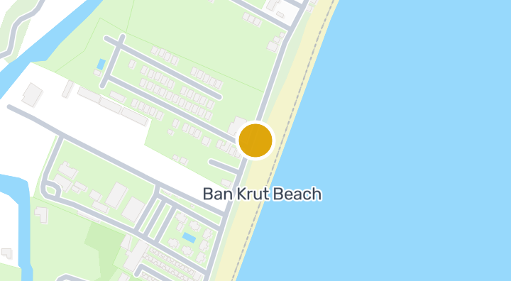
Golden Star Residence

Golden Star Residence

Condominium

Livinghouse Thailand Condominium

Livinghouse Thailand Condominium

Condominium

Baan Grood Arcadia Resort and Spa

Baan Grood Arcadia Resort and Spa

Condominium

Soyez averti dès qu'une nouvelle unité est disponible dans Baan Aya.

Voir les condos disponibles
Dans Baan Aya

À découvrir aussi

  • Parcourir les biens

    BaanMe — votre plateforme de confiance pour les annonces immobilières, les analyses du marché et l'intelligence immobilière.

  • Explorer les 77 provinces de Thaïlande

    Utilisez la carte interactive pour passer de 77 provinces à 928 districts et 7 425 sous-districts, puis comparez logements, prix, projets et guides locaux.

  • Logements près des transports, écoles et sites d’intérêt

    Choisissez un lieu important pour votre quotidien, puis comparez les locations et biens à vendre à proximité. Chaque lieu ci-dessous dispose d’annonces actives dans sa zone de recherche.

  • Rapport sur le marché immobilier en Thaïlande

    Prix médians demandés pour toutes les annonces actives à Thaïlande, en bahts thaïlandais.