賃貸物件を探す

賃貸コンドミニアム

賃貸一戸建て

賃貸ヴィラ

賃貸アパート

物件を購入

販売コンドミニアム

販売一戸建て

販売ヴィラ

販売中の土地

探す

エリア

インタラクティブ地図で77県から928郡・7,425地区へ進み、地域の物件、価格、プロジェクト、エリアガイドを比較できます。

プロジェクトを探す

掲載中のコンドミニアム、住宅団地、開発プロジェクトを検索

交通機関・学校・ランドマーク周辺の住まい

毎日の暮らしで大切な場所を選び、周辺の最新の賃貸・売買物件を比較できます。以下の場所にはすべて検索範囲内に掲載中の物件があります。

所有者が承認した売却機会

価格を確認済みで、相談に応じる意思がある所有者の物件を探せます。売却を急いでいない所有者の物件も含まれます。

近くのエージェントを探す

県ごとに認証済みの不動産エージェント・仲介会社を、掲載中の物件やレビューとともに閲覧できます。

リソース

ガイドと市場情報

タイ不動産市場レポート

ネットワーク上でアクティブな掲載が最も多い県です。県をクリックすると詳細な市場レポートを表示します。

おすすめガイド

タイで購入・賃貸・生活するのに最適なエリアを厳選

ビザ情報

タイのビザ種類、延長、申請について

タイの不動産法

公式情報源で確認した、外国人購入者・タイ人購入者・賃借人向けのわかりやすいタイ不動産法ガイド。

タイ洪水履歴マップ

無料ツール:過去の衛星(SAR)による洪水観測データを使って、タイの住所、ソイ、コンドミニアムプロジェクトが過去に浸水したことがあるかを確認できます。

不動産ニュース

公式情報源で確認した、タイのビザ・税金・不動産法に関する最新情報。

すべての記事

お役立ち情報、市場動向、物件ガイド

ツール

タイ住宅ローン計算機

入力した物件価格、頭金、年利、返済期間から住宅ローンの毎月の返済額を試算します。

移転費用計算ツール

タイの不動産移転にかかる税金・費用を計算

単位換算

タイの土地単位と国際単位を換算

  • 賃貸コンドミニアム
  • 賃貸一戸建て
  • 賃貸ヴィラ
  • 賃貸アパート
  • 販売コンドミニアム
  • 販売一戸建て
  • 販売ヴィラ
  • 販売中の土地
  • エリア
  • プロジェクトを探す
  • 交通機関・学校・ランドマーク周辺の住まい
  • 所有者が承認した売却機会
  • 近くのエージェントを探す
  • タイ不動産市場レポート
  • おすすめガイド
  • ビザ情報
  • タイの不動産法
  • タイ洪水履歴マップ
  • 不動産ニュース
  • すべての記事
  • タイ住宅ローン計算機
  • 移転費用計算ツール
  • 単位換算

BaanMeが選ばれる理由

本人確認済みエージェント

BaanMeのエージェントは、掲載を開始する前にタイ政府発行のIDで本人確認を行います。取引相手が誰なのかが常に明確で、悪質な業者は永久に利用停止となります。

安全なアプリ内チャット(近日公開)

アプリ内メッセージ機能を開発中です。公開前の連絡方法は仲介業者と物件によって異なります。

デポジット保護(近日公開)

近日、BaanMeが敷金をエスクローで管理し、すべての請求内容を審査します。不当な減額やオーナーの音信不通といった問題を防ぎます。

契約サポート

署名前に、対応可能な契約言語と条件を仲介業者に確認してください。

環境への取り組み

私たちはあなたと私たち、そしてすべての人の環境を大切にしています。そのため、パーイ地域の森林再生に取り組む地元NGO「Conserve Natural Forests」と協力し、タイ・パーイの熱帯雨林再生に力を注いでいます。

地域

  • Bangkokの物件
  • Chiang Maiの物件
  • Samut Prakanの物件
  • Phetchabunの物件
  • Lamphunの物件
  • Nonthaburiの物件
  • Chiang Raiの物件
  • Chon Buriの物件

物件を探す

  • バンコクの賃貸コンドミニアム
  • バンコクの賃貸アパート
  • チェンマイの賃貸一戸建て
  • バンコクの賃貸オフィス
  • バンコクの賃貸倉庫
  • サムイ島の賃貸一戸建て
  • すべての物件 →

よくある質問

  • Thailand Property Market Trends 2026: A Selective Recovery
  • その他 →

BaanMe

  • BaanMeについて
  • 報道関係のお問い合わせ
  • ブランド素材
  • プライバシーポリシー
  • 利用規約
  • 地図の帰属について
  • ヘルプ
  • Google で BaanMe を優先ソースに追加
  • アカウントを削除

© Niklas Benjamin Muegge, 2026

  1. ホーム
  2. Baan Aya
Baan Aya
概要施設データと統計ロケーションレビュー空室のあるコンドミニアム近くのプロジェクト

Baan Aya

空室のあるコンドミニアムを見る
Baan Aya内
設備
  • 駐車スペース
  • CCTV
基本情報

2008

完成年

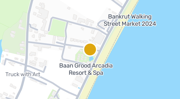
所在地

Prachuap Khiri Khan

陥没発生可能性(DMR):baanme.areaPage.governmentStats.flood.sinkholeBand.potential

81分

Prachuap Khiri Khan Military Airportまで

通勤時間

10分

Prachuap Khiri Khan

通勤時間を確認

場所を保存し、この物件からの所要時間を比較できます。

周辺エリア

Prachuap Khiri Khan

Prachuap Khiri Khan

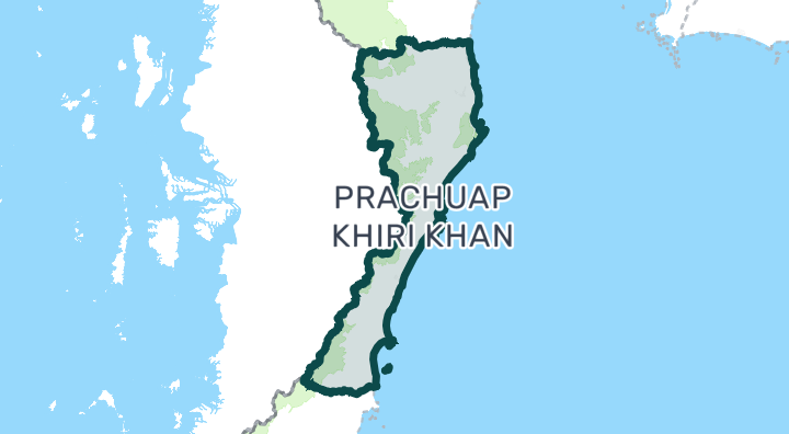
Prachuap Khiri Khan province is best known for Hua Hin, Thailand's oldest seaside resort and a favorite of the Thai royal family. Unlike Phuket or Pattaya, Hua Hin has a distinctly Thai character with a growing international community. The region offers long sandy beaches, world-class golf courses, and a relaxed pace of life — all within driving distance of Bangkok. It's particularly popular with Scandinavian and European retirees, and Bangkok families seeking weekend homes. Hua Hin — The main town. Night markets, beaches, Bluport and Market Village malls, and a walkable town center. Condos line the beachfront; housing estates spread west toward the hills. Well-established expat infrastructure with international restaurants, hospitals, and English-speaking services. Pran Buri / Pak Nam Pran — 30 minutes south of Hua Hin. Quieter, more boutique-oriented. Popular for stylish beachfront homes and eco-resorts. Less developed infrastructure but growing fast. Cha-am — Just north of Hua Hin (technically in Phetchaburi province but part of the same market). More affordable beachfront condos. Popular with Thai weekenders. Retirees — Large European expat community, excellent hospitals, golf courses, mild pace of life Bangkok weekenders — 2.5-hour drive makes it Thailand's most accessible beach market from the capital Golf enthusiasts — 10+ championship courses including Black Mountain, Banyan, and Royal Hua Hin Value seekers — Beachfront living at a fraction of Phuket or Samui prices Hua Hin condos range from 40,000–100,000 THB/sqm, significantly below Bangkok or Phuket. Beachfront 1-bed condos start around 2–4 million THB. Pool villas in housing estates go for 5–15 million THB. Larger beachfront properties reach 20–50+ million THB. Rentals are affordable — 10,000–25,000 THB/month for a condo, 20,000–60,000 THB for a house with pool. Hua Hin is accessible via the Phetkasem Highway from Bangkok (2.5–3 hours by car). There is a train station on the southern line with daily services to Bangkok. A small airport exists but has limited commercial service. Most residents rely on private vehicles. A planned motorway extension from Bangkok will cut travel times further. Hua Hin has a more Thai-oriented market than Phuket — prices are lower but so is the short-term rental demand from international tourists. The western hills (toward Kaeng Krachan National Park) offer cooler temperatures and dramatic scenery — popular for boutique developments. Healthcare is well-served by Bangkok Hospital Hua Hin and San Paulo Hospital. The market is seasonal — peak rental demand is Nov–Mar (cool season) and Thai holiday weekends. Off-season occupancy can be low.

Prachuap Khiri Khanを見る

立地のリスクと周辺情報

河川氾濫高(推定に基づく)
鉄砲水データ不足(根拠不明)
干ばつ中(周辺地域に基づく)
大気質の悪化中(実測に基づく)
火災リスクデータ不足(根拠不明)
猛暑データ不足(根拠不明)
河川洪水
最寄りの排水経路からの比高は -16.178172354103282 m です。間接的な指標です。
資料の対象範囲: モデルによるスクリーニング · 信頼度:中
鉄砲水・急な洪水
分析に利用できる資料がありません。
資料の対象範囲: 根拠が不足しています
干ばつ
分析した10日間の期間の 18.333333333333332% で降雨が地域の平年値を下回りました。地域判定には本プロジェクトの基準を使用します。
資料の対象範囲: 周辺地域の状況 · 信頼度:中
大気質
PM2.5 の年平均は 19.071440222968825 µg/m³、出典は OpenAQ です。現在の大気質ではありません。
資料の対象範囲: 周辺地域の状況 · 信頼度:中
火災
分析に利用できる資料がありません。
資料の対象範囲: 根拠が不足しています
暑熱
分析に利用できる資料がありません。
資料の対象範囲: 根拠が不足しています

洪水

河川氾濫

この場所をカバーする衛星による洪水観測データはまだありません

河川氾濫リスクは、タイ北部の4県(チェンマイ、チェンライ、ランプーン、パヤオ)をカバーする2024年の単一の衛星観測イベントのみに基づいて評価されています。それ以外の地域で「未確認」と表示される場合、観測データがまだ存在しないことを意味し、安全であることを意味するものではありません。

鉄砲水

未評価

信頼度:中

  • 最寄りの排水路からの高さ:-16.2 m
  • 最寄りの水路までの距離:1197 m

鉄砲水の地形データはOpenStreetMapの水路データに基づいています。 OpenStreetMapの帰属表示を見る

周辺エリア情報

政府建設コスト見積り(最大)
12,500 THB/m² — Prachuap Khiri Khan県内
出典:Treasury Department (กรมธนารักษ์) construction cost appraisal · ライセンス:Open Data Common (Treasury Department building valuation catalogue) · 2024-08-15〜2027-12-31
政府建設コスト見積り(中央値)
7,850 THB/m² — Prachuap Khiri Khan県内
出典:Treasury Department (กรมธนารักษ์) construction cost appraisal · ライセンス:Open Data Common (Treasury Department building valuation catalogue) · 2024-08-15〜2027-12-31
政府建設コスト見積り(最小)
400 THB/m² — Prachuap Khiri Khan県内
出典:Treasury Department (กรมธนารักษ์) construction cost appraisal · ライセンス:Open Data Common (Treasury Department building valuation catalogue) · 2024-08-15〜2027-12-31
政府地価評価額(地区)(最大)(実勢価格ではなく、税・登記費用算定用の評価額)
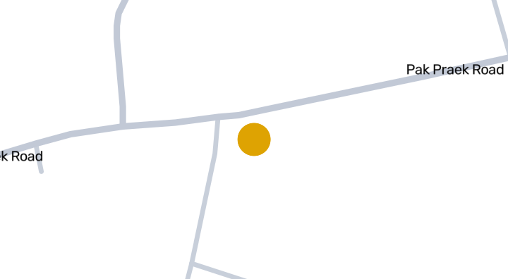
2,500 THB/sq_wah — Pak Phraek地区内
出典:Treasury Department (กรมธนารักษ์) land valuation (ราคาประเมินที่ดิน) - attach_all_20240805.csv · ライセンス:Open Data Common · 2024-08-14〜2024-08-14
政府地価評価額(地区)(中央値)(実勢価格ではなく、税・登記費用算定用の評価額)
500 THB/sq_wah — Pak Phraek地区内
出典:Treasury Department (กรมธนารักษ์) land valuation (ราคาประเมินที่ดิน) - attach_all_20240805.csv · ライセンス:Open Data Common · 2024-08-14〜2024-08-14
政府地価評価額(地区)(最小)(実勢価格ではなく、税・登記費用算定用の評価額)
150 THB/sq_wah — Pak Phraek地区内
出典:Treasury Department (กรมธนารักษ์) land valuation (ราคาประเมินที่ดิน) - attach_all_20240805.csv · ライセンス:Open Data Common · 2024-08-14〜2024-08-14
最も乾燥する月
12月 — Prachuap Khiri Khan県内
出典:Open-Meteo (ERA5 reanalysis, via archive-api.open-meteo.com) · ライセンス:CC BY 4.0 (Attribution 4.0 International) -- https://open-meteo.com/en/licence · 1991-01-01〜2020-12-31
Climate rainfall annual total mean mm
1,584.9 mm — Prachuap Khiri Khan県内
出典:Open-Meteo (ERA5 reanalysis, via archive-api.open-meteo.com) · ライセンス:CC BY 4.0 (Attribution 4.0 International) -- https://open-meteo.com/en/licence · 1991-01-01〜2020-12-31
最も雨の多い月
10月 — Prachuap Khiri Khan県内
出典:Open-Meteo (ERA5 reanalysis, via archive-api.open-meteo.com) · ライセンス:CC BY 4.0 (Attribution 4.0 International) -- https://open-meteo.com/en/licence · 1991-01-01〜2020-12-31
最寄りの排水路からの高さ(中央値)
7.3 m — Pak Phraek地区内
出典:Terrain-derived flash-flood indicators (HAND + slope + OSM drainage proximity; NOT a forecast or probability, not calibrated against observed events) from Copernicus DEM GLO-30 (via Mapterhorn terrain tiles) and OpenStreetMap waterway data. The banded metric flags whether the region CONTAINS terrain susceptible to flash flooding somewhere within it -- not the susceptibility of the region as a whole, and not of any individual property. · ライセンス:Copernicus WorldDEM-30 Licence, commercial use permitted (see ./region-elevation.ts's ELEVATION_SOURCE_LICENSE for the full citation) combined with OpenStreetMap contributors: ODbL 1.0 (https://www.openstreetmap.org/copyright) · 2010-12-12〜2015-01-07
最寄りの排水路からの高さ(下位10%)
-4.7 m — Pak Phraek地区内
出典:Terrain-derived flash-flood indicators (HAND + slope + OSM drainage proximity; NOT a forecast or probability, not calibrated against observed events) from Copernicus DEM GLO-30 (via Mapterhorn terrain tiles) and OpenStreetMap waterway data. The banded metric flags whether the region CONTAINS terrain susceptible to flash flooding somewhere within it -- not the susceptibility of the region as a whole, and not of any individual property. · ライセンス:Copernicus WorldDEM-30 Licence, commercial use permitted (see ./region-elevation.ts's ELEVATION_SOURCE_LICENSE for the full citation) combined with OpenStreetMap contributors: ODbL 1.0 (https://www.openstreetmap.org/copyright) · 2010-12-12〜2015-01-07
地形の傾斜(中央値)
0.6% — Pak Phraek地区内
出典:Terrain-derived flash-flood indicators (HAND + slope + OSM drainage proximity; NOT a forecast or probability, not calibrated against observed events) from Copernicus DEM GLO-30 (via Mapterhorn terrain tiles) and OpenStreetMap waterway data. The banded metric flags whether the region CONTAINS terrain susceptible to flash flooding somewhere within it -- not the susceptibility of the region as a whole, and not of any individual property. · ライセンス:Copernicus WorldDEM-30 Licence, commercial use permitted (see ./region-elevation.ts's ELEVATION_SOURCE_LICENSE for the full citation) combined with OpenStreetMap contributors: ODbL 1.0 (https://www.openstreetmap.org/copyright) · 2010-12-12〜2015-01-07
地形の傾斜(急な方10%)
4% — Pak Phraek地区内
出典:Terrain-derived flash-flood indicators (HAND + slope + OSM drainage proximity; NOT a forecast or probability, not calibrated against observed events) from Copernicus DEM GLO-30 (via Mapterhorn terrain tiles) and OpenStreetMap waterway data. The banded metric flags whether the region CONTAINS terrain susceptible to flash flooding somewhere within it -- not the susceptibility of the region as a whole, and not of any individual property. · ライセンス:Copernicus WorldDEM-30 Licence, commercial use permitted (see ./region-elevation.ts's ELEVATION_SOURCE_LICENSE for the full citation) combined with OpenStreetMap contributors: ODbL 1.0 (https://www.openstreetmap.org/copyright) · 2010-12-12〜2015-01-07
最寄りの水路までの距離(中央値)
1,510.6 m — Pak Phraek地区内
出典:Terrain-derived flash-flood indicators (HAND + slope + OSM drainage proximity; NOT a forecast or probability, not calibrated against observed events) from Copernicus DEM GLO-30 (via Mapterhorn terrain tiles) and OpenStreetMap waterway data. The banded metric flags whether the region CONTAINS terrain susceptible to flash flooding somewhere within it -- not the susceptibility of the region as a whole, and not of any individual property. · ライセンス:Copernicus WorldDEM-30 Licence, commercial use permitted (see ./region-elevation.ts's ELEVATION_SOURCE_LICENSE for the full citation) combined with OpenStreetMap contributors: ODbL 1.0 (https://www.openstreetmap.org/copyright) · 2010-12-12〜2015-01-07
最寄りの水路までの距離(近い方10%)
259.6 m — Pak Phraek地区内
出典:Terrain-derived flash-flood indicators (HAND + slope + OSM drainage proximity; NOT a forecast or probability, not calibrated against observed events) from Copernicus DEM GLO-30 (via Mapterhorn terrain tiles) and OpenStreetMap waterway data. The banded metric flags whether the region CONTAINS terrain susceptible to flash flooding somewhere within it -- not the susceptibility of the region as a whole, and not of any individual property. · ライセンス:Copernicus WorldDEM-30 Licence, commercial use permitted (see ./region-elevation.ts's ELEVATION_SOURCE_LICENSE for the full citation) combined with OpenStreetMap contributors: ODbL 1.0 (https://www.openstreetmap.org/copyright) · 2010-12-12〜2015-01-07
鉄砲水に対する地形の脆弱性
低 — Pak Phraek地区内
出典:Terrain-derived flash-flood indicators (HAND + slope + OSM drainage proximity; NOT a forecast or probability, not calibrated against observed events) from Copernicus DEM GLO-30 (via Mapterhorn terrain tiles) and OpenStreetMap waterway data. The banded metric flags whether the region CONTAINS terrain susceptible to flash flooding somewhere within it -- not the susceptibility of the region as a whole, and not of any individual property. · ライセンス:Copernicus WorldDEM-30 Licence, commercial use permitted (see ./region-elevation.ts's ELEVATION_SOURCE_LICENSE for the full citation) combined with OpenStreetMap contributors: ODbL 1.0 (https://www.openstreetmap.org/copyright) · 2010-12-12〜2015-01-07
標高(最大)
146.1 m — Pak Phraek地区内
出典:Mapterhorn terrain tiles (Copernicus DEM GLO-30 / WorldDEM-30, terrarium encoding, via tiles.mapterhorn.com) · ライセンス:Copernicus WorldDEM-30 Licence (COP-DEM-GLO-30-F, 'Global 30m Full, Free & Open' -- https://documentation.dataspace.copernicus.eu/APIs/SentinelHub/Data/DEM/resources/license/License-COPDEM-30.pdf); free of charge, reproduction/distribution/public-communication/adaptation all granted, commercial use permitted; required notice: "produced using Copernicus WorldDEM-30 © DLR e.V. 2010-2014 and © Airbus Defence and Space GmbH 2014-2018 provided under COPERNICUS by the European Union and ESA; all rights reserved." Tiles served by Mapterhorn (© Mapterhorn, https://mapterhorn.com/attribution) -- both notices required. · 2010-12-12〜2015-01-07
標高(中央値)
29.6 m — Pak Phraek地区内
出典:Mapterhorn terrain tiles (Copernicus DEM GLO-30 / WorldDEM-30, terrarium encoding, via tiles.mapterhorn.com) · ライセンス:Copernicus WorldDEM-30 Licence (COP-DEM-GLO-30-F, 'Global 30m Full, Free & Open' -- https://documentation.dataspace.copernicus.eu/APIs/SentinelHub/Data/DEM/resources/license/License-COPDEM-30.pdf); free of charge, reproduction/distribution/public-communication/adaptation all granted, commercial use permitted; required notice: "produced using Copernicus WorldDEM-30 © DLR e.V. 2010-2014 and © Airbus Defence and Space GmbH 2014-2018 provided under COPERNICUS by the European Union and ESA; all rights reserved." Tiles served by Mapterhorn (© Mapterhorn, https://mapterhorn.com/attribution) -- both notices required. · 2010-12-12〜2015-01-07
標高(最小)
5.8 m — Pak Phraek地区内
出典:Mapterhorn terrain tiles (Copernicus DEM GLO-30 / WorldDEM-30, terrarium encoding, via tiles.mapterhorn.com) · ライセンス:Copernicus WorldDEM-30 Licence (COP-DEM-GLO-30-F, 'Global 30m Full, Free & Open' -- https://documentation.dataspace.copernicus.eu/APIs/SentinelHub/Data/DEM/resources/license/License-COPDEM-30.pdf); free of charge, reproduction/distribution/public-communication/adaptation all granted, commercial use permitted; required notice: "produced using Copernicus WorldDEM-30 © DLR e.V. 2010-2014 and © Airbus Defence and Space GmbH 2014-2018 provided under COPERNICUS by the European Union and ESA; all rights reserved." Tiles served by Mapterhorn (© Mapterhorn, https://mapterhorn.com/attribution) -- both notices required. · 2010-12-12〜2015-01-07
標高(範囲)
140.3 m — Pak Phraek地区内
出典:Mapterhorn terrain tiles (Copernicus DEM GLO-30 / WorldDEM-30, terrarium encoding, via tiles.mapterhorn.com) · ライセンス:Copernicus WorldDEM-30 Licence (COP-DEM-GLO-30-F, 'Global 30m Full, Free & Open' -- https://documentation.dataspace.copernicus.eu/APIs/SentinelHub/Data/DEM/resources/license/License-COPDEM-30.pdf); free of charge, reproduction/distribution/public-communication/adaptation all granted, commercial use permitted; required notice: "produced using Copernicus WorldDEM-30 © DLR e.V. 2010-2014 and © Airbus Defence and Space GmbH 2014-2018 provided under COPERNICUS by the European Union and ESA; all rights reserved." Tiles served by Mapterhorn (© Mapterhorn, https://mapterhorn.com/attribution) -- both notices required. · 2010-12-12〜2015-01-07
10日間単位での降水不足の割合(過去10年)
18.3% — Bang Saphan Noi郡内
出典:Climate Hazards Center UC Santa Barbara & WFP -- Thailand: Rainfall Indicators at Subnational Level (HDX) · ライセンス:CC BY (Creative Commons Attribution International) · 2016-01-01〜2025-12-31
過去10年で最悪の3か月降水不足
26.7% — Bang Saphan Noi郡内
出典:Climate Hazards Center UC Santa Barbara & WFP -- Thailand: Rainfall Indicators at Subnational Level (HDX) · ライセンス:CC BY (Creative Commons Attribution International) · 2016-01-01〜2025-12-31
PM10 年平均値
41.8 µg/m³ — Prachuap Khiri Khan県内
出典:OpenAQ — Hua Hin Weather Station Prachuap Khiri Khan Meteorological Station-364729 (reference) · ライセンス:Open Data Common (Pollution Control Department) · 2025-01-01〜2026-01-01
PM2.5 年平均値
19.1 µg/m³ — Prachuap Khiri Khan県内
出典:OpenAQ — Hua Hin Weather Station Prachuap Khiri Khan Meteorological Station-364729 (reference) · ライセンス:Open Data Common (Pollution Control Department) · 2025-01-01〜2026-01-01
直近3か月の降水量(平年比)
125.4% — Bang Saphan Noi郡内
出典:Climate Hazards Center UC Santa Barbara & WFP -- Thailand: Rainfall Indicators at Subnational Level (HDX) · ライセンス:CC BY (Creative Commons Attribution International) · 2026-07-01〜2026-09-21
このエリアの詳細を見る

スクリーニング資料は、安全の保証、将来のリスク予測、現地調査ではありません。

物件レビュー

まだレビューがありません。最初のレビューを投稿しましょう。

レビュー

レビューを書く

サインインが必要です。1つのプロジェクトにつきレビューは1件まで。

レビューを投稿するにはサインインしてください。

近くのプロジェクト
Golden Star Residence

Golden Star Residence

コンドミニアム

Livinghouse Thailand Condominium

Livinghouse Thailand Condominium

コンドミニアム

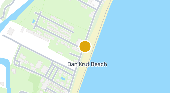
Baan Grood Arcadia Resort and Spa

Baan Grood Arcadia Resort and Spa

コンドミニアム

Baan Ayaで新しいユニットが空いたら通知します。

空室のあるコンドミニアムを見る
Baan Aya内

もっと見る

  • 物件を探す

    BaanMe — タイの不動産情報、市場データ、物件掲載を提供する信頼のプラットフォーム。

  • タイ全77県を探索

    インタラクティブ地図で77県から928郡・7,425地区へ進み、地域の物件、価格、プロジェクト、エリアガイドを比較できます。

  • 交通機関・学校・ランドマーク周辺の住まい

    毎日の暮らしで大切な場所を選び、周辺の最新の賃貸・売買物件を比較できます。以下の場所にはすべて検索範囲内に掲載中の物件があります。

  • タイ不動産市場レポート

    タイの全アクティブ物件における中央希望価格(タイバーツ)。