
Fang에 새 매물이 등록되면 알려드립니다.
지역 프로필: Fang
태국 정부 공식 자료와 공개 데이터 소스를 바탕으로 이 지역에 대해 알려진 모든 정보입니다.
필요한 각 가격 표본에 활성 매물이 최소 30개 있을 때만 중앙값과 수익률을 표시합니다. 가격은 호가입니다.
시장 현황
㎡당 가격
| 매물 유형 | 매물 | 중간 매매가 | ㎡당 가격 | 중간 월세 | 수익률 |
|---|---|---|---|---|---|
| 주택 | 1 | — | — | — | — |
| 토지 | 1 | — | — | — | — |
매물 — Fang
공식 토지 평가액 (지자체 구역)
중간값 감정가
฿500 / sq. wah
최저 감정가฿100 / sq. wah
중간값 감정가฿500 / sq. wah
최고 감정가฿3,000 / sq. wah
지가 범위는 ฿100 / sq. wah에서 ฿3,000 / sq. wah입니다
건축비 (도 중앙값)
최저 감정가฿400 / m²
중위 감정가฿7,900 / m²
최고 감정가฿13,000 / m²
건축비는 제곱미터당 ฿400 / m²에서 ฿13,000 / m² 사이입니다
인구
122,1452021년 이후 −0.4%
성별 비율
등록 인구(남성)49%
등록 인구(여성)51%
등록 가구 수
48,798
인구 밀도
149.5 명 / km²
가구당 인원수
2.5
환경
대기질
도 단위 측정값 (Chiang Mai)
PM2.5 연평균
20.6 µg/m³
WHO 권고 기준: PM2.5 5 µg/m³ / PM10 15 µg/m³. 태국 기준: PM2.5 15 µg/m³ / PM10 50 µg/m³.
지형 및 기후
최저 고도461 m
중위 고도719.6 m
최고 고도1,464.7 m
고도 범위는 461 m에서 1,464.7 m입니다
고도 범위
1,003.7 m
홍수 노출
지형에 따른 돌발홍수 취약도
최소낮음보통높음
지형 돌발홍수 취약도 등급: 보통2024년 관측된 침수 현황
평가되지 않음관측되지 않음낮음보통높음
2024년 홍수 노출 등급: 평가되지 않음2024년 홍수 당시 이 지역의 절반 미만만 위성으로 평가할 수 있었기 때문에 이 수치는 불완전합니다. 나머지 지역이 침수되지 않았다는 의미는 아닙니다.
싱크홀 발생 가능성 (DMR)
낮음보통높음매우 높음
싱크홀 발생 가능성: 매우 높음관측된 침수 면적 (2024년)
0%
위성 분석 범위
0%
가장 가까운 배수로 위 높이 (10번째 백분위수)
-62.3 m
가장 가까운 하천까지의 거리 (10번째 백분위수)
281 m
지형 경사 (90번째 백분위수)
7.2%
가뭄
1981~2010년 이후 평년값 대비 강우 부족량(CHIRPS) — 기상 관측치이며 토양 수분이 아니고 예보도 아닙니다.
최근 3개월 강우량(평년 대비)
88.5%
최근 10년간 부족했던 10일 단위 비율
10.6%
최근 10년간 최악의 3개월 부족량
35.5%
대기질
PM2.5 — OpenAQ
기준측정소
20.6 µg/m³
Fang의 편의시설
가까이 있는 것들 — 상점, 학교, 대중교통 등.
20
쇼핑
15
교육
4
의료
8
여가
42
서비스
1
자연
52
food
13
nightlife
슈퍼마켓(2)더 보기
병원(1)더 보기
공원(1)더 보기
편의시설 데이터 © OpenStreetMap 기여자
Fang 프로젝트
이 지역의 콘도미니엄 및 개발 프로젝트
Nanthawan Land And House Park Chiangmai
Nanthawan Land And House Park Chiangmai is a house project located in San Sai, Fang, Chiang Mai. The development sits in a quiet, rural part of Thailand's northern highlands, where property listings are available in the surrounding area. Points of interest nearby include Sunday Walking Street, an attraction about 13 minutes away, Old Chiang Rai Airport about 99 minutes away, and Territorial Defense Field Beach about 103 minutes away. The neighborhood is also home to Wat Nantaram school, a local educational institution serving the community.
Baan Kanrawee
Baan Kanrawee is a condominium project located in San Sai, Fang, Chiang Mai. Situated in Thailand's northern highlands, the area offers a quiet, rural setting. Nearby points of interest include Sunday Walking Street, about 13 minutes away, and Old Chiang Rai Airport, roughly 99 minutes away. Territorial Defense Field Beach is also within reach, at approximately 103 minutes away. Details about the developer, completion date, and amenities have not been provided.
Baan Maejo Green Ville
Baan Maejo Green Ville is a condominium project located in San Sai, Fang, Chiang Mai, in Thailand's northern highlands. The surrounding subdistrict offers a quiet, rural setting with property listings available in the area. Nearby attractions include Sunday Walking Street, about 13 minutes away, while Old Chiang Rai Airport is roughly 99 minutes away and Territorial Defense Field Beach is about 103 minutes from the project. The developer and completion date have not been disclosed.
Nong Chom SanSai
Nong Chom SanSai is a condominium project located in San Sai, Fang, Chiang Mai. The developer and completion date have not been disclosed, and no specific amenities have been listed for the project. The area offers access to several attractions, with Sunday Walking Street about 13 minutes away, Old Chiang Rai Airport about 99 minutes away, and Territorial Defense Field Beach about 103 minutes away. Set in Chiang Mai province, the project benefits from the region's appeal as a destination known for its mountain surroundings and quality of life.
Thungthong @ Baan Moh
Thungthong @ Baan Moh is a condominium project located in San Sai, Fang, Chiang Mai. The developer and completion date have not been disclosed. Points of interest in the area include Sunday Walking Street, roughly 13 minutes away, Old Chiang Rai Airport at about 99 minutes, and Territorial Defense Field Beach at around 103 minutes.
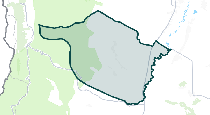
Fang 지도
지역을 탭하여 하위 지역과 세부 구역을 확인하세요.
Fang 둘러보기
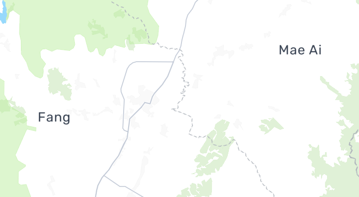
인기 지역
더 둘러보기
Fang 매물 둘러보기
원하는 조건을 정확히 찾아보세요
Fang에 대해 자주 묻는 질문
Fang에는 매매 및 임대 매물이 몇 건 있나요?
BaanMe 네트워크에는 Fang에 2건의 활성 매물이 있습니다: 매매 2건, 임대 0건입니다 (매매와 임대로 동시에 등록된 매물은 각 수치에 한 번씩 포함됩니다).
Fang 주변에는 무엇이 있습니까?
OpenStreetMap 데이터에 따르면 Fang 주변에는 2 개의 슈퍼마켓, 2 개의 병원, 1 개의 공원 및 47 개의 레스토랑과 카페이(가) 있습니다. 주변 옵션에는 Fang Hospital이(가) 포함됩니다.
Fang의 대기질은 어떻습니까?
Fang의 연평균 PM2.5는 20.6 µg/m³로, WHO 권고치인 5 µg/m³ 및 태국 기준치인 15 µg/m³와 비교됩니다. 이는 도 단위 수준의 측정값이며, 이 지역 자체의 관측소 데이터가 아닙니다.
Fang은 홍수 위험이 있습니까?
Fang의 2024년 관측된 홍수 노출도는 평가되지 않음이었습니다. 지형적 돌발홍수 취약성은 보통입니다. 싱크홀 발생 가능성(DMR 조사)은 매우 높음입니다.
Fang의 인구는 얼마입니까?
Fang의 등록 인구는 122,145명입니다 (2021년 이후 −0.4%).
Fang의 공식 토지 감정가는 얼마입니까?
태국 재무부가 산정한 Fang(이 준구 직접)의 공식 토지 평가액 중앙값은 제곱와당 ฿500입니다 — 이는 양도 수수료 및 세금 계산에 사용되는 정부 평가액이며 시장 가격이 아닙니다.
Fang은 2024년에 홍수가 있었나요?
2024년 몬순 시즌 위성 관측 결과 Fang에서 평가되지 않음 수준의 홍수 노출이 관측되었습니다. 이는 해당 사건에서 관측된 내용을 반영한 것이며, 일반적인 홍수 위험 예측이 아닙니다.
Fang의 대기 오염은 얼마나 심각합니까?
OpenAQ 기준 관측소 자료에 따르면 Fang의 PM2.5 연평균 값은 20.6 µg/m³입니다.