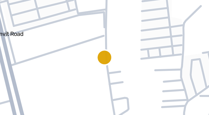
Pornthip The Chic
부대시설
- 주차 공간
주요 정보
2018
준공
위치
Bang Lamung
인근에 석회암 카르스트 지형이 있습니다(지질 정보이며 위험 등급이 아닙니다)
42분
Dokkrai Airstrip까지
주변 지역
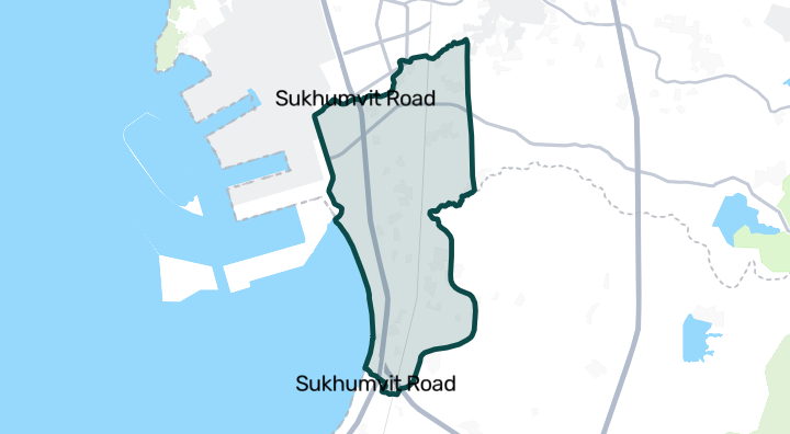
Bang Lamung
Bang Lamung is a subdistrict in Chon Buri province, carrying the same name as its parent district. It has an active property market with inventory records available for buyers and renters exploring the area. Families in Bang Lamung have access to several schools, with three nearby in total. Named options include Ban Bang Lamung School and Srisuvit School, both located within the area. Green space is available at Taksin Nation Park and Banglamung Park, giving residents places to relax outdoors. For spiritual and community gatherings, Wat Si Wanaram serves as a local place of worship. Everyday shopping is straightforward, with four convenience stores located nearby, making it easy to pick up essentials close to home.
Bang Lamung 둘러보기입지 위험 및 주변 정보
하천 홍수높음(추정 기반)
돌발 홍수낮음(추정 기반)
가뭄보통(주변 지역 기반)
대기질 악화보통(관측 기반)
화재 위험데이터 부족(근거 없음)
폭염낮음(주변 지역 기반)
- 하천 홍수
- 가장 가까운 배수로 대비 높이는 2.377412715313106m입니다. 간접 선별 지표입니다.
- 자료의 공간 범위: 모델 기반 선별 분석 · 신뢰도: 보통
- 돌발 홍수
- 지형 기반 취약성 등급은 낮음입니다. 침수 깊이 예측이 아닙니다.
- 자료의 공간 범위: 모델 기반 선별 분석 · 신뢰도: 높음
- 가뭄
- 분석한 10일 기간의 15%에서 강수량이 지역 평년값보다 낮았습니다. 지역 등급은 프로젝트 기준을 사용합니다.
- 자료의 공간 범위: 주변 지역 배경 · 신뢰도: 보통
- 대기질
- PM2.5 연평균은 19.355055209310496 µg/m³, 출처는 OpenAQ입니다. 현재 대기질 수치가 아닙니다.
- 자료의 공간 범위: 주변 지역 배경 · 신뢰도: 보통
- 화재
- 분석 가능한 자료가 없습니다.
- 자료의 공간 범위: 자료 부족
- 고온
- 월 최고기온의 연평균은 30.56176885524447 °C입니다. 지역 등급은 프로젝트 기준이며 개인 건강 예측이 아닙니다.
- 자료의 공간 범위: 주변 지역 배경 · 신뢰도: 보통
홍수
하천 범람
이 위치를 포함하는 위성 홍수 관측 데이터가 아직 없습니다
하천 범람 위험은 태국 북부 4개 주(치앙마이, 치앙라이, 람푼, 파야오)를 포함하는 2024년의 단일 위성 관측 홍수 사건만을 근거로 평가됩니다. 이 지역 밖에서 '알 수 없음'으로 표시되는 것은 아직 관측 데이터가 없다는 의미이며, 안전하다는 의미가 아닙니다.
돌발 홍수
낮음 — 하천에서 어느 정도 떨어져 있거나 고지대입니다
신뢰도: 높음
- 가장 가까운 배수로 대비 높이: 2.4 m
- 가장 가까운 수로까지의 거리: 1515 m
- 경사도: 0.6%
돌발 홍수 지형 데이터는 OpenStreetMap의 수로 데이터에서 가져왔습니다. OpenStreetMap 출처 표시 보기
주변 정보
- 정부 건설비 추정치, 최대
- 11,500 THB/m² — Chon Buri 주 내
- 출처: Treasury Department (กรมธนารักษ์) construction cost appraisal · 라이선스: Open Data Common (Treasury Department building valuation catalogue) · 2024-08-15부터 2027-12-31까지
- 정부 건설비 추정치, 중앙값
- 7,700 THB/m² — Chon Buri 주 내
- 출처: Treasury Department (กรมธนารักษ์) construction cost appraisal · 라이선스: Open Data Common (Treasury Department building valuation catalogue) · 2024-08-15부터 2027-12-31까지
- 정부 건설비 추정치, 최소
- 400 THB/m² — Chon Buri 주 내
- 출처: Treasury Department (กรมธนารักษ์) construction cost appraisal · 라이선스: Open Data Common (Treasury Department building valuation catalogue) · 2024-08-15부터 2027-12-31까지
- 정부 토지 감정가 (지자체), 최대 — 세금·등록비 산정용 감정가이며 시세가 아님
- 30,000 THB/sq_wah — Bang Lamung 면/동 내
- 출처: Treasury Department (กรมธนารักษ์) land valuation (ราคาประเมินที่ดิน) - attach_all_20240805.csv — เทศบาลตำบลบางละมุง / เทศบาลนครแหลมฉบัง (municipal area) · 라이선스: Open Data Common · 2024-08-14부터 2024-08-14까지
- 정부 토지 감정가 (지자체), 중앙값 — 세금·등록비 산정용 감정가이며 시세가 아님
- 4,750 THB/sq_wah — Bang Lamung 면/동 내
- 출처: Treasury Department (กรมธนารักษ์) land valuation (ราคาประเมินที่ดิน) - attach_all_20240805.csv — เทศบาลตำบลบางละมุง / เทศบาลนครแหลมฉบัง (municipal area) · 라이선스: Open Data Common · 2024-08-14부터 2024-08-14까지
- 정부 토지 감정가 (지자체), 최소 — 세금·등록비 산정용 감정가이며 시세가 아님
- 2,000 THB/sq_wah — Bang Lamung 면/동 내
- 출처: Treasury Department (กรมธนารักษ์) land valuation (ราคาประเมินที่ดิน) - attach_all_20240805.csv — เทศบาลตำบลบางละมุง / เทศบาลนครแหลมฉบัง (municipal area) · 라이선스: Open Data Common · 2024-08-14부터 2024-08-14까지
- 정부 토지 감정가 (하위 행정구역), 최대 — 세금·등록비 산정용 감정가이며 시세가 아님
- 4,000 THB/sq_wah — Bang Lamung 군/구 내
- 출처: Treasury Department (กรมธนารักษ์) land valuation (ราคาประเมินที่ดิน) - attach_all_20240805.csv · 라이선스: Open Data Common · 2024-08-14부터 2024-08-14까지
- 정부 토지 감정가 (하위 행정구역), 중앙값 — 세금·등록비 산정용 감정가이며 시세가 아님
- 1,250 THB/sq_wah — Bang Lamung 군/구 내
- 출처: Treasury Department (กรมธนารักษ์) land valuation (ราคาประเมินที่ดิน) - attach_all_20240805.csv · 라이선스: Open Data Common · 2024-08-14부터 2024-08-14까지
- 정부 토지 감정가 (하위 행정구역), 최소 — 세금·등록비 산정용 감정가이며 시세가 아님
- 500 THB/sq_wah — Bang Lamung 군/구 내
- 출처: Treasury Department (กรมธนารักษ์) land valuation (ราคาประเมินที่ดิน) - attach_all_20240805.csv · 라이선스: Open Data Common · 2024-08-14부터 2024-08-14까지
- 가장 건조한 달
- 12월 — Chon Buri 주 내
- 출처: Open-Meteo (ERA5 reanalysis, via archive-api.open-meteo.com) · 라이선스: CC BY 4.0 (Attribution 4.0 International) -- https://open-meteo.com/en/licence · 1991-01-01부터 2020-12-31까지
- Climate rainfall annual total mean mm
- 1,648.4 mm — Chon Buri 주 내
- 출처: Open-Meteo (ERA5 reanalysis, via archive-api.open-meteo.com) · 라이선스: CC BY 4.0 (Attribution 4.0 International) -- https://open-meteo.com/en/licence · 1991-01-01부터 2020-12-31까지
- 평균 최고 기온
- 30.6 C — Chon Buri 주 내
- 출처: Open-Meteo (ERA5 reanalysis, via archive-api.open-meteo.com) · 라이선스: CC BY 4.0 (Attribution 4.0 International) -- https://open-meteo.com/en/licence · 1991-01-01부터 2020-12-31까지
- 강수량이 가장 많은 달
- 9월 — Chon Buri 주 내
- 출처: Open-Meteo (ERA5 reanalysis, via archive-api.open-meteo.com) · 라이선스: CC BY 4.0 (Attribution 4.0 International) -- https://open-meteo.com/en/licence · 1991-01-01부터 2020-12-31까지
- 가장 가까운 배수로 대비 높이 (중앙값)
- 0.7 m — Bang Lamung 면/동 내
- 출처: Terrain-derived flash-flood indicators (HAND + slope + OSM drainage proximity; NOT a forecast or probability, not calibrated against observed events) from Copernicus DEM GLO-30 (via Mapterhorn terrain tiles) and OpenStreetMap waterway data. The banded metric flags whether the region CONTAINS terrain susceptible to flash flooding somewhere within it -- not the susceptibility of the region as a whole, and not of any individual property. · 라이선스: Copernicus WorldDEM-30 Licence, commercial use permitted (see ./region-elevation.ts's ELEVATION_SOURCE_LICENSE for the full citation) combined with OpenStreetMap contributors: ODbL 1.0 (https://www.openstreetmap.org/copyright) · 2010-12-12부터 2015-01-07까지
- 가장 가까운 배수로 대비 높이 (하위 10%)
- -1.9 m — Bang Lamung 면/동 내
- 출처: Terrain-derived flash-flood indicators (HAND + slope + OSM drainage proximity; NOT a forecast or probability, not calibrated against observed events) from Copernicus DEM GLO-30 (via Mapterhorn terrain tiles) and OpenStreetMap waterway data. The banded metric flags whether the region CONTAINS terrain susceptible to flash flooding somewhere within it -- not the susceptibility of the region as a whole, and not of any individual property. · 라이선스: Copernicus WorldDEM-30 Licence, commercial use permitted (see ./region-elevation.ts's ELEVATION_SOURCE_LICENSE for the full citation) combined with OpenStreetMap contributors: ODbL 1.0 (https://www.openstreetmap.org/copyright) · 2010-12-12부터 2015-01-07까지
- 지형 경사도 (중앙값)
- 0.4% — Bang Lamung 면/동 내
- 출처: Terrain-derived flash-flood indicators (HAND + slope + OSM drainage proximity; NOT a forecast or probability, not calibrated against observed events) from Copernicus DEM GLO-30 (via Mapterhorn terrain tiles) and OpenStreetMap waterway data. The banded metric flags whether the region CONTAINS terrain susceptible to flash flooding somewhere within it -- not the susceptibility of the region as a whole, and not of any individual property. · 라이선스: Copernicus WorldDEM-30 Licence, commercial use permitted (see ./region-elevation.ts's ELEVATION_SOURCE_LICENSE for the full citation) combined with OpenStreetMap contributors: ODbL 1.0 (https://www.openstreetmap.org/copyright) · 2010-12-12부터 2015-01-07까지
- 지형 경사도 (급경사 10%)
- 0.6% — Bang Lamung 면/동 내
- 출처: Terrain-derived flash-flood indicators (HAND + slope + OSM drainage proximity; NOT a forecast or probability, not calibrated against observed events) from Copernicus DEM GLO-30 (via Mapterhorn terrain tiles) and OpenStreetMap waterway data. The banded metric flags whether the region CONTAINS terrain susceptible to flash flooding somewhere within it -- not the susceptibility of the region as a whole, and not of any individual property. · 라이선스: Copernicus WorldDEM-30 Licence, commercial use permitted (see ./region-elevation.ts's ELEVATION_SOURCE_LICENSE for the full citation) combined with OpenStreetMap contributors: ODbL 1.0 (https://www.openstreetmap.org/copyright) · 2010-12-12부터 2015-01-07까지
- 가장 가까운 수로까지의 거리 (중앙값)
- 814.8 m — Bang Lamung 면/동 내
- 출처: Terrain-derived flash-flood indicators (HAND + slope + OSM drainage proximity; NOT a forecast or probability, not calibrated against observed events) from Copernicus DEM GLO-30 (via Mapterhorn terrain tiles) and OpenStreetMap waterway data. The banded metric flags whether the region CONTAINS terrain susceptible to flash flooding somewhere within it -- not the susceptibility of the region as a whole, and not of any individual property. · 라이선스: Copernicus WorldDEM-30 Licence, commercial use permitted (see ./region-elevation.ts's ELEVATION_SOURCE_LICENSE for the full citation) combined with OpenStreetMap contributors: ODbL 1.0 (https://www.openstreetmap.org/copyright) · 2010-12-12부터 2015-01-07까지
- 가장 가까운 수로까지의 거리 (근접 10%)
- 51.5 m — Bang Lamung 면/동 내
- 출처: Terrain-derived flash-flood indicators (HAND + slope + OSM drainage proximity; NOT a forecast or probability, not calibrated against observed events) from Copernicus DEM GLO-30 (via Mapterhorn terrain tiles) and OpenStreetMap waterway data. The banded metric flags whether the region CONTAINS terrain susceptible to flash flooding somewhere within it -- not the susceptibility of the region as a whole, and not of any individual property. · 라이선스: Copernicus WorldDEM-30 Licence, commercial use permitted (see ./region-elevation.ts's ELEVATION_SOURCE_LICENSE for the full citation) combined with OpenStreetMap contributors: ODbL 1.0 (https://www.openstreetmap.org/copyright) · 2010-12-12부터 2015-01-07까지
- 돌발 홍수에 대한 지형 취약성
- 보통 — Bang Lamung 면/동 내
- 출처: Terrain-derived flash-flood indicators (HAND + slope + OSM drainage proximity; NOT a forecast or probability, not calibrated against observed events) from Copernicus DEM GLO-30 (via Mapterhorn terrain tiles) and OpenStreetMap waterway data. The banded metric flags whether the region CONTAINS terrain susceptible to flash flooding somewhere within it -- not the susceptibility of the region as a whole, and not of any individual property. · 라이선스: Copernicus WorldDEM-30 Licence, commercial use permitted (see ./region-elevation.ts's ELEVATION_SOURCE_LICENSE for the full citation) combined with OpenStreetMap contributors: ODbL 1.0 (https://www.openstreetmap.org/copyright) · 2010-12-12부터 2015-01-07까지
- 고도, 최대
- 27.5 m — Bang Lamung 면/동 내
- 출처: Mapterhorn terrain tiles (Copernicus DEM GLO-30 / WorldDEM-30, terrarium encoding, via tiles.mapterhorn.com) · 라이선스: Copernicus WorldDEM-30 Licence (COP-DEM-GLO-30-F, 'Global 30m Full, Free & Open' -- https://documentation.dataspace.copernicus.eu/APIs/SentinelHub/Data/DEM/resources/license/License-COPDEM-30.pdf); free of charge, reproduction/distribution/public-communication/adaptation all granted, commercial use permitted; required notice: "produced using Copernicus WorldDEM-30 © DLR e.V. 2010-2014 and © Airbus Defence and Space GmbH 2014-2018 provided under COPERNICUS by the European Union and ESA; all rights reserved." Tiles served by Mapterhorn (© Mapterhorn, https://mapterhorn.com/attribution) -- both notices required. · 2010-12-12부터 2015-01-07까지
- 고도, 중앙값
- 9.3 m — Bang Lamung 면/동 내
- 출처: Mapterhorn terrain tiles (Copernicus DEM GLO-30 / WorldDEM-30, terrarium encoding, via tiles.mapterhorn.com) · 라이선스: Copernicus WorldDEM-30 Licence (COP-DEM-GLO-30-F, 'Global 30m Full, Free & Open' -- https://documentation.dataspace.copernicus.eu/APIs/SentinelHub/Data/DEM/resources/license/License-COPDEM-30.pdf); free of charge, reproduction/distribution/public-communication/adaptation all granted, commercial use permitted; required notice: "produced using Copernicus WorldDEM-30 © DLR e.V. 2010-2014 and © Airbus Defence and Space GmbH 2014-2018 provided under COPERNICUS by the European Union and ESA; all rights reserved." Tiles served by Mapterhorn (© Mapterhorn, https://mapterhorn.com/attribution) -- both notices required. · 2010-12-12부터 2015-01-07까지
- 고도, 최소
- 2 m — Bang Lamung 면/동 내
- 출처: Mapterhorn terrain tiles (Copernicus DEM GLO-30 / WorldDEM-30, terrarium encoding, via tiles.mapterhorn.com) · 라이선스: Copernicus WorldDEM-30 Licence (COP-DEM-GLO-30-F, 'Global 30m Full, Free & Open' -- https://documentation.dataspace.copernicus.eu/APIs/SentinelHub/Data/DEM/resources/license/License-COPDEM-30.pdf); free of charge, reproduction/distribution/public-communication/adaptation all granted, commercial use permitted; required notice: "produced using Copernicus WorldDEM-30 © DLR e.V. 2010-2014 and © Airbus Defence and Space GmbH 2014-2018 provided under COPERNICUS by the European Union and ESA; all rights reserved." Tiles served by Mapterhorn (© Mapterhorn, https://mapterhorn.com/attribution) -- both notices required. · 2010-12-12부터 2015-01-07까지
- 고도, 범위
- 25.5 m — Bang Lamung 면/동 내
- 출처: Mapterhorn terrain tiles (Copernicus DEM GLO-30 / WorldDEM-30, terrarium encoding, via tiles.mapterhorn.com) · 라이선스: Copernicus WorldDEM-30 Licence (COP-DEM-GLO-30-F, 'Global 30m Full, Free & Open' -- https://documentation.dataspace.copernicus.eu/APIs/SentinelHub/Data/DEM/resources/license/License-COPDEM-30.pdf); free of charge, reproduction/distribution/public-communication/adaptation all granted, commercial use permitted; required notice: "produced using Copernicus WorldDEM-30 © DLR e.V. 2010-2014 and © Airbus Defence and Space GmbH 2014-2018 provided under COPERNICUS by the European Union and ESA; all rights reserved." Tiles served by Mapterhorn (© Mapterhorn, https://mapterhorn.com/attribution) -- both notices required. · 2010-12-12부터 2015-01-07까지
- 10일 단위 강수 부족 비율 (최근 10년)
- 15% — Bang Lamung 군/구 내
- 출처: Climate Hazards Center UC Santa Barbara & WFP -- Thailand: Rainfall Indicators at Subnational Level (HDX) · 라이선스: CC BY (Creative Commons Attribution International) · 2016-01-01부터 2025-12-31까지
- 최근 10년간 최악의 3개월 강수 부족
- 27% — Bang Lamung 군/구 내
- 출처: Climate Hazards Center UC Santa Barbara & WFP -- Thailand: Rainfall Indicators at Subnational Level (HDX) · 라이선스: CC BY (Creative Commons Attribution International) · 2016-01-01부터 2025-12-31까지
- PM2.5 연평균 (저가 센서)
- 19.1 µg/m³ — Chon Buri 주 내
- 출처: OpenAQ — โรงเรียนชุมชนวัดเขาไม้แก้ว-2813688 (low-cost) · 라이선스: CC BY 4.0 (AirGradient via OpenAQ) · 2025-01-01부터 2026-01-01까지
- PM2.5 연평균
- 19.4 µg/m³ — Chon Buri 주 내
- 출처: OpenAQ — Laem Chabang Municipal Stadium-7840 (reference) · 라이선스: Open Data Common (Pollution Control Department) · 2025-01-01부터 2025-12-30까지
- 최근 3개월 강수량 대비 평년 비율
- 139.6% — Bang Lamung 군/구 내
- 출처: Climate Hazards Center UC Santa Barbara & WFP -- Thailand: Rainfall Indicators at Subnational Level (HDX) · 라이선스: CC BY (Creative Commons Attribution International) · 2026-07-01부터 2026-09-21까지
선별 분석 자료는 안전 보증, 미래 위험 예측 또는 현장 조사가 아닙니다.
매물 리뷰
아직 리뷰가 없습니다. 첫 리뷰를 남겨보세요.
리뷰
리뷰 작성
로그인이 필요합니다. 프로젝트당 리뷰는 1개만 작성할 수 있습니다.
리뷰를 작성하려면 로그인하세요.
주변 프로젝트
Pruksa Ville 71/1 Laem Chabang-Bang Lamung Condominium in Ch
콘도미니엄
LIFE GARDEN HOME (Rong Po) – Condominium in Bang Lamung, Ch
콘도미니엄
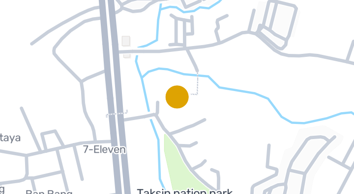
Lio Prime Sriracha - Laemchabung
콘도미니엄
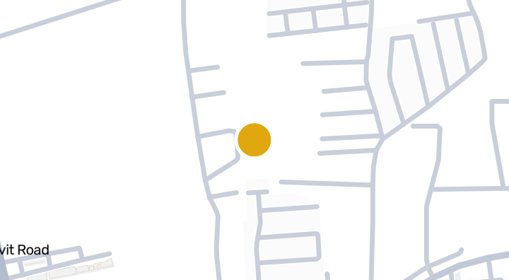
PMC Home 4 Condominium in Bang Lamung, Chon Buri
콘도미니엄
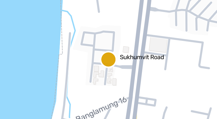
Sea Breeze Villa Pattaya
콘도미니엄
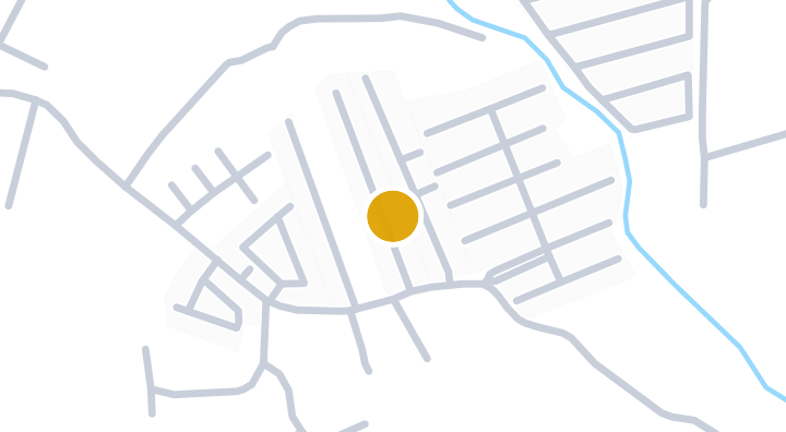
Suwarinee Foresta 4
콘도미니엄
Nautical 9 Condominium in Bang Lamung, Chon Buri
콘도미니엄
Bay View Resort Banglamung
콘도미니엄
Life @ Banglamung Condominium in Bang Lamung, Chon Buri
콘도미니엄
Groovy Light Banglamung Condominium in Bueng, Si Racha, Chon
콘도미니엄
Dusit Thani tower Condominium in Bang Lamung, Chon Buri
콘도미니엄
Baan Klang Suan
콘도미니엄
Pornthip The Chic에 새 유닛이 나오면 알려드립니다.