Rent a Home

Condos for Rent

Houses for Rent

Villas for Rent

Apartments for Rent

Buy a Home

Condos for Sale

Houses for Sale

Villas for Sale

Land for Sale

Explore

Areas

Use the interactive map to move from 77 provinces into 928 districts and 7,425 subdistricts, then compare local homes, prices, projects, and neighborhood guides.

Browse Projects

Search condos, housing estates, and developments with active listings

Homes near transit, schools and landmarks

Choose a place that matters to your daily life, then compare live rentals and homes for sale nearby. Every place below has active inventory in its search area.

Owner-approved opportunities

Explore properties whose owners have confirmed a price and are open to a conversation, including owners with no hurry to sell.

Find an agent near you

Browse verified real estate agents and agencies by province, with active listings and reviews.

Resources

Guides & insights

Thailand Property Market Report

The provinces with the most active listings on the network. Click a province for its full market report.

Best Of Guides

Curated picks for the best areas to buy, rent, and live in Thailand

Visa Opportunities

Visa types, extensions, and applications for Thailand

Thailand property law

Plain-language guides to Thai property law, verified against official sources — for foreign buyers, Thai buyers and renters.

Thailand Flood History Map

Free tool: check whether an address, soi, or condo project in Thailand has flooded before, using historical satellite (SAR) flood observations.

Property news

The latest visa, tax and property-law updates for Thailand, verified against official sources.

All Articles

Tips, market insights, and property guides

Tools

Thailand Mortgage Calculator

Estimate a monthly home-loan payment from the property price, down payment, annual interest rate, and loan term you enter.

Transfer Fees Calculator

Estimate taxes and fees for property transfers in Thailand

Unit Conversions

Convert between Thai and international land units

  • Condos for Rent
  • Houses for Rent
  • Villas for Rent
  • Apartments for Rent
  • Condos for Sale
  • Houses for Sale
  • Villas for Sale
  • Land for Sale
  • Areas
  • Browse Projects
  • Homes near transit, schools and landmarks
  • Owner-approved opportunities
  • Find an agent near you
  • Thailand Property Market Report
  • Best Of Guides
  • Visa Opportunities
  • Thailand property law
  • Thailand Flood History Map
  • Property news
  • All Articles
  • Thailand Mortgage Calculator
  • Transfer Fees Calculator
  • Unit Conversions

Why BaanMe?

ID-Verified Agents

Every BaanMe agent is verified against a Thai government ID before they can publish a single listing — so you always know exactly who you are dealing with, and bad actors get permanently banned.

Secure In-App Chat (Coming Soon)

We are developing in-app messaging. Until it launches, contact options depend on the agent and listing.

Deposit Protection (Coming Soon)

Soon, BaanMe will hold your security deposit in escrow and review every claim ourselves — so unfair deductions and disappearing landlords become a thing of the past.

Contract Support

Ask your agent which contract languages and terms are available before signing.

Environmental Impact

We care about your, our, and everyone's environment. Which is why we have committed ourselves to re-foresting the rainforest in Pai, Thailand, with the help of Conserve Natural Forests, a local NGO committed to forest restoration in and around Pai.

Regions

  • Homes in Bangkok
  • Homes in Chiang Mai
  • Homes in Samut Prakan
  • Homes in Phetchabun
  • Homes in Lamphun
  • Homes in Nonthaburi
  • Homes in Chiang Rai
  • Homes in Chon Buri

Browse Properties

  • Bangkok Condos for Rent
  • Bangkok Apartments for Rent
  • Chiang Mai Houses for Rent
  • Bangkok Offices for Rent
  • Bangkok Warehouses for Rent
  • Koh Samui Houses for Rent
  • All Properties →

FAQ

  • Thailand Property Market Trends 2026: A Selective Recovery
  • More →

Best Of Guides

  • Best Areas to Buy a Condo in Bangkok
  • Best Neighborhoods for Expats in Thailand
  • Best Areas to Rent in Chiang Mai
  • Best Places to Buy a House in Phuket
  • Best Neighborhoods for Families in Bangkok
  • All Guides →

BaanMe

  • About BaanMe
  • Press Inquiries
  • Brand Assets
  • Privacy Policy
  • Terms & Conditions
  • Map Attribution
  • Help
  • Add BaanMe as a preferred source on Google
  • Delete Account

© Niklas Benjamin Muegge, 2026

  1. Home
  2. Nice Breeze 6
Nice Breeze 6
OverviewFacilitiesFacts & StatsLocationReviewAvailable CondosNearby Projects

Nice Breeze 6

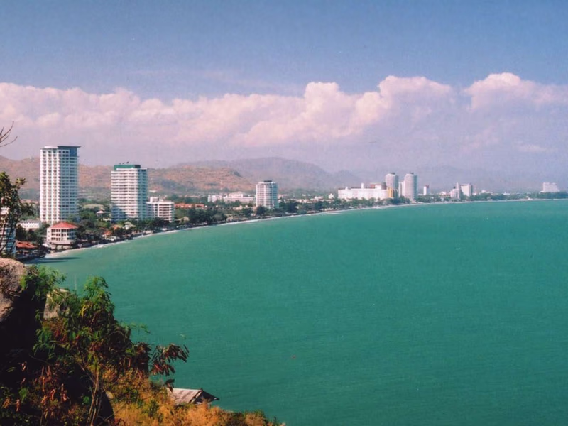
Nice Breeze 6 is a condominium project located in Hua Hin, Prachuap Khiri Khan. Residents are about 8 minutes from For Art's Sake and roughly 12 minutes from Hua Hin Beach. Prachuap Khiri Khan Military Airport is approximately 86 minutes away. The project offers a base in Hua Hin, a well-known resort town with beaches and an established international community.

See Available Condos
In Nice Breeze 6
Facilities
  • 24h Security
  • CCTV
  • BBQ Area
Facts & Stats

43

Units

2020

Completion

Location

Hua Hin

Sinkhole susceptibility (DMR): Medium

86 min

to Prachuap Khiri Khan Military Airport

commute

8 min

Hua Hin

Check your commute

Save places and compare travel times from this home.

Neighborhood

Hua Hin

Hua Hin

Hua Hin is Thailand's most established beach resort town, with a history stretching back to the 1920s when the Thai royal family built a seaside palace here. Today it's a mature, comfortable beach town that perfectly balances Thai culture with international convenience. The vibe is distinctly more relaxed and less party-oriented than Pattaya or Phuket — think sunset walks, morning golf, and night market dinners rather than nightclubs. Central Hua Hin — The historic center. Night market, Hilton hotel, the original train station (one of Thailand's most photogenic). Walkable, with a good mix of local and international restaurants. Khao Takiab (south) — Quieter beachfront with condos and temple-topped headland. Popular with long-stay retirees. Cicada Market creative arts venue. North Hua Hin / Cha-am side — More affordable beachfront condos. Thai weekend-trip market. Large-scale resort developments. West Hua Hin / Hills — Toward Black Mountain golf course and Kaeng Krachan. Housing estates with mountain views. Cooler, greener, more spacious. Hua Hin is arguably Thailand's best all-round retirement destination. The Scandinavian and European community is well-established with social clubs, volunteer groups, and regular events. Healthcare is excellent (Bangkok Hospital Hua Hin, San Paulo). Golf is world-class and affordable (10+ courses within 30 minutes). The town is walkable, flat, and easy to navigate. And at 2.5 hours from Bangkok, it's close enough for city trips without city stress. Beachfront condos: 2–6 million THB for 1-bed. Pool villas in estates: 5–15 million THB. Premium beachfront houses: 15–50+ million THB. Long-term rentals: 10,000–25,000 THB/month for condos, 20,000–50,000 THB/month for houses. Roughly 40–60% cheaper than Phuket for comparable beach proximity.

Explore Hua Hin

Location risk & context

river floodingMedium(estimated)
flash floodingLow(estimated)
droughtHigh(based on the surrounding area)
poor air qualityMedium(observed)
fire riskNot enough data yet(basis not available)
extreme heatNot enough data yet(basis not available)
River flooding
Terrain height above nearest drainage: 8.523137711919844 m. This is an indirect screening indicator.
Evidence scope: Modelled screening · Confidence: Medium
Flash flooding
Terrain-derived susceptibility band: Minimal. This is not a flood-depth forecast.
Evidence scope: Modelled screening · Confidence: High
Drought
Rainfall was below the local normal in 23.055555555555557% of analysed 10-day periods. Regional screening uses project-defined thresholds.
Evidence scope: Area context · Confidence: Medium
Air quality
Annual mean PM2.5: 18.74972677595629 µg/m³, source: PCD. This is not a current air-quality reading.
Evidence scope: Area context · Confidence: High
Fire
No usable evidence is available.
Evidence scope: Insufficient evidence
Heat
No usable evidence is available.
Evidence scope: Insufficient evidence

Flood

River flood

No satellite flood observation covers this location yet

River hazard is scored only against a single 2024 satellite-observed flood event covering four northern Thailand provinces (Chiang Mai, Chiang Rai, Lamphun, Phayao). "Unknown" outside that area means no observation exists yet — it does not mean the area is safe.

Flash flood

Minimal — flat terrain, far from any watercourse

Confidence: high

  • Height above nearest drainage: 8.5 m
  • Distance to nearest watercourse: 1482 m
  • Slope: 1.8%

Flash-flood terrain data is derived from OpenStreetMap waterway data. See OpenStreetMap attribution

Area context

Government construction cost estimate, maximum
12,500 THB/m² — In Prachuap Khiri Khan province
Source: Treasury Department (กรมธนารักษ์) construction cost appraisal · License: Open Data Common (Treasury Department building valuation catalogue) · 2024-08-15 to 2027-12-31
Government construction cost estimate, typical
7,850 THB/m² — In Prachuap Khiri Khan province
Source: Treasury Department (กรมธนารักษ์) construction cost appraisal · License: Open Data Common (Treasury Department building valuation catalogue) · 2024-08-15 to 2027-12-31
Government construction cost estimate, minimum
400 THB/m² — In Prachuap Khiri Khan province
Source: Treasury Department (กรมธนารักษ์) construction cost appraisal · License: Open Data Common (Treasury Department building valuation catalogue) · 2024-08-15 to 2027-12-31
Treasury land appraisal (municipality), maximum — assessed value, not market price
50,000 THB/sq_wah — In Hua Hin subdistrict
Source: Treasury Department (กรมธนารักษ์) land valuation (ราคาประเมินที่ดิน) - attach_all_20240805.csv — เทศบาลเมืองหัวหิน (municipal area) · License: Open Data Common · 2024-08-14 to 2024-08-14
Treasury land appraisal (municipality), typical — assessed value, not market price
5,500 THB/sq_wah — In Hua Hin subdistrict
Source: Treasury Department (กรมธนารักษ์) land valuation (ราคาประเมินที่ดิน) - attach_all_20240805.csv — เทศบาลเมืองหัวหิน (municipal area) · License: Open Data Common · 2024-08-14 to 2024-08-14
Treasury land appraisal (municipality), minimum — assessed value, not market price
1,500 THB/sq_wah — In Hua Hin subdistrict
Source: Treasury Department (กรมธนารักษ์) land valuation (ราคาประเมินที่ดิน) - attach_all_20240805.csv — เทศบาลเมืองหัวหิน (municipal area) · License: Open Data Common · 2024-08-14 to 2024-08-14
Treasury land appraisal (subdistrict), maximum — assessed value, not market price
2,000 THB/sq_wah — In Hua Hin district
Source: Treasury Department (กรมธนารักษ์) land valuation (ราคาประเมินที่ดิน) - attach_all_20240805.csv · License: Open Data Common · 2024-08-14 to 2024-08-14
Treasury land appraisal (subdistrict), typical — assessed value, not market price
300 THB/sq_wah — In Hua Hin district
Source: Treasury Department (กรมธนารักษ์) land valuation (ราคาประเมินที่ดิน) - attach_all_20240805.csv · License: Open Data Common · 2024-08-14 to 2024-08-14
Treasury land appraisal (subdistrict), minimum — assessed value, not market price
75 THB/sq_wah — In Hua Hin district
Source: Treasury Department (กรมธนารักษ์) land valuation (ราคาประเมินที่ดิน) - attach_all_20240805.csv · License: Open Data Common · 2024-08-14 to 2024-08-14
Driest month
December — In Prachuap Khiri Khan province
Source: Open-Meteo (ERA5 reanalysis, via archive-api.open-meteo.com) · License: CC BY 4.0 (Attribution 4.0 International) -- https://open-meteo.com/en/licence · 1991-01-01 to 2020-12-31
Climate rainfall annual total mean mm
1,584.9 mm — In Prachuap Khiri Khan province
Source: Open-Meteo (ERA5 reanalysis, via archive-api.open-meteo.com) · License: CC BY 4.0 (Attribution 4.0 International) -- https://open-meteo.com/en/licence · 1991-01-01 to 2020-12-31
Wettest month
October — In Prachuap Khiri Khan province
Source: Open-Meteo (ERA5 reanalysis, via archive-api.open-meteo.com) · License: CC BY 4.0 (Attribution 4.0 International) -- https://open-meteo.com/en/licence · 1991-01-01 to 2020-12-31
Height above nearest drainage (typical)
16.2 m — In Hua Hin subdistrict
Source: Terrain-derived flash-flood indicators (HAND + slope + OSM drainage proximity; NOT a forecast or probability, not calibrated against observed events) from Copernicus DEM GLO-30 (via Mapterhorn terrain tiles) and OpenStreetMap waterway data. The banded metric flags whether the region CONTAINS terrain susceptible to flash flooding somewhere within it -- not the susceptibility of the region as a whole, and not of any individual property. · License: Copernicus WorldDEM-30 Licence, commercial use permitted (see ./region-elevation.ts's ELEVATION_SOURCE_LICENSE for the full citation) combined with OpenStreetMap contributors: ODbL 1.0 (https://www.openstreetmap.org/copyright) · 2010-12-12 to 2015-01-07
Height above nearest drainage (lowest 10%)
0.3 m — In Hua Hin subdistrict
Source: Terrain-derived flash-flood indicators (HAND + slope + OSM drainage proximity; NOT a forecast or probability, not calibrated against observed events) from Copernicus DEM GLO-30 (via Mapterhorn terrain tiles) and OpenStreetMap waterway data. The banded metric flags whether the region CONTAINS terrain susceptible to flash flooding somewhere within it -- not the susceptibility of the region as a whole, and not of any individual property. · License: Copernicus WorldDEM-30 Licence, commercial use permitted (see ./region-elevation.ts's ELEVATION_SOURCE_LICENSE for the full citation) combined with OpenStreetMap contributors: ODbL 1.0 (https://www.openstreetmap.org/copyright) · 2010-12-12 to 2015-01-07
Terrain slope (typical)
2.6% — In Hua Hin subdistrict
Source: Terrain-derived flash-flood indicators (HAND + slope + OSM drainage proximity; NOT a forecast or probability, not calibrated against observed events) from Copernicus DEM GLO-30 (via Mapterhorn terrain tiles) and OpenStreetMap waterway data. The banded metric flags whether the region CONTAINS terrain susceptible to flash flooding somewhere within it -- not the susceptibility of the region as a whole, and not of any individual property. · License: Copernicus WorldDEM-30 Licence, commercial use permitted (see ./region-elevation.ts's ELEVATION_SOURCE_LICENSE for the full citation) combined with OpenStreetMap contributors: ODbL 1.0 (https://www.openstreetmap.org/copyright) · 2010-12-12 to 2015-01-07
Terrain slope (steepest 10%)
9.3% — In Hua Hin subdistrict
Source: Terrain-derived flash-flood indicators (HAND + slope + OSM drainage proximity; NOT a forecast or probability, not calibrated against observed events) from Copernicus DEM GLO-30 (via Mapterhorn terrain tiles) and OpenStreetMap waterway data. The banded metric flags whether the region CONTAINS terrain susceptible to flash flooding somewhere within it -- not the susceptibility of the region as a whole, and not of any individual property. · License: Copernicus WorldDEM-30 Licence, commercial use permitted (see ./region-elevation.ts's ELEVATION_SOURCE_LICENSE for the full citation) combined with OpenStreetMap contributors: ODbL 1.0 (https://www.openstreetmap.org/copyright) · 2010-12-12 to 2015-01-07
Distance to nearest watercourse (typical)
3,307.7 m — In Hua Hin subdistrict
Source: Terrain-derived flash-flood indicators (HAND + slope + OSM drainage proximity; NOT a forecast or probability, not calibrated against observed events) from Copernicus DEM GLO-30 (via Mapterhorn terrain tiles) and OpenStreetMap waterway data. The banded metric flags whether the region CONTAINS terrain susceptible to flash flooding somewhere within it -- not the susceptibility of the region as a whole, and not of any individual property. · License: Copernicus WorldDEM-30 Licence, commercial use permitted (see ./region-elevation.ts's ELEVATION_SOURCE_LICENSE for the full citation) combined with OpenStreetMap contributors: ODbL 1.0 (https://www.openstreetmap.org/copyright) · 2010-12-12 to 2015-01-07
Distance to nearest watercourse (closest 10%)
599.9 m — In Hua Hin subdistrict
Source: Terrain-derived flash-flood indicators (HAND + slope + OSM drainage proximity; NOT a forecast or probability, not calibrated against observed events) from Copernicus DEM GLO-30 (via Mapterhorn terrain tiles) and OpenStreetMap waterway data. The banded metric flags whether the region CONTAINS terrain susceptible to flash flooding somewhere within it -- not the susceptibility of the region as a whole, and not of any individual property. · License: Copernicus WorldDEM-30 Licence, commercial use permitted (see ./region-elevation.ts's ELEVATION_SOURCE_LICENSE for the full citation) combined with OpenStreetMap contributors: ODbL 1.0 (https://www.openstreetmap.org/copyright) · 2010-12-12 to 2015-01-07
Flash-flood terrain susceptibility
moderate — In Hua Hin subdistrict
Source: Terrain-derived flash-flood indicators (HAND + slope + OSM drainage proximity; NOT a forecast or probability, not calibrated against observed events) from Copernicus DEM GLO-30 (via Mapterhorn terrain tiles) and OpenStreetMap waterway data. The banded metric flags whether the region CONTAINS terrain susceptible to flash flooding somewhere within it -- not the susceptibility of the region as a whole, and not of any individual property. · License: Copernicus WorldDEM-30 Licence, commercial use permitted (see ./region-elevation.ts's ELEVATION_SOURCE_LICENSE for the full citation) combined with OpenStreetMap contributors: ODbL 1.0 (https://www.openstreetmap.org/copyright) · 2010-12-12 to 2015-01-07
Elevation, maximum
150.4 m — In Hua Hin subdistrict
Source: Mapterhorn terrain tiles (Copernicus DEM GLO-30 / WorldDEM-30, terrarium encoding, via tiles.mapterhorn.com) · License: Copernicus WorldDEM-30 Licence (COP-DEM-GLO-30-F, 'Global 30m Full, Free & Open' -- https://documentation.dataspace.copernicus.eu/APIs/SentinelHub/Data/DEM/resources/license/License-COPDEM-30.pdf); free of charge, reproduction/distribution/public-communication/adaptation all granted, commercial use permitted; required notice: "produced using Copernicus WorldDEM-30 © DLR e.V. 2010-2014 and © Airbus Defence and Space GmbH 2014-2018 provided under COPERNICUS by the European Union and ESA; all rights reserved." Tiles served by Mapterhorn (© Mapterhorn, https://mapterhorn.com/attribution) -- both notices required. · 2010-12-12 to 2015-01-07
Elevation, typical
25.3 m — In Hua Hin subdistrict
Source: Mapterhorn terrain tiles (Copernicus DEM GLO-30 / WorldDEM-30, terrarium encoding, via tiles.mapterhorn.com) · License: Copernicus WorldDEM-30 Licence (COP-DEM-GLO-30-F, 'Global 30m Full, Free & Open' -- https://documentation.dataspace.copernicus.eu/APIs/SentinelHub/Data/DEM/resources/license/License-COPDEM-30.pdf); free of charge, reproduction/distribution/public-communication/adaptation all granted, commercial use permitted; required notice: "produced using Copernicus WorldDEM-30 © DLR e.V. 2010-2014 and © Airbus Defence and Space GmbH 2014-2018 provided under COPERNICUS by the European Union and ESA; all rights reserved." Tiles served by Mapterhorn (© Mapterhorn, https://mapterhorn.com/attribution) -- both notices required. · 2010-12-12 to 2015-01-07
Elevation, minimum
6.9 m — In Hua Hin subdistrict
Source: Mapterhorn terrain tiles (Copernicus DEM GLO-30 / WorldDEM-30, terrarium encoding, via tiles.mapterhorn.com) · License: Copernicus WorldDEM-30 Licence (COP-DEM-GLO-30-F, 'Global 30m Full, Free & Open' -- https://documentation.dataspace.copernicus.eu/APIs/SentinelHub/Data/DEM/resources/license/License-COPDEM-30.pdf); free of charge, reproduction/distribution/public-communication/adaptation all granted, commercial use permitted; required notice: "produced using Copernicus WorldDEM-30 © DLR e.V. 2010-2014 and © Airbus Defence and Space GmbH 2014-2018 provided under COPERNICUS by the European Union and ESA; all rights reserved." Tiles served by Mapterhorn (© Mapterhorn, https://mapterhorn.com/attribution) -- both notices required. · 2010-12-12 to 2015-01-07
Elevation, range
143.4 m — In Hua Hin subdistrict
Source: Mapterhorn terrain tiles (Copernicus DEM GLO-30 / WorldDEM-30, terrarium encoding, via tiles.mapterhorn.com) · License: Copernicus WorldDEM-30 Licence (COP-DEM-GLO-30-F, 'Global 30m Full, Free & Open' -- https://documentation.dataspace.copernicus.eu/APIs/SentinelHub/Data/DEM/resources/license/License-COPDEM-30.pdf); free of charge, reproduction/distribution/public-communication/adaptation all granted, commercial use permitted; required notice: "produced using Copernicus WorldDEM-30 © DLR e.V. 2010-2014 and © Airbus Defence and Space GmbH 2014-2018 provided under COPERNICUS by the European Union and ESA; all rights reserved." Tiles served by Mapterhorn (© Mapterhorn, https://mapterhorn.com/attribution) -- both notices required. · 2010-12-12 to 2015-01-07
Share of 10-day periods with rainfall deficit (10-year)
23.1% — In Hua Hin district
Source: Climate Hazards Center UC Santa Barbara & WFP -- Thailand: Rainfall Indicators at Subnational Level (HDX) · License: CC BY (Creative Commons Attribution International) · 2016-01-01 to 2025-12-31
Worst 3-month rainfall deficit (10-year)
22.6% — In Hua Hin district
Source: Climate Hazards Center UC Santa Barbara & WFP -- Thailand: Rainfall Indicators at Subnational Level (HDX) · License: CC BY (Creative Commons Attribution International) · 2016-01-01 to 2025-12-31
PM10, annual average
41.8 µg/m³ — In Prachuap Khiri Khan province
Source: OpenAQ — Hua Hin Weather Station Prachuap Khiri Khan Meteorological Station-364729 (reference) · License: Open Data Common (Pollution Control Department) · 2025-01-01 to 2026-01-01
PM2.5, annual average
19.1 µg/m³ — In Prachuap Khiri Khan province
Source: OpenAQ — Hua Hin Weather Station Prachuap Khiri Khan Meteorological Station-364729 (reference) · License: Open Data Common (Pollution Control Department) · 2025-01-01 to 2026-01-01
Recent 3-month rainfall vs. normal
104.3% — In Hua Hin district
Source: Climate Hazards Center UC Santa Barbara & WFP -- Thailand: Rainfall Indicators at Subnational Level (HDX) · License: CC BY (Creative Commons Attribution International) · 2026-07-01 to 2026-09-21
PM10, annual average (government monitoring)
40.3 µg/m³ — In Hua Hin subdistrict
Source: Pollution Control Department (PCD) — PM10 automatic stations · License: Open Data Common (Pollution Control Department) · 2024-01-01 to 2024-12-31
Days per year above the PM10 air quality standard
0 days — In Hua Hin subdistrict
Source: Pollution Control Department (PCD) — PM10 automatic stations · License: Open Data Common (Pollution Control Department) · 2024-01-01 to 2024-12-31
PM2.5, annual average (government monitoring)
18.7 µg/m³ — In Hua Hin subdistrict
Source: Pollution Control Department (PCD) — Bangkok metropolitan PM2.5 automatic stations · License: Open Data Common (Pollution Control Department) · 2024-01-01 to 2024-12-31
Days per year above the PM2.5 air quality standard
19 days — In Hua Hin subdistrict
Source: Pollution Control Department (PCD) — Bangkok metropolitan PM2.5 automatic stations · License: Open Data Common (Pollution Control Department) · 2024-01-01 to 2024-12-31
See more about this area

Screening evidence is not a safety guarantee, a future risk forecast or a site inspection.

Property Reviews

No reviews yet — be the first to leave one.

Reviews

Leave a review

Sign in required. One review per project.

Sign in to leave a review.

Nearby Projects
Hua Hin Nice Breeze Project 6

Hua Hin Nice Breeze Project 6

Condominium
Natural Lake Hill

Natural Lake Hill

Condominium

Nice Breeze 5 Condominium in Hua Hin, Prachuap Khiri Khan

Nice Breeze 5 Condominium in Hua Hin, Prachuap Khiri Khan

Condominium
Emerald Hill Condominium in Cha-Am, Phetchaburi

Emerald Hill Condominium in Cha-Am, Phetchaburi

Condominium
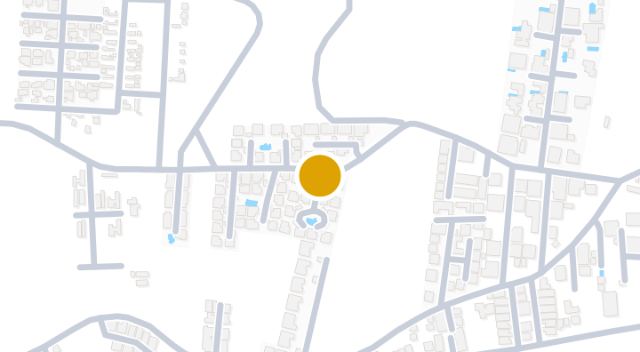
Pine Queen Village Condominium in Hua Hin, Prachuap Khiri Kh

Pine Queen Village Condominium in Hua Hin, Prachuap Khiri Kh

Condominium
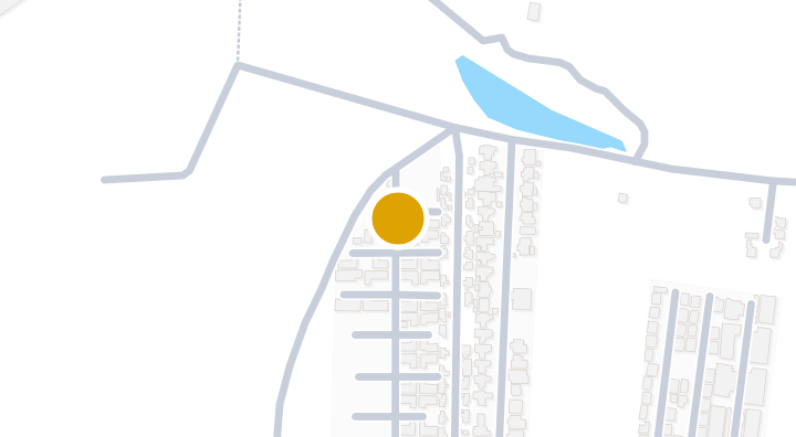
The Grandio Huahin Pool Villa - Condominium in Hua Hin, Pran

The Grandio Huahin Pool Villa - Condominium in Hua Hin, Pran

Condominium
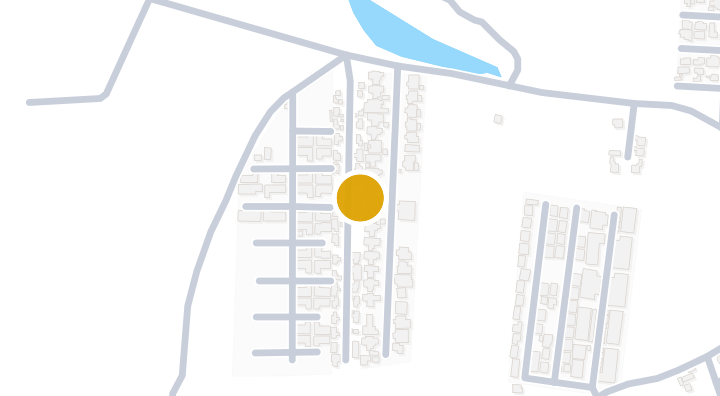
Tharadol Resort Condominium in Hua Hin, Prachuap Khiri Khan

Tharadol Resort Condominium in Hua Hin, Prachuap Khiri Khan

Condominium
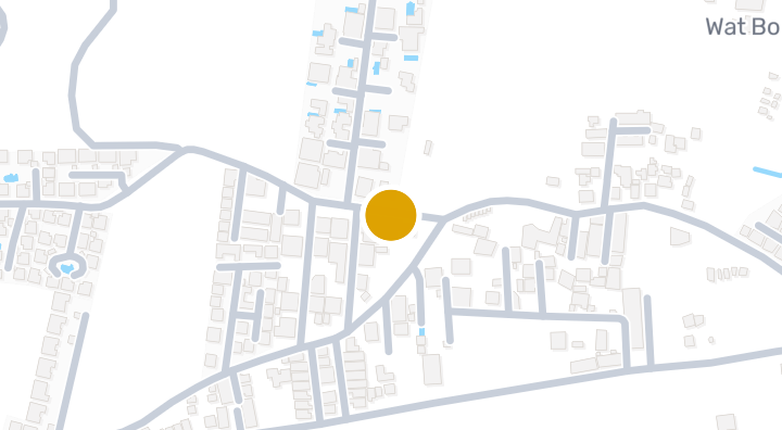
Sunset Village

Sunset Village

Condominium

Pine Gold Village Condominium in Hua Hin, Prachuap Khiri

Pine Gold Village Condominium in Hua Hin, Prachuap Khiri

Condominium
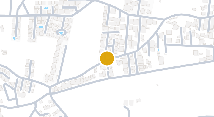
Nice Breeze 4

Nice Breeze 4

Condominium

Nice Breeze 3 Condominium in Hua Hin, Prachuap Khiri Khan

Nice Breeze 3 Condominium in Hua Hin, Prachuap Khiri Khan

Condominium
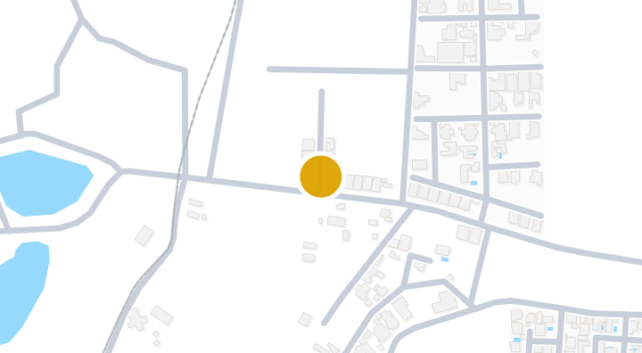
Naree Pool 2 Condominium in Hua Hin, Prachuap Khiri Khan

Naree Pool 2 Condominium in Hua Hin, Prachuap Khiri Khan

Condominium

Get notified when new units become available in Nice Breeze 6.

See Available Condos
In Nice Breeze 6

Explore more

  • Browse Properties

    BaanMe — your trusted platform for property listings, real estate insights, and market intelligence.

  • Explore all 77 provinces of Thailand

    Use the interactive map to move from 77 provinces into 928 districts and 7,425 subdistricts, then compare local homes, prices, projects, and neighborhood guides.

  • Homes near transit, schools and landmarks

    Choose a place that matters to your daily life, then compare live rentals and homes for sale nearby. Every place below has active inventory in its search area.

  • Thailand Property Market Report

    Median asking prices across all active listings in Thailand, in Thai Baht.