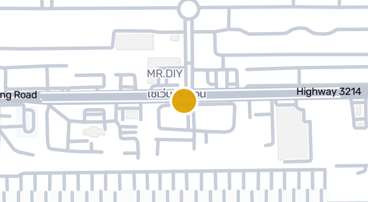
Sila Munkong Factory
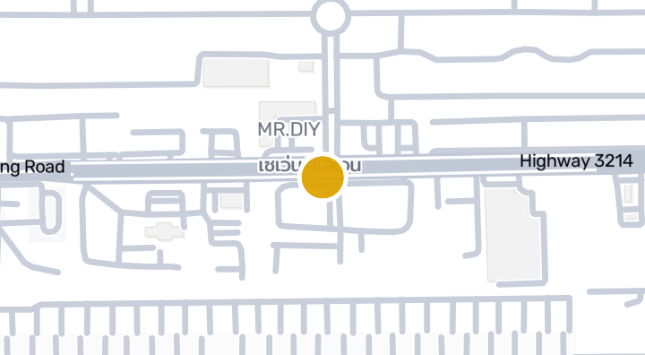
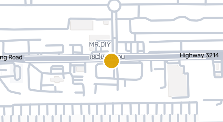
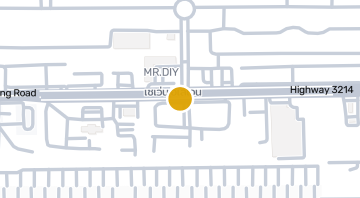
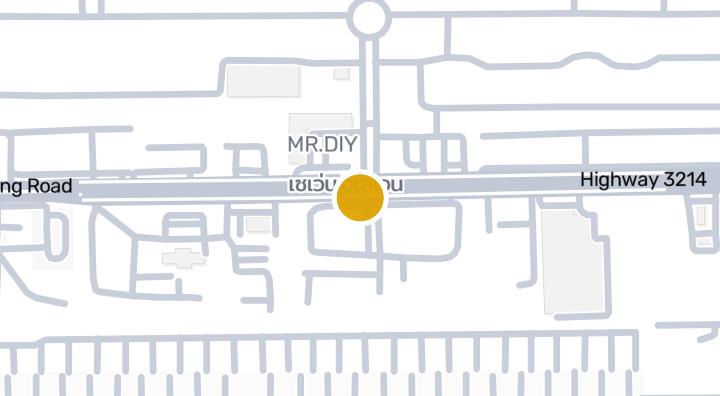
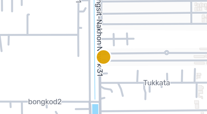
Sila Munkong Factory is a condominium project located in Khlong Song, Khlong Luang, Pathum Thani. The developer and completion date have not been disclosed. Nearby, residents can reach the Dhammakaya Foundation attraction in about 0 minutes and Pawai Airfield in about 74 minutes. There is also 1 nearby beach in the area.
Location
Sila Munkong Factory
74 min
to Pawai Airfield
commute
1 min
Check your commute
Save places and compare travel times from this home.
Location risk & context
river floodingLow(observed)
flash floodingLow(estimated)
droughtMedium(based on the surrounding area)
poor air qualityHigh(observed)
fire riskNot enough data yet(basis not available)
extreme heatMedium(based on the surrounding area)
- River flooding
- Historical observations produced the Low screening band; this is not a future flood probability.
- Evidence scope: Observed evidence · Confidence: Low
- Flash flooding
- Terrain-derived susceptibility band: Low. This is not a flood-depth forecast.
- Evidence scope: Modelled screening · Confidence: High
- Drought
- Rainfall was below the local normal in 19.72222222222222% of analysed 10-day periods. Regional screening uses project-defined thresholds.
- Evidence scope: Area context · Confidence: Medium
- Air quality
- Annual mean PM2.5: 30.814825714753688 µg/m³, source: OpenAQ. This is not a current air-quality reading.
- Evidence scope: Area context · Confidence: Medium
- Fire
- No usable evidence is available.
- Evidence scope: Insufficient evidence
- Heat
- Annual mean of monthly maximum temperatures: 32.32673372726044 °C. Regional screening uses project-defined thresholds, not an individual health forecast.
- Evidence scope: Area context · Confidence: Medium
Flood
River flood
Low — no significant flooding observed in the covered event
Confidence: low
River hazard is scored only against a single 2024 satellite-observed flood event covering four northern Thailand provinces (Chiang Mai, Chiang Rai, Lamphun, Phayao). "Unknown" outside that area means no observation exists yet — it does not mean the area is safe.
Flash flood
Low — some distance from watercourses or higher ground
Confidence: high
- Height above nearest drainage: 1.4 m
- Distance to nearest watercourse: 3801 m
- Slope: 0.1%
Flash-flood terrain data is derived from OpenStreetMap waterway data. See OpenStreetMap attribution
Area context
- Government construction cost estimate, maximum
- 12,000 THB/m² — In Pathum Thani province
- Source: Treasury Department (กรมธนารักษ์) construction cost appraisal · License: Open Data Common (Treasury Department building valuation catalogue) · 2024-08-15 to 2027-12-31
- Government construction cost estimate, typical
- 7,700 THB/m² — In Pathum Thani province
- Source: Treasury Department (กรมธนารักษ์) construction cost appraisal · License: Open Data Common (Treasury Department building valuation catalogue) · 2024-08-15 to 2027-12-31
- Government construction cost estimate, minimum
- 450 THB/m² — In Pathum Thani province
- Source: Treasury Department (กรมธนารักษ์) construction cost appraisal · License: Open Data Common (Treasury Department building valuation catalogue) · 2024-08-15 to 2027-12-31
- Treasury land appraisal (municipality), maximum — assessed value, not market price
- 70,000 THB/sq_wah — In Khlong Song subdistrict
- Source: Treasury Department (กรมธนารักษ์) land valuation (ราคาประเมินที่ดิน) - attach_all_20240805.csv — เทศบาลเมืองท่าโขลง / เทศบาลเมืองคลองหลวง (municipal area) · License: Open Data Common · 2024-08-14 to 2024-08-14
- Treasury land appraisal (municipality), typical — assessed value, not market price
- 4,500 THB/sq_wah — In Khlong Song subdistrict
- Source: Treasury Department (กรมธนารักษ์) land valuation (ราคาประเมินที่ดิน) - attach_all_20240805.csv — เทศบาลเมืองท่าโขลง / เทศบาลเมืองคลองหลวง (municipal area) · License: Open Data Common · 2024-08-14 to 2024-08-14
- Treasury land appraisal (municipality), minimum — assessed value, not market price
- 1,500 THB/sq_wah — In Khlong Song subdistrict
- Source: Treasury Department (กรมธนารักษ์) land valuation (ราคาประเมินที่ดิน) - attach_all_20240805.csv — เทศบาลเมืองท่าโขลง / เทศบาลเมืองคลองหลวง (municipal area) · License: Open Data Common · 2024-08-14 to 2024-08-14
- Treasury land appraisal (subdistrict), maximum — assessed value, not market price
- 6,200 THB/sq_wah — In Khlong Luang district
- Source: Treasury Department (กรมธนารักษ์) land valuation (ราคาประเมินที่ดิน) - attach_all_20240805.csv · License: Open Data Common · 2024-08-14 to 2024-08-14
- Treasury land appraisal (subdistrict), typical — assessed value, not market price
- 2,000 THB/sq_wah — In Khlong Luang district
- Source: Treasury Department (กรมธนารักษ์) land valuation (ราคาประเมินที่ดิน) - attach_all_20240805.csv · License: Open Data Common · 2024-08-14 to 2024-08-14
- Treasury land appraisal (subdistrict), minimum — assessed value, not market price
- 1,000 THB/sq_wah — In Khlong Luang district
- Source: Treasury Department (กรมธนารักษ์) land valuation (ราคาประเมินที่ดิน) - attach_all_20240805.csv · License: Open Data Common · 2024-08-14 to 2024-08-14
- Driest month
- December — In Pathum Thani province
- Source: Open-Meteo (ERA5 reanalysis, via archive-api.open-meteo.com) · License: CC BY 4.0 (Attribution 4.0 International) -- https://open-meteo.com/en/licence · 1991-01-01 to 2020-12-31
- Climate rainfall annual total mean mm
- 1,433.7 mm — In Pathum Thani province
- Source: Open-Meteo (ERA5 reanalysis, via archive-api.open-meteo.com) · License: CC BY 4.0 (Attribution 4.0 International) -- https://open-meteo.com/en/licence · 1991-01-01 to 2020-12-31
- Average daily high temperature
- 32.3 C — In Pathum Thani province
- Source: Open-Meteo (ERA5 reanalysis, via archive-api.open-meteo.com) · License: CC BY 4.0 (Attribution 4.0 International) -- https://open-meteo.com/en/licence · 1991-01-01 to 2020-12-31
- Wettest month
- September — In Pathum Thani province
- Source: Open-Meteo (ERA5 reanalysis, via archive-api.open-meteo.com) · License: CC BY 4.0 (Attribution 4.0 International) -- https://open-meteo.com/en/licence · 1991-01-01 to 2020-12-31
- Height above nearest drainage (typical)
- -5.6 m — In Khlong Song subdistrict
- Source: Terrain-derived flash-flood indicators (HAND + slope + OSM drainage proximity; NOT a forecast or probability, not calibrated against observed events) from Copernicus DEM GLO-30 (via Mapterhorn terrain tiles) and OpenStreetMap waterway data. The banded metric flags whether the region CONTAINS terrain susceptible to flash flooding somewhere within it -- not the susceptibility of the region as a whole, and not of any individual property. · License: Copernicus WorldDEM-30 Licence, commercial use permitted (see ./region-elevation.ts's ELEVATION_SOURCE_LICENSE for the full citation) combined with OpenStreetMap contributors: ODbL 1.0 (https://www.openstreetmap.org/copyright) · 2010-12-12 to 2015-01-07
- Height above nearest drainage (lowest 10%)
- -6.5 m — In Khlong Song subdistrict
- Source: Terrain-derived flash-flood indicators (HAND + slope + OSM drainage proximity; NOT a forecast or probability, not calibrated against observed events) from Copernicus DEM GLO-30 (via Mapterhorn terrain tiles) and OpenStreetMap waterway data. The banded metric flags whether the region CONTAINS terrain susceptible to flash flooding somewhere within it -- not the susceptibility of the region as a whole, and not of any individual property. · License: Copernicus WorldDEM-30 Licence, commercial use permitted (see ./region-elevation.ts's ELEVATION_SOURCE_LICENSE for the full citation) combined with OpenStreetMap contributors: ODbL 1.0 (https://www.openstreetmap.org/copyright) · 2010-12-12 to 2015-01-07
- Terrain slope (typical)
- 0.1% — In Khlong Song subdistrict
- Source: Terrain-derived flash-flood indicators (HAND + slope + OSM drainage proximity; NOT a forecast or probability, not calibrated against observed events) from Copernicus DEM GLO-30 (via Mapterhorn terrain tiles) and OpenStreetMap waterway data. The banded metric flags whether the region CONTAINS terrain susceptible to flash flooding somewhere within it -- not the susceptibility of the region as a whole, and not of any individual property. · License: Copernicus WorldDEM-30 Licence, commercial use permitted (see ./region-elevation.ts's ELEVATION_SOURCE_LICENSE for the full citation) combined with OpenStreetMap contributors: ODbL 1.0 (https://www.openstreetmap.org/copyright) · 2010-12-12 to 2015-01-07
- Terrain slope (steepest 10%)
- 0.4% — In Khlong Song subdistrict
- Source: Terrain-derived flash-flood indicators (HAND + slope + OSM drainage proximity; NOT a forecast or probability, not calibrated against observed events) from Copernicus DEM GLO-30 (via Mapterhorn terrain tiles) and OpenStreetMap waterway data. The banded metric flags whether the region CONTAINS terrain susceptible to flash flooding somewhere within it -- not the susceptibility of the region as a whole, and not of any individual property. · License: Copernicus WorldDEM-30 Licence, commercial use permitted (see ./region-elevation.ts's ELEVATION_SOURCE_LICENSE for the full citation) combined with OpenStreetMap contributors: ODbL 1.0 (https://www.openstreetmap.org/copyright) · 2010-12-12 to 2015-01-07
- Distance to nearest watercourse (typical)
- 4,446.6 m — In Khlong Song subdistrict
- Source: Terrain-derived flash-flood indicators (HAND + slope + OSM drainage proximity; NOT a forecast or probability, not calibrated against observed events) from Copernicus DEM GLO-30 (via Mapterhorn terrain tiles) and OpenStreetMap waterway data. The banded metric flags whether the region CONTAINS terrain susceptible to flash flooding somewhere within it -- not the susceptibility of the region as a whole, and not of any individual property. · License: Copernicus WorldDEM-30 Licence, commercial use permitted (see ./region-elevation.ts's ELEVATION_SOURCE_LICENSE for the full citation) combined with OpenStreetMap contributors: ODbL 1.0 (https://www.openstreetmap.org/copyright) · 2010-12-12 to 2015-01-07
- Distance to nearest watercourse (closest 10%)
- 2,920.7 m — In Khlong Song subdistrict
- Source: Terrain-derived flash-flood indicators (HAND + slope + OSM drainage proximity; NOT a forecast or probability, not calibrated against observed events) from Copernicus DEM GLO-30 (via Mapterhorn terrain tiles) and OpenStreetMap waterway data. The banded metric flags whether the region CONTAINS terrain susceptible to flash flooding somewhere within it -- not the susceptibility of the region as a whole, and not of any individual property. · License: Copernicus WorldDEM-30 Licence, commercial use permitted (see ./region-elevation.ts's ELEVATION_SOURCE_LICENSE for the full citation) combined with OpenStreetMap contributors: ODbL 1.0 (https://www.openstreetmap.org/copyright) · 2010-12-12 to 2015-01-07
- Flash-flood terrain susceptibility
- low — In Khlong Song subdistrict
- Source: Terrain-derived flash-flood indicators (HAND + slope + OSM drainage proximity; NOT a forecast or probability, not calibrated against observed events) from Copernicus DEM GLO-30 (via Mapterhorn terrain tiles) and OpenStreetMap waterway data. The banded metric flags whether the region CONTAINS terrain susceptible to flash flooding somewhere within it -- not the susceptibility of the region as a whole, and not of any individual property. · License: Copernicus WorldDEM-30 Licence, commercial use permitted (see ./region-elevation.ts's ELEVATION_SOURCE_LICENSE for the full citation) combined with OpenStreetMap contributors: ODbL 1.0 (https://www.openstreetmap.org/copyright) · 2010-12-12 to 2015-01-07
- Elevation, maximum
- 14.6 m — In Khlong Song subdistrict
- Source: Mapterhorn terrain tiles (Copernicus DEM GLO-30 / WorldDEM-30, terrarium encoding, via tiles.mapterhorn.com) · License: Copernicus WorldDEM-30 Licence (COP-DEM-GLO-30-F, 'Global 30m Full, Free & Open' -- https://documentation.dataspace.copernicus.eu/APIs/SentinelHub/Data/DEM/resources/license/License-COPDEM-30.pdf); free of charge, reproduction/distribution/public-communication/adaptation all granted, commercial use permitted; required notice: "produced using Copernicus WorldDEM-30 © DLR e.V. 2010-2014 and © Airbus Defence and Space GmbH 2014-2018 provided under COPERNICUS by the European Union and ESA; all rights reserved." Tiles served by Mapterhorn (© Mapterhorn, https://mapterhorn.com/attribution) -- both notices required. · 2010-12-12 to 2015-01-07
- Elevation, typical
- 3.5 m — In Khlong Song subdistrict
- Source: Mapterhorn terrain tiles (Copernicus DEM GLO-30 / WorldDEM-30, terrarium encoding, via tiles.mapterhorn.com) · License: Copernicus WorldDEM-30 Licence (COP-DEM-GLO-30-F, 'Global 30m Full, Free & Open' -- https://documentation.dataspace.copernicus.eu/APIs/SentinelHub/Data/DEM/resources/license/License-COPDEM-30.pdf); free of charge, reproduction/distribution/public-communication/adaptation all granted, commercial use permitted; required notice: "produced using Copernicus WorldDEM-30 © DLR e.V. 2010-2014 and © Airbus Defence and Space GmbH 2014-2018 provided under COPERNICUS by the European Union and ESA; all rights reserved." Tiles served by Mapterhorn (© Mapterhorn, https://mapterhorn.com/attribution) -- both notices required. · 2010-12-12 to 2015-01-07
- Elevation, minimum
- 3 m — In Khlong Song subdistrict
- Source: Mapterhorn terrain tiles (Copernicus DEM GLO-30 / WorldDEM-30, terrarium encoding, via tiles.mapterhorn.com) · License: Copernicus WorldDEM-30 Licence (COP-DEM-GLO-30-F, 'Global 30m Full, Free & Open' -- https://documentation.dataspace.copernicus.eu/APIs/SentinelHub/Data/DEM/resources/license/License-COPDEM-30.pdf); free of charge, reproduction/distribution/public-communication/adaptation all granted, commercial use permitted; required notice: "produced using Copernicus WorldDEM-30 © DLR e.V. 2010-2014 and © Airbus Defence and Space GmbH 2014-2018 provided under COPERNICUS by the European Union and ESA; all rights reserved." Tiles served by Mapterhorn (© Mapterhorn, https://mapterhorn.com/attribution) -- both notices required. · 2010-12-12 to 2015-01-07
- Elevation, range
- 11.6 m — In Khlong Song subdistrict
- Source: Mapterhorn terrain tiles (Copernicus DEM GLO-30 / WorldDEM-30, terrarium encoding, via tiles.mapterhorn.com) · License: Copernicus WorldDEM-30 Licence (COP-DEM-GLO-30-F, 'Global 30m Full, Free & Open' -- https://documentation.dataspace.copernicus.eu/APIs/SentinelHub/Data/DEM/resources/license/License-COPDEM-30.pdf); free of charge, reproduction/distribution/public-communication/adaptation all granted, commercial use permitted; required notice: "produced using Copernicus WorldDEM-30 © DLR e.V. 2010-2014 and © Airbus Defence and Space GmbH 2014-2018 provided under COPERNICUS by the European Union and ESA; all rights reserved." Tiles served by Mapterhorn (© Mapterhorn, https://mapterhorn.com/attribution) -- both notices required. · 2010-12-12 to 2015-01-07
- Share of 10-day periods with rainfall deficit (10-year)
- 19.7% — In Khlong Luang district
- Source: Climate Hazards Center UC Santa Barbara & WFP -- Thailand: Rainfall Indicators at Subnational Level (HDX) · License: CC BY (Creative Commons Attribution International) · 2016-01-01 to 2025-12-31
- Worst 3-month rainfall deficit (10-year)
- 25% — In Khlong Luang district
- Source: Climate Hazards Center UC Santa Barbara & WFP -- Thailand: Rainfall Indicators at Subnational Level (HDX) · License: CC BY (Creative Commons Attribution International) · 2016-01-01 to 2025-12-31
- PM10, annual average
- 55.9 µg/m³ — In Pathum Thani province
- Source: OpenAQ — Bangkok University Rangsit Campus-237939 (reference) · License: Open Data Common (Pollution Control Department) · 2025-01-01 to 2026-01-01
- PM2.5, annual average
- 30.8 µg/m³ — In Pathum Thani province
- Source: OpenAQ — Bangkok University Rangsit Campus-237939 (reference) · License: Open Data Common (Pollution Control Department) · 2025-01-01 to 2026-01-01
- Recent 3-month rainfall vs. normal
- 112.6% — In Khlong Luang district
- Source: Climate Hazards Center UC Santa Barbara & WFP -- Thailand: Rainfall Indicators at Subnational Level (HDX) · License: CC BY (Creative Commons Attribution International) · 2026-07-01 to 2026-09-21
Screening evidence is not a safety guarantee, a future risk forecast or a site inspection.
Property Reviews
No reviews yet — be the first to leave one.
Reviews
Leave a review
Sign in required. One review per project.
Sign in to leave a review.
Nearby Projects
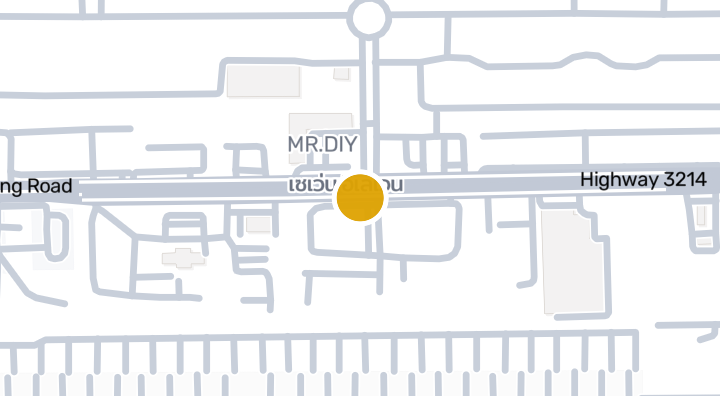
Parichart khlong 4 Condominium | Khlong Song, Khlong Luang,
Condominium
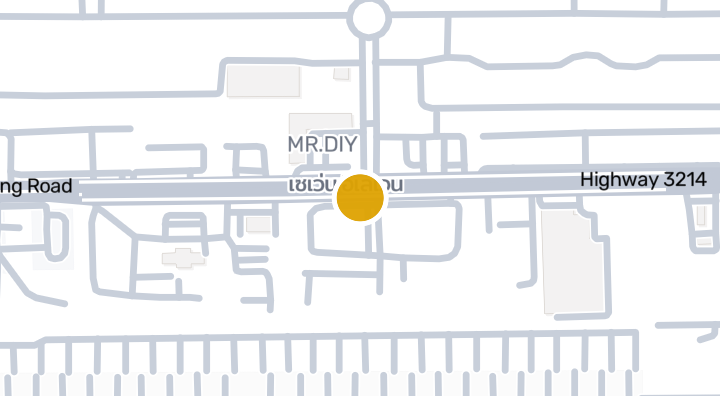
Baan Pruksa 64/2 Rangsit - Klong 3 | Condominium in KhlongLu
Condominium
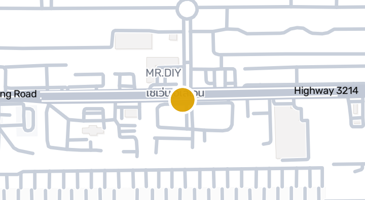
Baan Phan Nipar 2 Condominium in Khlong Song, Khlong Luang,
Condominium
Bann Pruksa Prime Rangsit-Klong 3 | Condominium in Khlong Lu
Condominium
Baan Nuan Tong Condominium in Khlong Song, Khlong Luang,Path
Condominium
Baan Pruksa 123 Phaholyothin-Khlong Luang | Condominium in K
Condominium
Baan Sap Phan Saen 1 Condominium in Khlong Song, Khlong Luag
Condominium
Baan Pruksa Rangsit-Klong 2
Condominium
Baan Pruksa 13 Rangsit Klong 3
Condominium
Baan Parichat Lak Si
Condominium
Thanmankhong
Condominium
BAAN PRUKSA 65/2 RANGSIT -KLONG 2 | Condominium in Khlong Lu
Condominium
Get notified when new units become available in Sila Munkong Factory.
Explore more
Browse Properties
BaanMe — your trusted platform for property listings, real estate insights, and market intelligence.
Explore all 77 provinces of Thailand
Use the interactive map to move from 77 provinces into 928 districts and 7,425 subdistricts, then compare local homes, prices, projects, and neighborhood guides.
Homes near transit, schools and landmarks
Choose a place that matters to your daily life, then compare live rentals and homes for sale nearby. Every place below has active inventory in its search area.
Thailand Property Market Report
Median asking prices across all active listings in Thailand, in Thai Baht.