Rent a Home

Condos for Rent

Houses for Rent

Villas for Rent

Apartments for Rent

Buy a Home

Condos for Sale

Houses for Sale

Villas for Sale

Land for Sale

Explore

Areas

Use the interactive map to move from 77 provinces into 928 districts and 7,425 subdistricts, then compare local homes, prices, projects, and neighborhood guides.

Browse Projects

Search condos, housing estates, and developments with active listings

Homes near transit, schools and landmarks

Choose a place that matters to your daily life, then compare live rentals and homes for sale nearby. Every place below has active inventory in its search area.

Owner-approved opportunities

Explore properties whose owners have confirmed a price and are open to a conversation, including owners with no hurry to sell.

Find an agent near you

Browse verified real estate agents and agencies by province, with active listings and reviews.

Resources

Guides & insights

Thailand Property Market Report

The provinces with the most active listings on the network. Click a province for its full market report.

Best Of Guides

Curated picks for the best areas to buy, rent, and live in Thailand

Visa Opportunities

Visa types, extensions, and applications for Thailand

Thailand property law

Plain-language guides to Thai property law, verified against official sources — for foreign buyers, Thai buyers and renters.

Thailand Flood History Map

Free tool: check whether an address, soi, or condo project in Thailand has flooded before, using historical satellite (SAR) flood observations.

Property news

The latest visa, tax and property-law updates for Thailand, verified against official sources.

All Articles

Tips, market insights, and property guides

Tools

Thailand Mortgage Calculator

Estimate a monthly home-loan payment from the property price, down payment, annual interest rate, and loan term you enter.

Transfer Fees Calculator

Estimate taxes and fees for property transfers in Thailand

Unit Conversions

Convert between Thai and international land units

  • Condos for Rent
  • Houses for Rent
  • Villas for Rent
  • Apartments for Rent
  • Condos for Sale
  • Houses for Sale
  • Villas for Sale
  • Land for Sale
  • Areas
  • Browse Projects
  • Homes near transit, schools and landmarks
  • Owner-approved opportunities
  • Find an agent near you
  • Thailand Property Market Report
  • Best Of Guides
  • Visa Opportunities
  • Thailand property law
  • Thailand Flood History Map
  • Property news
  • All Articles
  • Thailand Mortgage Calculator
  • Transfer Fees Calculator
  • Unit Conversions

Why BaanMe?

ID-Verified Agents

Every BaanMe agent is verified against a Thai government ID before they can publish a single listing — so you always know exactly who you are dealing with, and bad actors get permanently banned.

Secure In-App Chat (Coming Soon)

We are developing in-app messaging. Until it launches, contact options depend on the agent and listing.

Deposit Protection (Coming Soon)

Soon, BaanMe will hold your security deposit in escrow and review every claim ourselves — so unfair deductions and disappearing landlords become a thing of the past.

Contract Support

Ask your agent which contract languages and terms are available before signing.

Environmental Impact

We care about your, our, and everyone's environment. Which is why we have committed ourselves to re-foresting the rainforest in Pai, Thailand, with the help of Conserve Natural Forests, a local NGO committed to forest restoration in and around Pai.

Regions

  • Homes in Bangkok
  • Homes in Chiang Mai
  • Homes in Samut Prakan
  • Homes in Phetchabun
  • Homes in Lamphun
  • Homes in Nonthaburi
  • Homes in Chiang Rai
  • Homes in Chon Buri

Browse Properties

  • Bangkok Condos for Rent
  • Bangkok Apartments for Rent
  • Chiang Mai Houses for Rent
  • Bangkok Offices for Rent
  • Bangkok Warehouses for Rent
  • Koh Samui Houses for Rent
  • All Properties →

FAQ

  • Thailand Property Market Trends 2026: A Selective Recovery
  • More →

Best Of Guides

  • Best Areas to Buy a Condo in Bangkok
  • Best Neighborhoods for Expats in Thailand
  • Best Areas to Rent in Chiang Mai
  • Best Places to Buy a House in Phuket
  • Best Neighborhoods for Families in Bangkok
  • All Guides →

BaanMe

  • About BaanMe
  • Press Inquiries
  • Brand Assets
  • Privacy Policy
  • Terms & Conditions
  • Map Attribution
  • Help
  • Add BaanMe as a preferred source on Google
  • Delete Account

© Niklas Benjamin Muegge, 2026

  1. Home
  2. Sunrise Estate
Sunrise Estate
OverviewLocationReviewAvailable CondosNearby Projects

Sunrise Estate

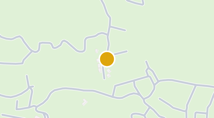
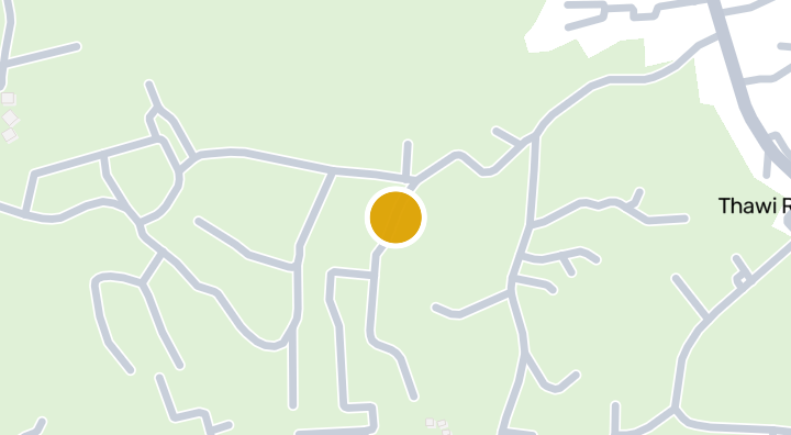
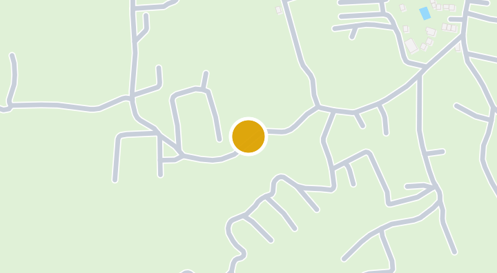
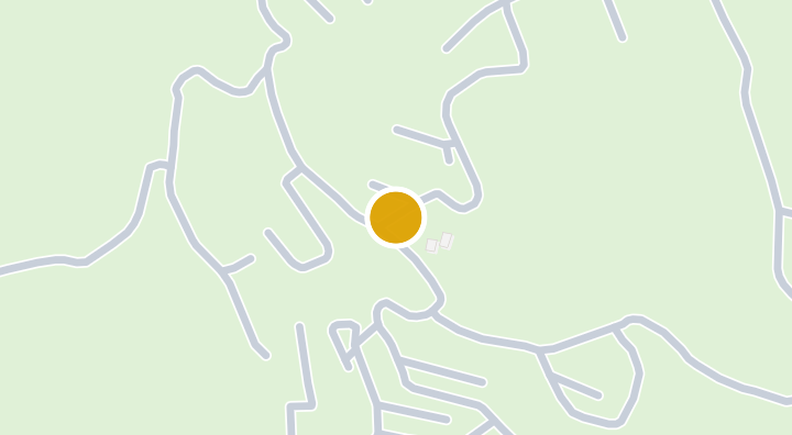
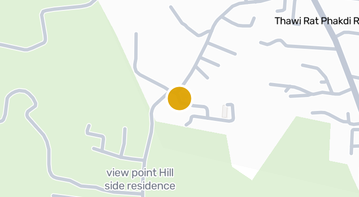
Sunrise Estate is a condominium project located in Bo Phut, on the island of Ko Samui in Surat Thani province. The surrounding area is part of a well-established island property market known for its beaches and resort lifestyle. Daily conveniences and leisure are close at hand, with Chaweng Noi Beach about 3 minutes away, the Hill Side Residence viewpoint around 4 minutes away, and Bandon International Hospital Chaweng roughly 962 metres from the project. This combination of beachside leisure, a scenic attraction, and nearby medical care makes Sunrise Estate a practical base on Ko Samui.

See Available Condos
In Sunrise Estate

Location

Ko Samui

Landslide susceptibility (DMR): Medium

3 min

to Chaweng Noi Beach

4 min

to view point Hill side residence

commute

3 min

Ko Samui

Check your commute

Save places and compare travel times from this home.

Neighborhood

Ko Samui

Ko Samui

Koh Samui is Thailand's second-largest island and its most established Gulf of Thailand resort destination. With its own international airport, world-class resorts (Four Seasons, W, Ritz-Carlton Reserve), and a mature villa rental market, Samui offers a full tropical island lifestyle without the isolation of more remote islands. The ring road circles the island in about an hour, connecting beach towns that each have distinct characters. Chaweng — The main tourist strip. Long white beach, nightlife, shopping. Dense development. Best for short-term rental income but the least "island" feel. Bophut (Fisherman's Village) — Charming, upscale area with converted shophouses, boutique restaurants, and a Friday night walking street. Popular with families and more discerning expats. Maenam — Quieter northern beach. Long stretch of sand, local feel. More affordable. Good family area with Samui International School nearby. Lamai — Southeast coast. Second-busiest after Chaweng but more relaxed. Good mix of tourist infrastructure and local life. Mid-range pricing. West coast hills — Sunset-facing hillside villas with panoramic Gulf views. The most premium residential locations. Privacy, views, and seclusion. Inland pool villas: 8–15 million THB. Sea-view villas: 15–40 million THB. Beachfront luxury: 30–100+ million THB. Condos are limited but start at 3–5 million THB. Holiday rental yields in peak season (Dec–Apr) are strong — managed villas can gross 6–10% — but drop significantly in low season. Bangkok Airways' monopoly on Samui Airport keeps flight prices high — a return trip from Bangkok costs 5,000–10,000 THB vs. 2,000 THB for comparable distances elsewhere. Most villa purchases are structured as leasehold (30+30+30 year) since foreigners cannot own land freehold. Construction and renovation costs are 20–30% higher than the mainland due to material transport logistics. November–December brings the heaviest rains. The west coast is more sheltered than the east during monsoon.

Explore Ko Samui

Location risk & context

river floodingLow(estimated)
flash floodingLow(estimated)
droughtMedium(based on the surrounding area)
poor air qualityNot enough data yet(basis not available)
fire riskNot enough data yet(basis not available)
extreme heatNot enough data yet(basis not available)
River flooding
Terrain height above nearest drainage: 72.24490649396294 m. This is an indirect screening indicator.
Evidence scope: Modelled screening · Confidence: Medium
Flash flooding
Terrain-derived susceptibility band: Low. This is not a flood-depth forecast.
Evidence scope: Modelled screening · Confidence: High
Drought
Rainfall was below the local normal in 16.11111111111111% of analysed 10-day periods. Regional screening uses project-defined thresholds.
Evidence scope: Area context · Confidence: Medium
Air quality
No usable evidence is available.
Evidence scope: Insufficient evidence
Fire
No usable evidence is available.
Evidence scope: Insufficient evidence
Heat
No usable evidence is available.
Evidence scope: Insufficient evidence

Flood

River flood

No satellite flood observation covers this location yet

River hazard is scored only against a single 2024 satellite-observed flood event covering four northern Thailand provinces (Chiang Mai, Chiang Rai, Lamphun, Phayao). "Unknown" outside that area means no observation exists yet — it does not mean the area is safe.

Flash flood

Low — some distance from watercourses or higher ground

Confidence: high

  • Height above nearest drainage: 72.2 m
  • Distance to nearest watercourse: 1874 m
  • Slope: 13.3%

Flash-flood terrain data is derived from OpenStreetMap waterway data. See OpenStreetMap attribution

Area context

Government construction cost estimate, maximum
12,500 THB/m² — In Surat Thani province
Source: Treasury Department (กรมธนารักษ์) construction cost appraisal · License: Open Data Common (Treasury Department building valuation catalogue) · 2024-08-15 to 2027-12-31
Government construction cost estimate, typical
7,500 THB/m² — In Surat Thani province
Source: Treasury Department (กรมธนารักษ์) construction cost appraisal · License: Open Data Common (Treasury Department building valuation catalogue) · 2024-08-15 to 2027-12-31
Government construction cost estimate, minimum
450 THB/m² — In Surat Thani province
Source: Treasury Department (กรมธนารักษ์) construction cost appraisal · License: Open Data Common (Treasury Department building valuation catalogue) · 2024-08-15 to 2027-12-31
Treasury land appraisal (municipality), maximum — assessed value, not market price
4,000 THB/sq_wah — In Bo Phut subdistrict
Source: Treasury Department (กรมธนารักษ์) land valuation (ราคาประเมินที่ดิน) - attach_all_20240805.csv — เทศบาลนครเกาะสมุย (municipal area) · License: Open Data Common · 2024-08-14 to 2024-08-14
Treasury land appraisal (municipality), typical — assessed value, not market price
2,500 THB/sq_wah — In Bo Phut subdistrict
Source: Treasury Department (กรมธนารักษ์) land valuation (ราคาประเมินที่ดิน) - attach_all_20240805.csv — เทศบาลนครเกาะสมุย (municipal area) · License: Open Data Common · 2024-08-14 to 2024-08-14
Treasury land appraisal (municipality), minimum — assessed value, not market price
500 THB/sq_wah — In Bo Phut subdistrict
Source: Treasury Department (กรมธนารักษ์) land valuation (ราคาประเมินที่ดิน) - attach_all_20240805.csv — เทศบาลนครเกาะสมุย (municipal area) · License: Open Data Common · 2024-08-14 to 2024-08-14
Treasury land appraisal (subdistrict), maximum — assessed value, not market price
20,000 THB/sq_wah — In Surat Thani province
Source: Treasury Department (กรมธนารักษ์) land valuation (ราคาประเมินที่ดิน) - attach_all_20240805.csv · License: Open Data Common · 2024-08-14 to 2024-08-14
Treasury land appraisal (subdistrict), typical — assessed value, not market price
500 THB/sq_wah — In Surat Thani province
Source: Treasury Department (กรมธนารักษ์) land valuation (ราคาประเมินที่ดิน) - attach_all_20240805.csv · License: Open Data Common · 2024-08-14 to 2024-08-14
Treasury land appraisal (subdistrict), minimum — assessed value, not market price
150 THB/sq_wah — In Surat Thani province
Source: Treasury Department (กรมธนารักษ์) land valuation (ราคาประเมินที่ดิน) - attach_all_20240805.csv · License: Open Data Common · 2024-08-14 to 2024-08-14
Driest month
February — In Surat Thani province
Source: Open-Meteo (ERA5 reanalysis, via archive-api.open-meteo.com) · License: CC BY 4.0 (Attribution 4.0 International) -- https://open-meteo.com/en/licence · 1991-01-01 to 2020-12-31
Climate rainfall annual total mean mm
1,732.4 mm — In Surat Thani province
Source: Open-Meteo (ERA5 reanalysis, via archive-api.open-meteo.com) · License: CC BY 4.0 (Attribution 4.0 International) -- https://open-meteo.com/en/licence · 1991-01-01 to 2020-12-31
Wettest month
October — In Surat Thani province
Source: Open-Meteo (ERA5 reanalysis, via archive-api.open-meteo.com) · License: CC BY 4.0 (Attribution 4.0 International) -- https://open-meteo.com/en/licence · 1991-01-01 to 2020-12-31
Height above nearest drainage (typical)
51.3 m — In Bo Phut subdistrict
Source: Terrain-derived flash-flood indicators (HAND + slope + OSM drainage proximity; NOT a forecast or probability, not calibrated against observed events) from Copernicus DEM GLO-30 (via Mapterhorn terrain tiles) and OpenStreetMap waterway data. The banded metric flags whether the region CONTAINS terrain susceptible to flash flooding somewhere within it -- not the susceptibility of the region as a whole, and not of any individual property. · License: Copernicus WorldDEM-30 Licence, commercial use permitted (see ./region-elevation.ts's ELEVATION_SOURCE_LICENSE for the full citation) combined with OpenStreetMap contributors: ODbL 1.0 (https://www.openstreetmap.org/copyright) · 2010-12-12 to 2015-01-07
Height above nearest drainage (lowest 10%)
-33.9 m — In Bo Phut subdistrict
Source: Terrain-derived flash-flood indicators (HAND + slope + OSM drainage proximity; NOT a forecast or probability, not calibrated against observed events) from Copernicus DEM GLO-30 (via Mapterhorn terrain tiles) and OpenStreetMap waterway data. The banded metric flags whether the region CONTAINS terrain susceptible to flash flooding somewhere within it -- not the susceptibility of the region as a whole, and not of any individual property. · License: Copernicus WorldDEM-30 Licence, commercial use permitted (see ./region-elevation.ts's ELEVATION_SOURCE_LICENSE for the full citation) combined with OpenStreetMap contributors: ODbL 1.0 (https://www.openstreetmap.org/copyright) · 2010-12-12 to 2015-01-07
Terrain slope (typical)
3.9% — In Bo Phut subdistrict
Source: Terrain-derived flash-flood indicators (HAND + slope + OSM drainage proximity; NOT a forecast or probability, not calibrated against observed events) from Copernicus DEM GLO-30 (via Mapterhorn terrain tiles) and OpenStreetMap waterway data. The banded metric flags whether the region CONTAINS terrain susceptible to flash flooding somewhere within it -- not the susceptibility of the region as a whole, and not of any individual property. · License: Copernicus WorldDEM-30 Licence, commercial use permitted (see ./region-elevation.ts's ELEVATION_SOURCE_LICENSE for the full citation) combined with OpenStreetMap contributors: ODbL 1.0 (https://www.openstreetmap.org/copyright) · 2010-12-12 to 2015-01-07
Terrain slope (steepest 10%)
9.7% — In Bo Phut subdistrict
Source: Terrain-derived flash-flood indicators (HAND + slope + OSM drainage proximity; NOT a forecast or probability, not calibrated against observed events) from Copernicus DEM GLO-30 (via Mapterhorn terrain tiles) and OpenStreetMap waterway data. The banded metric flags whether the region CONTAINS terrain susceptible to flash flooding somewhere within it -- not the susceptibility of the region as a whole, and not of any individual property. · License: Copernicus WorldDEM-30 Licence, commercial use permitted (see ./region-elevation.ts's ELEVATION_SOURCE_LICENSE for the full citation) combined with OpenStreetMap contributors: ODbL 1.0 (https://www.openstreetmap.org/copyright) · 2010-12-12 to 2015-01-07
Distance to nearest watercourse (typical)
1,652.9 m — In Bo Phut subdistrict
Source: Terrain-derived flash-flood indicators (HAND + slope + OSM drainage proximity; NOT a forecast or probability, not calibrated against observed events) from Copernicus DEM GLO-30 (via Mapterhorn terrain tiles) and OpenStreetMap waterway data. The banded metric flags whether the region CONTAINS terrain susceptible to flash flooding somewhere within it -- not the susceptibility of the region as a whole, and not of any individual property. · License: Copernicus WorldDEM-30 Licence, commercial use permitted (see ./region-elevation.ts's ELEVATION_SOURCE_LICENSE for the full citation) combined with OpenStreetMap contributors: ODbL 1.0 (https://www.openstreetmap.org/copyright) · 2010-12-12 to 2015-01-07
Distance to nearest watercourse (closest 10%)
802.2 m — In Bo Phut subdistrict
Source: Terrain-derived flash-flood indicators (HAND + slope + OSM drainage proximity; NOT a forecast or probability, not calibrated against observed events) from Copernicus DEM GLO-30 (via Mapterhorn terrain tiles) and OpenStreetMap waterway data. The banded metric flags whether the region CONTAINS terrain susceptible to flash flooding somewhere within it -- not the susceptibility of the region as a whole, and not of any individual property. · License: Copernicus WorldDEM-30 Licence, commercial use permitted (see ./region-elevation.ts's ELEVATION_SOURCE_LICENSE for the full citation) combined with OpenStreetMap contributors: ODbL 1.0 (https://www.openstreetmap.org/copyright) · 2010-12-12 to 2015-01-07
Flash-flood terrain susceptibility
moderate — In Bo Phut subdistrict
Source: Terrain-derived flash-flood indicators (HAND + slope + OSM drainage proximity; NOT a forecast or probability, not calibrated against observed events) from Copernicus DEM GLO-30 (via Mapterhorn terrain tiles) and OpenStreetMap waterway data. The banded metric flags whether the region CONTAINS terrain susceptible to flash flooding somewhere within it -- not the susceptibility of the region as a whole, and not of any individual property. · License: Copernicus WorldDEM-30 Licence, commercial use permitted (see ./region-elevation.ts's ELEVATION_SOURCE_LICENSE for the full citation) combined with OpenStreetMap contributors: ODbL 1.0 (https://www.openstreetmap.org/copyright) · 2010-12-12 to 2015-01-07
Elevation, maximum
499.3 m — In Bo Phut subdistrict
Source: Mapterhorn terrain tiles (Copernicus DEM GLO-30 / WorldDEM-30, terrarium encoding, via tiles.mapterhorn.com) · License: Copernicus WorldDEM-30 Licence (COP-DEM-GLO-30-F, 'Global 30m Full, Free & Open' -- https://documentation.dataspace.copernicus.eu/APIs/SentinelHub/Data/DEM/resources/license/License-COPDEM-30.pdf); free of charge, reproduction/distribution/public-communication/adaptation all granted, commercial use permitted; required notice: "produced using Copernicus WorldDEM-30 © DLR e.V. 2010-2014 and © Airbus Defence and Space GmbH 2014-2018 provided under COPERNICUS by the European Union and ESA; all rights reserved." Tiles served by Mapterhorn (© Mapterhorn, https://mapterhorn.com/attribution) -- both notices required. · 2010-12-12 to 2015-01-07
Elevation, typical
88.8 m — In Bo Phut subdistrict
Source: Mapterhorn terrain tiles (Copernicus DEM GLO-30 / WorldDEM-30, terrarium encoding, via tiles.mapterhorn.com) · License: Copernicus WorldDEM-30 Licence (COP-DEM-GLO-30-F, 'Global 30m Full, Free & Open' -- https://documentation.dataspace.copernicus.eu/APIs/SentinelHub/Data/DEM/resources/license/License-COPDEM-30.pdf); free of charge, reproduction/distribution/public-communication/adaptation all granted, commercial use permitted; required notice: "produced using Copernicus WorldDEM-30 © DLR e.V. 2010-2014 and © Airbus Defence and Space GmbH 2014-2018 provided under COPERNICUS by the European Union and ESA; all rights reserved." Tiles served by Mapterhorn (© Mapterhorn, https://mapterhorn.com/attribution) -- both notices required. · 2010-12-12 to 2015-01-07
Elevation, minimum
3 m — In Bo Phut subdistrict
Source: Mapterhorn terrain tiles (Copernicus DEM GLO-30 / WorldDEM-30, terrarium encoding, via tiles.mapterhorn.com) · License: Copernicus WorldDEM-30 Licence (COP-DEM-GLO-30-F, 'Global 30m Full, Free & Open' -- https://documentation.dataspace.copernicus.eu/APIs/SentinelHub/Data/DEM/resources/license/License-COPDEM-30.pdf); free of charge, reproduction/distribution/public-communication/adaptation all granted, commercial use permitted; required notice: "produced using Copernicus WorldDEM-30 © DLR e.V. 2010-2014 and © Airbus Defence and Space GmbH 2014-2018 provided under COPERNICUS by the European Union and ESA; all rights reserved." Tiles served by Mapterhorn (© Mapterhorn, https://mapterhorn.com/attribution) -- both notices required. · 2010-12-12 to 2015-01-07
Elevation, range
496.3 m — In Bo Phut subdistrict
Source: Mapterhorn terrain tiles (Copernicus DEM GLO-30 / WorldDEM-30, terrarium encoding, via tiles.mapterhorn.com) · License: Copernicus WorldDEM-30 Licence (COP-DEM-GLO-30-F, 'Global 30m Full, Free & Open' -- https://documentation.dataspace.copernicus.eu/APIs/SentinelHub/Data/DEM/resources/license/License-COPDEM-30.pdf); free of charge, reproduction/distribution/public-communication/adaptation all granted, commercial use permitted; required notice: "produced using Copernicus WorldDEM-30 © DLR e.V. 2010-2014 and © Airbus Defence and Space GmbH 2014-2018 provided under COPERNICUS by the European Union and ESA; all rights reserved." Tiles served by Mapterhorn (© Mapterhorn, https://mapterhorn.com/attribution) -- both notices required. · 2010-12-12 to 2015-01-07
Share of 10-day periods with rainfall deficit (10-year)
16.1% — In Ko Samui district
Source: Climate Hazards Center UC Santa Barbara & WFP -- Thailand: Rainfall Indicators at Subnational Level (HDX) · License: CC BY (Creative Commons Attribution International) · 2016-01-01 to 2025-12-31
Worst 3-month rainfall deficit (10-year)
17.5% — In Ko Samui district
Source: Climate Hazards Center UC Santa Barbara & WFP -- Thailand: Rainfall Indicators at Subnational Level (HDX) · License: CC BY (Creative Commons Attribution International) · 2016-01-01 to 2025-12-31
Recent 3-month rainfall vs. normal
100.3% — In Ko Samui district
Source: Climate Hazards Center UC Santa Barbara & WFP -- Thailand: Rainfall Indicators at Subnational Level (HDX) · License: CC BY (Creative Commons Attribution International) · 2026-07-01 to 2026-09-21
See more about this area

Screening evidence is not a safety guarantee, a future risk forecast or a site inspection.

Property Reviews

No reviews yet — be the first to leave one.

Reviews

Leave a review

Sign in required. One review per project.

Sign in to leave a review.

Nearby Projects
The Lux Samui – Condominium in Bo Phut, Ko Samui

The Lux Samui – Condominium in Bo Phut, Ko Samui

Condominium
Naori Residence

Naori Residence

Condominium

The Legend

The Legend

Condominium

Creek Villa Samui – Condominium in Bo Phut, Ko Samui

Creek Villa Samui – Condominium in Bo Phut, Ko Samui

Condominium
Apple Villas Koh Samui

Apple Villas Koh Samui

Condominium

Villa The Wave - Condominium in Bo Phut, Ko Samui

Villa The Wave - Condominium in Bo Phut, Ko Samui

Condominium
Samui Green Cottages — Condominium in Bo Phut, Ko Samui

Samui Green Cottages — Condominium in Bo Phut, Ko Samui

Condominium
Villa Jaliza Condominium in Bo Phut, Ko Samui

Villa Jaliza Condominium in Bo Phut, Ko Samui

Condominium
Oceans Chaweng

Oceans Chaweng

Condominium

Verano Residence

Verano Residence

Condominium

Sunrise Residence Condominium in Bo Phut, Ko Samui

Sunrise Residence Condominium in Bo Phut, Ko Samui

Condominium
Saitara Peak Condominium in Bo Phut, Ko Samui, Surat Thani

Saitara Peak Condominium in Bo Phut, Ko Samui, Surat Thani

Condominium

Get notified when new units become available in Sunrise Estate.

See Available Condos
In Sunrise Estate

Explore more

  • Browse Properties

    BaanMe — your trusted platform for property listings, real estate insights, and market intelligence.

  • Explore all 77 provinces of Thailand

    Use the interactive map to move from 77 provinces into 928 districts and 7,425 subdistricts, then compare local homes, prices, projects, and neighborhood guides.

  • Homes near transit, schools and landmarks

    Choose a place that matters to your daily life, then compare live rentals and homes for sale nearby. Every place below has active inventory in its search area.

  • Thailand Property Market Report

    Median asking prices across all active listings in Thailand, in Thai Baht.