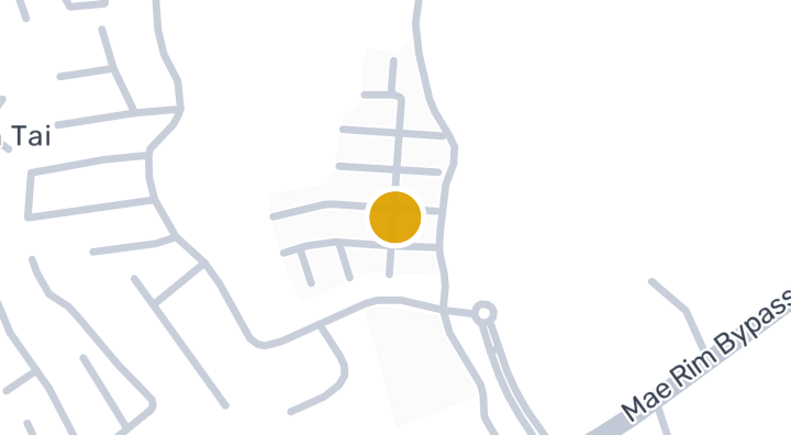
Donkaew Village 14
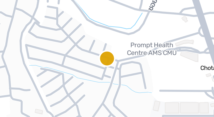
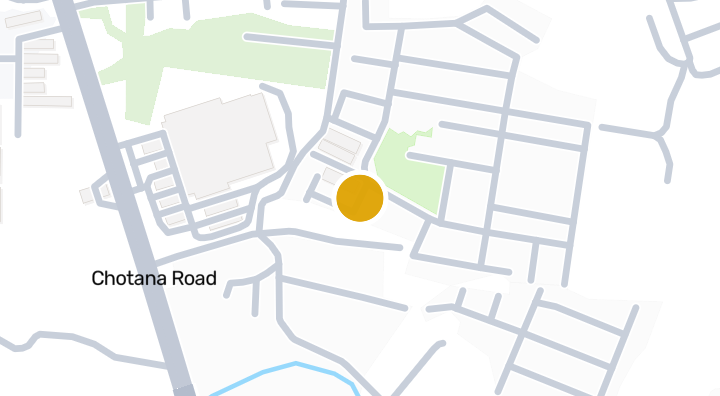
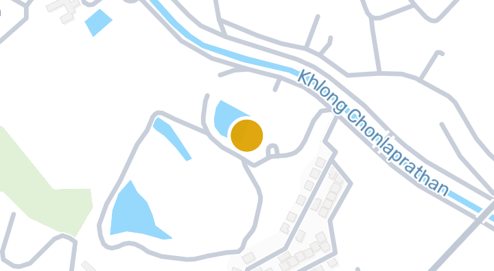
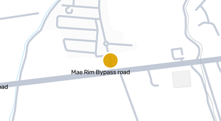
Donkaew Village 14 是一个位于清迈湄林县Rim Tai的住宅项目,以独栋房屋为主。项目周边生活配套包括约10分钟车程可达的Greenvalley高尔夫俱乐部、约22分钟可达的清迈天空探险机场,以及约25分钟可达的Pang Pao海滩。根据截至2026年1月1日的5笔近期成交记录,该区域租金中位数为每月20,000泰铢,约合每平方米127泰铢。湄林地处清迈北部,以自然山景和宽敞的住宅环境著称,适合以驾车出行为主的家庭。对于寻找清迈近郊独栋住宅的买家或租户而言,Donkaew Village 14提供了一个值得考虑的选择。
位置
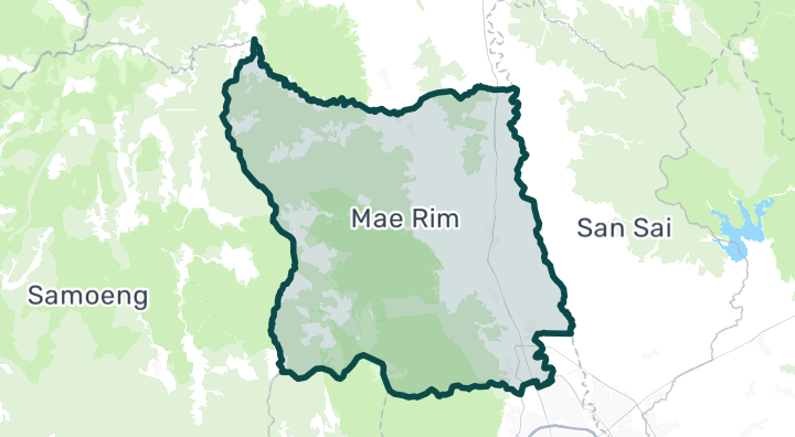
Mae Rim
22 分钟
至Chiang Mai Sky Adventure
周边社区
Mae Rim
Mae Rim is Chiang Mai's gateway to the mountains. The main road heading north climbs steadily, offering increasingly dramatic views, cooler temperatures, and lush vegetation. Adventure tourism (ziplines, elephant parks, ATV trails) lines the highway, while side roads lead to quiet villages and hillside properties with panoramic valley views. Noticeably cooler than the city — especially pleasant in the hot season Nature-oriented living: hiking, mountain biking, birdwatching Several boutique resorts and wellness retreats (Four Seasons, Dhara Dhevi nearby) Growing organic farming and farm-to-table dining scene Houses on larger plots: 3–12 million THB. Mountain-view properties with land: 5–25 million THB. Rental houses: 12,000–35,000 THB/month. Land prices increase significantly with elevation and views.
探索Mae Rim位置风险与周边信息
河流洪水高(基于实测)
山洪暴发低(基于估算)
干旱低(基于周边区域)
空气质量差中(基于实测)
火灾风险数据尚不充足(来源不明)
极端高温数据尚不充足(来源不明)
- 河流洪水
- 历史观测得到 高 筛查等级,并非未来洪水概率。
- 资料范围: 观测资料 · 置信度:低
- 山洪或突发洪水
- 地形推导的易受影响等级为 低,并非洪水深度预测。
- 资料范围: 模型筛查 · 置信度:高
- 干旱
- 分析的10天期间中,8.333333333333332% 的降雨量低于当地正常值。区域筛查使用项目设定阈值。
- 资料范围: 区域背景 · 置信度:中
- 空气质量
- PM2.5 年均值:20.57780246767044 µg/m³,来源:OpenAQ。并非当前空气质量读数。
- 资料范围: 区域背景 · 置信度:中
- 火灾
- 暂无可用依据。
- 资料范围: 资料不足
- 高温
- 暂无可用依据。
- 资料范围: 资料不足
洪水
河流洪水
高 — 在已观测事件中附近出现过严重洪水
置信度:低
河流洪水风险仅根据 2024 年一次卫星观测的洪水事件评分,覆盖泰国北部四个府(清迈、清莱、南邦、帕尧)。该范围之外显示“尚无数据”仅表示暂无观测记录,并不代表该地区安全。
山洪
低 — 距水道较远或地势较高
置信度:高
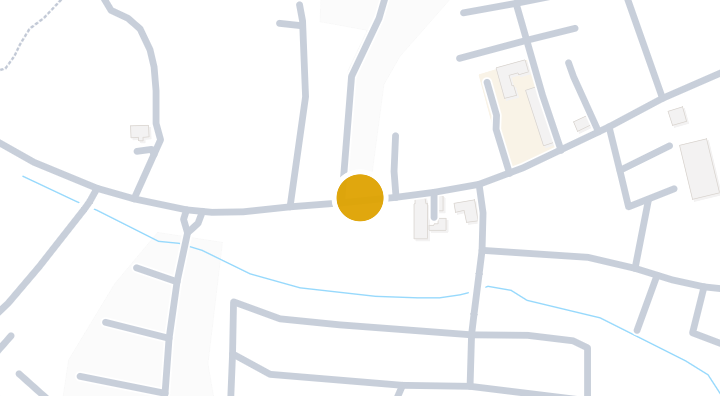
- 距最近排水道的相对高度:-4.5 米
- 距最近水道的距离:878 米
- 坡度:0.5%
山洪地形数据来自 OpenStreetMap 水道数据。 查看 OpenStreetMap 数据来源说明
周边信息
- 政府建筑造价估算,最高
- 13,000 THB/m² — Chiang Mai府范围内
- 数据来源:Treasury Department (กรมธนารักษ์) construction cost appraisal · 许可协议:Open Data Common (Treasury Department building valuation catalogue) · 2024-08-15 至 2027-12-31
- 政府建筑造价估算,中位
- 7,900 THB/m² — Chiang Mai府范围内
- 数据来源:Treasury Department (กรมธนารักษ์) construction cost appraisal · 许可协议:Open Data Common (Treasury Department building valuation catalogue) · 2024-08-15 至 2027-12-31
- 政府建筑造价估算,最低
- 400 THB/m² — Chiang Mai府范围内
- 数据来源:Treasury Department (กรมธนารักษ์) construction cost appraisal · 许可协议:Open Data Common (Treasury Department building valuation catalogue) · 2024-08-15 至 2027-12-31
- 土地厅市政区估价,最高——政府评估价,用于计税及过户费,非市场价
- 12,000 THB/sq_wah — Rim Tai分区范围内
- 数据来源:Treasury Department (กรมธนารักษ์) land valuation (ราคาประเมินที่ดิน) - attach_all_20240805.csv — เทศบาลตำบลแม่ริม (municipal area) · 许可协议:Open Data Common · 2024-08-14 至 2024-08-14
- 土地厅市政区估价,中位——政府评估价,用于计税及过户费,非市场价
- 4,500 THB/sq_wah — Rim Tai分区范围内
- 数据来源:Treasury Department (กรมธนารักษ์) land valuation (ราคาประเมินที่ดิน) - attach_all_20240805.csv — เทศบาลตำบลแม่ริม (municipal area) · 许可协议:Open Data Common · 2024-08-14 至 2024-08-14
- 土地厅市政区估价,最低——政府评估价,用于计税及过户费,非市场价
- 2,000 THB/sq_wah — Rim Tai分区范围内
- 数据来源:Treasury Department (กรมธนารักษ์) land valuation (ราคาประเมินที่ดิน) - attach_all_20240805.csv — เทศบาลตำบลแม่ริม (municipal area) · 许可协议:Open Data Common · 2024-08-14 至 2024-08-14
- 土地厅分区估价,最高——政府评估价,用于计税及过户费,非市场价
- 30,000 THB/sq_wah — Mae Rim县/区范围内
- 数据来源:Treasury Department (กรมธนารักษ์) land valuation (ราคาประเมินที่ดิน) - attach_all_20240805.csv · 许可协议:Open Data Common · 2024-08-14 至 2024-08-14
- 土地厅分区估价,中位——政府评估价,用于计税及过户费,非市场价
- 1,875 THB/sq_wah — Mae Rim县/区范围内
- 数据来源:Treasury Department (กรมธนารักษ์) land valuation (ราคาประเมินที่ดิน) - attach_all_20240805.csv · 许可协议:Open Data Common · 2024-08-14 至 2024-08-14
- 土地厅分区估价,最低——政府评估价,用于计税及过户费,非市场价
- 400 THB/sq_wah — Mae Rim县/区范围内
- 数据来源:Treasury Department (กรมธนารักษ์) land valuation (ราคาประเมินที่ดิน) - attach_all_20240805.csv · 许可协议:Open Data Common · 2024-08-14 至 2024-08-14
- 最干燥的月份
- 二月 — Chiang Mai府范围内
- 数据来源:Open-Meteo (ERA5 reanalysis, via archive-api.open-meteo.com) · 许可协议:CC BY 4.0 (Attribution 4.0 International) -- https://open-meteo.com/en/licence · 1991-01-01 至 2020-12-31
- Climate rainfall annual total mean mm
- 2,060.3 mm — Chiang Mai府范围内
- 数据来源:Open-Meteo (ERA5 reanalysis, via archive-api.open-meteo.com) · 许可协议:CC BY 4.0 (Attribution 4.0 International) -- https://open-meteo.com/en/licence · 1991-01-01 至 2020-12-31
- 降雨最多的月份
- 八月 — Chiang Mai府范围内
- 数据来源:Open-Meteo (ERA5 reanalysis, via archive-api.open-meteo.com) · 许可协议:CC BY 4.0 (Attribution 4.0 International) -- https://open-meteo.com/en/licence · 1991-01-01 至 2020-12-31
- 距最近排水道高度(中位数)
- -0.7 m — Rim Tai分区范围内
- 数据来源:Terrain-derived flash-flood indicators (HAND + slope + OSM drainage proximity; NOT a forecast or probability, not calibrated against observed events) from Copernicus DEM GLO-30 (via Mapterhorn terrain tiles) and OpenStreetMap waterway data. The banded metric flags whether the region CONTAINS terrain susceptible to flash flooding somewhere within it -- not the susceptibility of the region as a whole, and not of any individual property. · 许可协议:Copernicus WorldDEM-30 Licence, commercial use permitted (see ./region-elevation.ts's ELEVATION_SOURCE_LICENSE for the full citation) combined with OpenStreetMap contributors: ODbL 1.0 (https://www.openstreetmap.org/copyright) · 2010-12-12 至 2015-01-07
- 距最近排水道高度(最低 10%)
- -6 m — Rim Tai分区范围内
- 数据来源:Terrain-derived flash-flood indicators (HAND + slope + OSM drainage proximity; NOT a forecast or probability, not calibrated against observed events) from Copernicus DEM GLO-30 (via Mapterhorn terrain tiles) and OpenStreetMap waterway data. The banded metric flags whether the region CONTAINS terrain susceptible to flash flooding somewhere within it -- not the susceptibility of the region as a whole, and not of any individual property. · 许可协议:Copernicus WorldDEM-30 Licence, commercial use permitted (see ./region-elevation.ts's ELEVATION_SOURCE_LICENSE for the full citation) combined with OpenStreetMap contributors: ODbL 1.0 (https://www.openstreetmap.org/copyright) · 2010-12-12 至 2015-01-07
- 地形坡度(中位数)
- 0.6% — Rim Tai分区范围内
- 数据来源:Terrain-derived flash-flood indicators (HAND + slope + OSM drainage proximity; NOT a forecast or probability, not calibrated against observed events) from Copernicus DEM GLO-30 (via Mapterhorn terrain tiles) and OpenStreetMap waterway data. The banded metric flags whether the region CONTAINS terrain susceptible to flash flooding somewhere within it -- not the susceptibility of the region as a whole, and not of any individual property. · 许可协议:Copernicus WorldDEM-30 Licence, commercial use permitted (see ./region-elevation.ts's ELEVATION_SOURCE_LICENSE for the full citation) combined with OpenStreetMap contributors: ODbL 1.0 (https://www.openstreetmap.org/copyright) · 2010-12-12 至 2015-01-07
- 地形坡度(最陡 10%)
- 1.5% — Rim Tai分区范围内
- 数据来源:Terrain-derived flash-flood indicators (HAND + slope + OSM drainage proximity; NOT a forecast or probability, not calibrated against observed events) from Copernicus DEM GLO-30 (via Mapterhorn terrain tiles) and OpenStreetMap waterway data. The banded metric flags whether the region CONTAINS terrain susceptible to flash flooding somewhere within it -- not the susceptibility of the region as a whole, and not of any individual property. · 许可协议:Copernicus WorldDEM-30 Licence, commercial use permitted (see ./region-elevation.ts's ELEVATION_SOURCE_LICENSE for the full citation) combined with OpenStreetMap contributors: ODbL 1.0 (https://www.openstreetmap.org/copyright) · 2010-12-12 至 2015-01-07
- 距最近水道距离(中位数)
- 872.5 m — Rim Tai分区范围内
- 数据来源:Terrain-derived flash-flood indicators (HAND + slope + OSM drainage proximity; NOT a forecast or probability, not calibrated against observed events) from Copernicus DEM GLO-30 (via Mapterhorn terrain tiles) and OpenStreetMap waterway data. The banded metric flags whether the region CONTAINS terrain susceptible to flash flooding somewhere within it -- not the susceptibility of the region as a whole, and not of any individual property. · 许可协议:Copernicus WorldDEM-30 Licence, commercial use permitted (see ./region-elevation.ts's ELEVATION_SOURCE_LICENSE for the full citation) combined with OpenStreetMap contributors: ODbL 1.0 (https://www.openstreetmap.org/copyright) · 2010-12-12 至 2015-01-07
- 距最近水道距离(最近 10%)
- 221.2 m — Rim Tai分区范围内
- 数据来源:Terrain-derived flash-flood indicators (HAND + slope + OSM drainage proximity; NOT a forecast or probability, not calibrated against observed events) from Copernicus DEM GLO-30 (via Mapterhorn terrain tiles) and OpenStreetMap waterway data. The banded metric flags whether the region CONTAINS terrain susceptible to flash flooding somewhere within it -- not the susceptibility of the region as a whole, and not of any individual property. · 许可协议:Copernicus WorldDEM-30 Licence, commercial use permitted (see ./region-elevation.ts's ELEVATION_SOURCE_LICENSE for the full citation) combined with OpenStreetMap contributors: ODbL 1.0 (https://www.openstreetmap.org/copyright) · 2010-12-12 至 2015-01-07
- 山洪地形易发程度
- 中 — Rim Tai分区范围内
- 数据来源:Terrain-derived flash-flood indicators (HAND + slope + OSM drainage proximity; NOT a forecast or probability, not calibrated against observed events) from Copernicus DEM GLO-30 (via Mapterhorn terrain tiles) and OpenStreetMap waterway data. The banded metric flags whether the region CONTAINS terrain susceptible to flash flooding somewhere within it -- not the susceptibility of the region as a whole, and not of any individual property. · 许可协议:Copernicus WorldDEM-30 Licence, commercial use permitted (see ./region-elevation.ts's ELEVATION_SOURCE_LICENSE for the full citation) combined with OpenStreetMap contributors: ODbL 1.0 (https://www.openstreetmap.org/copyright) · 2010-12-12 至 2015-01-07
- 海拔最高值
- 347 m — Rim Tai分区范围内
- 数据来源:Mapterhorn terrain tiles (Copernicus DEM GLO-30 / WorldDEM-30, terrarium encoding, via tiles.mapterhorn.com) · 许可协议:Copernicus WorldDEM-30 Licence (COP-DEM-GLO-30-F, 'Global 30m Full, Free & Open' -- https://documentation.dataspace.copernicus.eu/APIs/SentinelHub/Data/DEM/resources/license/License-COPDEM-30.pdf); free of charge, reproduction/distribution/public-communication/adaptation all granted, commercial use permitted; required notice: "produced using Copernicus WorldDEM-30 © DLR e.V. 2010-2014 and © Airbus Defence and Space GmbH 2014-2018 provided under COPERNICUS by the European Union and ESA; all rights reserved." Tiles served by Mapterhorn (© Mapterhorn, https://mapterhorn.com/attribution) -- both notices required. · 2010-12-12 至 2015-01-07
- 海拔中位值
- 319.7 m — Rim Tai分区范围内
- 数据来源:Mapterhorn terrain tiles (Copernicus DEM GLO-30 / WorldDEM-30, terrarium encoding, via tiles.mapterhorn.com) · 许可协议:Copernicus WorldDEM-30 Licence (COP-DEM-GLO-30-F, 'Global 30m Full, Free & Open' -- https://documentation.dataspace.copernicus.eu/APIs/SentinelHub/Data/DEM/resources/license/License-COPDEM-30.pdf); free of charge, reproduction/distribution/public-communication/adaptation all granted, commercial use permitted; required notice: "produced using Copernicus WorldDEM-30 © DLR e.V. 2010-2014 and © Airbus Defence and Space GmbH 2014-2018 provided under COPERNICUS by the European Union and ESA; all rights reserved." Tiles served by Mapterhorn (© Mapterhorn, https://mapterhorn.com/attribution) -- both notices required. · 2010-12-12 至 2015-01-07
- 海拔最低值
- 310.9 m — Rim Tai分区范围内
- 数据来源:Mapterhorn terrain tiles (Copernicus DEM GLO-30 / WorldDEM-30, terrarium encoding, via tiles.mapterhorn.com) · 许可协议:Copernicus WorldDEM-30 Licence (COP-DEM-GLO-30-F, 'Global 30m Full, Free & Open' -- https://documentation.dataspace.copernicus.eu/APIs/SentinelHub/Data/DEM/resources/license/License-COPDEM-30.pdf); free of charge, reproduction/distribution/public-communication/adaptation all granted, commercial use permitted; required notice: "produced using Copernicus WorldDEM-30 © DLR e.V. 2010-2014 and © Airbus Defence and Space GmbH 2014-2018 provided under COPERNICUS by the European Union and ESA; all rights reserved." Tiles served by Mapterhorn (© Mapterhorn, https://mapterhorn.com/attribution) -- both notices required. · 2010-12-12 至 2015-01-07
- 海拔高差
- 36.1 m — Rim Tai分区范围内
- 数据来源:Mapterhorn terrain tiles (Copernicus DEM GLO-30 / WorldDEM-30, terrarium encoding, via tiles.mapterhorn.com) · 许可协议:Copernicus WorldDEM-30 Licence (COP-DEM-GLO-30-F, 'Global 30m Full, Free & Open' -- https://documentation.dataspace.copernicus.eu/APIs/SentinelHub/Data/DEM/resources/license/License-COPDEM-30.pdf); free of charge, reproduction/distribution/public-communication/adaptation all granted, commercial use permitted; required notice: "produced using Copernicus WorldDEM-30 © DLR e.V. 2010-2014 and © Airbus Defence and Space GmbH 2014-2018 provided under COPERNICUS by the European Union and ESA; all rights reserved." Tiles served by Mapterhorn (© Mapterhorn, https://mapterhorn.com/attribution) -- both notices required. · 2010-12-12 至 2015-01-07
- 近 10 年降雨不足旬数占比
- 8.3% — Mae Rim县/区范围内
- 数据来源:Climate Hazards Center UC Santa Barbara & WFP -- Thailand: Rainfall Indicators at Subnational Level (HDX) · 许可协议:CC BY (Creative Commons Attribution International) · 2016-01-01 至 2025-12-31
- 近 10 年最严重 3 个月降雨不足程度
- 32.8% — Mae Rim县/区范围内
- 数据来源:Climate Hazards Center UC Santa Barbara & WFP -- Thailand: Rainfall Indicators at Subnational Level (HDX) · 许可协议:CC BY (Creative Commons Attribution International) · 2016-01-01 至 2025-12-31
- 2024 年事件已分析面积占比
- 100% — Rim Tai分区范围内
- 数据来源:UNOSAT FL20240912THA -- Satellite detected water extents from 5 to 10 October 2024 over Chiang Mai and Lamphun Provinces (OBSERVED flood extent for ONE 2024 satellite pass -- not a general or future flood-risk indicator) · 许可协议:CC BY-SA (UNOSAT / United Nations Satellite Centre) · 2024-10-05 至 2024-10-10
- 2024 年事件观测洪水面积
- 1.5 km2 — Rim Tai分区范围内
- 数据来源:UNOSAT FL20240912THA -- Satellite detected water extents from 5 to 10 October 2024 over Chiang Mai and Lamphun Provinces (OBSERVED flood extent for ONE 2024 satellite pass -- not a general or future flood-risk indicator) · 许可协议:CC BY-SA (UNOSAT / United Nations Satellite Centre) · 2024-10-05 至 2024-10-10
- 2024 年事件受淹面积占比
- 17.3% — Rim Tai分区范围内
- 数据来源:UNOSAT FL20240912THA -- Satellite detected water extents from 5 to 10 October 2024 over Chiang Mai and Lamphun Provinces (OBSERVED flood extent for ONE 2024 satellite pass -- not a general or future flood-risk indicator) · 许可协议:CC BY-SA (UNOSAT / United Nations Satellite Centre) · 2024-10-05 至 2024-10-10
- 2024 年事件洪水暴露等级
- 高 — Rim Tai分区范围内
- 数据来源:UNOSAT FL20240912THA -- Satellite detected water extents from 5 to 10 October 2024 over Chiang Mai and Lamphun Provinces (OBSERVED flood extent for ONE 2024 satellite pass -- not a general or future flood-risk indicator) · 许可协议:CC BY-SA (UNOSAT / United Nations Satellite Centre) · 2024-10-05 至 2024-10-10
- PM2.5 年平均值(低成本传感器)
- 27.8 µg/m³ — Chiang Mai府范围内
- 数据来源:OpenAQ — ไดมอนด์.-2545166 (low-cost) · 许可协议:CC BY 4.0 (AirGradient via OpenAQ) · 2025-01-01 至 2026-01-01
- PM2.5 年平均值
- 20.6 µg/m³ — Chiang Mai府范围内
- 数据来源:OpenAQ — NARIT ASTROPARK (Parking)-1224519 (reference) · 许可协议:CC BY 4.0 (AirGradient via OpenAQ) · 2025-01-01 至 2026-01-01
- 近 3 个月降雨量占常年比例
- 104.3% — Mae Rim县/区范围内
- 数据来源:Climate Hazards Center UC Santa Barbara & WFP -- Thailand: Rainfall Indicators at Subnational Level (HDX) · 许可协议:CC BY (Creative Commons Attribution International) · 2026-07-01 至 2026-09-21
筛查资料不构成安全保证、未来风险预测或现场检查。
房源评价
还没有评价,快来成为第一个吧。
评价
撰写评价
需要登录。每个项目仅可评价一次。
登录后即可发表评价。
附近项目




当 Donkaew Village 14 有新单元时通知我。