Rent a Home

Condos for Rent

Houses for Rent

Villas for Rent

Apartments for Rent

Buy a Home

Condos for Sale

Houses for Sale

Villas for Sale

Land for Sale

Explore

Areas

Use the interactive map to move from 77 provinces into 928 districts and 7,425 subdistricts, then compare local homes, prices, projects, and neighborhood guides.

Browse Projects

Search condos, housing estates, and developments with active listings

Homes near transit, schools and landmarks

Choose a place that matters to your daily life, then compare live rentals and homes for sale nearby. Every place below has active inventory in its search area.

Owner-approved opportunities

Explore properties whose owners have confirmed a price and are open to a conversation, including owners with no hurry to sell.

Find an agent near you

Browse verified real estate agents and agencies by province, with active listings and reviews.

Resources

Guides & insights

Thailand Property Market Report

The provinces with the most active listings on the network. Click a province for its full market report.

Best Of Guides

Curated picks for the best areas to buy, rent, and live in Thailand

Visa Opportunities

Visa types, extensions, and applications for Thailand

Thailand property law

Plain-language guides to Thai property law, verified against official sources — for foreign buyers, Thai buyers and renters.

Thailand Flood History Map

Free tool: check whether an address, soi, or condo project in Thailand has flooded before, using historical satellite (SAR) flood observations.

Property news

The latest visa, tax and property-law updates for Thailand, verified against official sources.

All Articles

Tips, market insights, and property guides

Tools

Thailand Mortgage Calculator

Estimate a monthly home-loan payment from the property price, down payment, annual interest rate, and loan term you enter.

Transfer Fees Calculator

Estimate taxes and fees for property transfers in Thailand

Unit Conversions

Convert between Thai and international land units

  • Condos for Rent
  • Houses for Rent
  • Villas for Rent
  • Apartments for Rent
  • Condos for Sale
  • Houses for Sale
  • Villas for Sale
  • Land for Sale
  • Areas
  • Browse Projects
  • Homes near transit, schools and landmarks
  • Owner-approved opportunities
  • Find an agent near you
  • Thailand Property Market Report
  • Best Of Guides
  • Visa Opportunities
  • Thailand property law
  • Thailand Flood History Map
  • Property news
  • All Articles
  • Thailand Mortgage Calculator
  • Transfer Fees Calculator
  • Unit Conversions

What you can do

Find a home

Search listings by location, price, and property type.

Review the details

Compare photos, features, and available property information.

Ask the agent

Send an enquiry about a listing through BaanMe.

Plan your next step

Use location information and practical tools as part of your own research.

Environmental Impact

We care about your, our, and everyone's environment. Which is why we have committed ourselves to re-foresting the rainforest in Pai, Thailand, with the help of Conserve Natural Forests, a local NGO committed to forest restoration in and around Pai.

Regions

  • Homes in Bangkok
  • Homes in Chiang Mai
  • Homes in Samut Prakan
  • Homes in Phetchabun
  • Homes in Lamphun
  • Homes in Nonthaburi
  • Homes in Chiang Rai
  • Homes in Chon Buri

Browse Properties

  • Bangkok Condos for Rent
  • Bangkok Apartments for Rent
  • Chiang Mai Houses for Rent
  • Bangkok Offices for Rent
  • Bangkok Warehouses for Rent
  • Koh Samui Houses for Rent
  • All Properties →

FAQ

  • Thailand Property Market Trends 2026: A Selective Recovery
  • More →

Best Of Guides

  • Best Areas to Buy a Condo in Bangkok
  • Best Neighborhoods for Expats in Thailand
  • Best Areas to Rent in Chiang Mai
  • Best Places to Buy a House in Phuket
  • Best Neighborhoods for Families in Bangkok
  • All Guides →

BaanMe

  • About BaanMe
  • Press Inquiries
  • Reviews
  • Official links
  • Brand Assets
  • Privacy Policy
  • Terms & Conditions
  • Map Attribution
  • Help
  • Add BaanMe as a preferred source on Google
  • Delete Account
  • TPN — the network for property agents
  • MapScale — Thailand maps and boundaries

© Niklas Benjamin Muegge, 2026

  1. Home
  2. …
    1. Bangkok
    2. Pathum Wan
  3. Bangkok
  4. Pathum Wan
  5. SCOPE Langsuan
SCOPE Langsuan
OverviewFacilitiesLocationReviewAvailable CondosSimilar ProjectsNearby Projects

SCOPE Langsuan

Buy

฿52.0M – ฿85.0M

Rent

฿170K – ฿480K

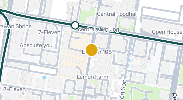
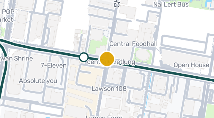
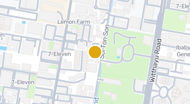
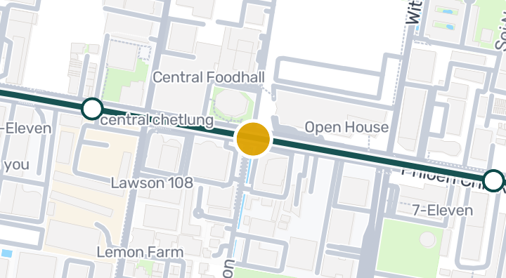
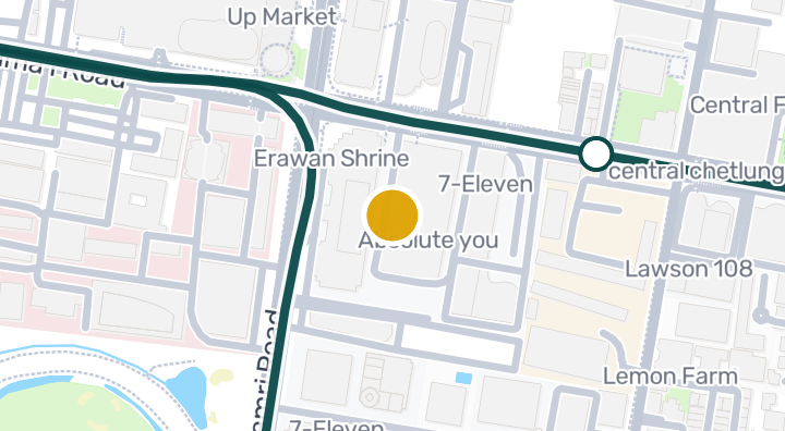
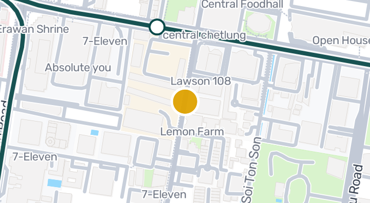
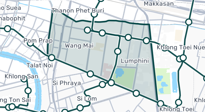
SCOPE Langsuan is a condominium located in Lumphini, Pathum Wan, Bangkok. The project offers a Finnish sauna, gym, and kids area. Recent price data as of 2026-01-01 shows a median sale price of THB 69,475,000, or approximately THB 735,896 per square metre, based on 6 recent transactions. Nearby, Nai Lert Park is about 551m away and Zen is about 557m away, with Groove @ CentralWorld (Harnn) around 661m away. Nai Lert Bus is roughly 5 minutes away, while Kamphaeng Saen Airport takes about 87 minutes to reach. There is also 1 nearby beach. Lumphini is a prime central subdistrict encompassing Chit Lom, Phloen Chit, Wireless Road and Langsuan, where parks, embassies, luxury retail and major offices support one of Bangkok's most premium condominium markets.

See Available Condos
In SCOPE Langsuan
Facilities
  • Gym
  • Finnish Sauna
  • Kids Area
  • Pool
  • Yoga Room
  • Meeting Room
  • Sauna

Location

Pathum Wan, Bangkok

6 min

to Chit Lom Station

22 min

to Aviation Division Army Movement Center

87 min

to Kamphaeng Saen Airport

commute

5 min

Pathum Wan, Bangkok

Check your commute

Save places and compare travel times from this home.

Neighborhood
Pathum Wan

Pathum Wan

Pathum Wan is Bangkok's most central and prestigious district. It's home to Siam Paragon, CentralWorld, Chidlom malls, Erawan shrine, and the Royal Bangkok Sports Club. The BTS interchange at Siam connects the Sukhumvit and Silom lines, making it the transit hub of the city. Property here is among the most expensive in Thailand — and holds its value accordingly. Siam area — High-energy urban core. Mega-malls, cinemas, and transit connections. Park Ventures and 28 Chidlom are landmark developments. Lang Suan / Ratchadamri — Quieter residential streets behind the commercial frontage. Mature trees, embassies, and ultra-luxury condos (Hansar, 98 Wireless). Walk to Lumphini Park. Chulalongkorn University area — Southern end of the district. More local character with university campuses and Sam Yan Mitrtown mixed-use development. The most expensive district in Thailand. Super-luxury projects on Wireless Road or Langsuan: 300,000–600,000+ THB/sqm. More standard central condos: 150,000–250,000 THB/sqm. Not a high rental yield area — buyers here prioritize capital appreciation and prestige.

Explore Pathum Wan

Location risk & context

river floodingHigh(estimated)
flash floodingMedium(estimated)
droughtHigh(based on the surrounding area)
poor air qualityMedium(observed)
fire riskNot enough data yet(basis not available)
extreme heatLow(based on the surrounding area)
River flooding
Terrain height above nearest drainage: -1.6 m. This is an indirect screening indicator.
Evidence scope: Modelled screening · Confidence: Medium
Flash flooding
Terrain-derived susceptibility band: Medium. This is not a flood-depth forecast.
Evidence scope: Modelled screening · Confidence: High
Drought
Rainfall was below the local normal in 21% of analysed 10-day periods. Regional screening uses project-defined thresholds.
Evidence scope: Area context · Confidence: Medium
Air quality
Annual mean PM2.5: 21.4 µg/m³, source: OpenAQ. This is not a current air-quality reading.
Evidence scope: Area context · Confidence: Medium
Fire
No usable evidence is available.
Evidence scope: Insufficient evidence
Heat
Annual mean of monthly maximum temperatures: 31.7 °C. Regional screening uses project-defined thresholds, not an individual health forecast.
Evidence scope: Area context · Confidence: Medium

Flood

River flood

No satellite flood observation covers this location yet

River hazard is scored only against a single 2024 satellite-observed flood event covering four northern Thailand provinces (Chiang Mai, Chiang Rai, Lamphun, Phayao). "Unknown" outside that area means no observation exists yet — it does not mean the area is safe.

Flash flood

Moderate — closer to a watercourse or lower-lying terrain

Confidence: high

  • Height above nearest drainage: -1.6 m
  • Distance to nearest watercourse: 2087 m
  • Slope: 5.1%

Flash-flood terrain data is derived from OpenStreetMap waterway data. See OpenStreetMap attribution

Area context

Government construction cost estimate, maximum
12,000 THB/m² — In Bangkok province
Source: Treasury Department (กรมธนารักษ์) construction cost appraisal · License: Open Data Common (Treasury Department building valuation catalogue) · 2024-08-15 to 2027-12-31
Government construction cost estimate, typical
7,950 THB/m² — In Bangkok province
Source: Treasury Department (กรมธนารักษ์) construction cost appraisal · License: Open Data Common (Treasury Department building valuation catalogue) · 2024-08-15 to 2027-12-31
Government construction cost estimate, minimum
400 THB/m² — In Bangkok province
Source: Treasury Department (กรมธนารักษ์) construction cost appraisal · License: Open Data Common (Treasury Department building valuation catalogue) · 2024-08-15 to 2027-12-31
Driest month
December — In Bangkok province
Source: Open-Meteo (ERA5 reanalysis, via archive-api.open-meteo.com) · License: CC BY 4.0 (Attribution 4.0 International) -- https://open-meteo.com/en/licence · 1991-01-01 to 2020-12-31
Climate rainfall annual total mean mm
1,195.3 mm — In Bangkok province
Source: Open-Meteo (ERA5 reanalysis, via archive-api.open-meteo.com) · License: CC BY 4.0 (Attribution 4.0 International) -- https://open-meteo.com/en/licence · 1991-01-01 to 2020-12-31
Average daily high temperature
31.7 C — In Bangkok province
Source: Open-Meteo (ERA5 reanalysis, via archive-api.open-meteo.com) · License: CC BY 4.0 (Attribution 4.0 International) -- https://open-meteo.com/en/licence · 1991-01-01 to 2020-12-31
Wettest month
September — In Bangkok province
Source: Open-Meteo (ERA5 reanalysis, via archive-api.open-meteo.com) · License: CC BY 4.0 (Attribution 4.0 International) -- https://open-meteo.com/en/licence · 1991-01-01 to 2020-12-31
Height above nearest drainage (typical)
-1.6 m — In Lumphini subdistrict
Source: Terrain-derived flash-flood indicators (HAND + slope + OSM drainage proximity; NOT a forecast or probability, not calibrated against observed events) from Copernicus DEM GLO-30 (via Mapterhorn terrain tiles) and OpenStreetMap waterway data. The banded metric flags whether the region CONTAINS terrain susceptible to flash flooding somewhere within it -- not the susceptibility of the region as a whole, and not of any individual property. · License: Copernicus WorldDEM-30 Licence, commercial use permitted (see ./region-elevation.ts's ELEVATION_SOURCE_LICENSE for the full citation) combined with OpenStreetMap contributors: ODbL 1.0 (https://www.openstreetmap.org/copyright) · 2010-12-12 to 2015-01-07
Height above nearest drainage (lowest 10%)
-4.2 m — In Lumphini subdistrict
Source: Terrain-derived flash-flood indicators (HAND + slope + OSM drainage proximity; NOT a forecast or probability, not calibrated against observed events) from Copernicus DEM GLO-30 (via Mapterhorn terrain tiles) and OpenStreetMap waterway data. The banded metric flags whether the region CONTAINS terrain susceptible to flash flooding somewhere within it -- not the susceptibility of the region as a whole, and not of any individual property. · License: Copernicus WorldDEM-30 Licence, commercial use permitted (see ./region-elevation.ts's ELEVATION_SOURCE_LICENSE for the full citation) combined with OpenStreetMap contributors: ODbL 1.0 (https://www.openstreetmap.org/copyright) · 2010-12-12 to 2015-01-07
Terrain slope (typical)
0.6% — In Lumphini subdistrict
Source: Terrain-derived flash-flood indicators (HAND + slope + OSM drainage proximity; NOT a forecast or probability, not calibrated against observed events) from Copernicus DEM GLO-30 (via Mapterhorn terrain tiles) and OpenStreetMap waterway data. The banded metric flags whether the region CONTAINS terrain susceptible to flash flooding somewhere within it -- not the susceptibility of the region as a whole, and not of any individual property. · License: Copernicus WorldDEM-30 Licence, commercial use permitted (see ./region-elevation.ts's ELEVATION_SOURCE_LICENSE for the full citation) combined with OpenStreetMap contributors: ODbL 1.0 (https://www.openstreetmap.org/copyright) · 2010-12-12 to 2015-01-07
Terrain slope (steepest 10%)
1.2% — In Lumphini subdistrict
Source: Terrain-derived flash-flood indicators (HAND + slope + OSM drainage proximity; NOT a forecast or probability, not calibrated against observed events) from Copernicus DEM GLO-30 (via Mapterhorn terrain tiles) and OpenStreetMap waterway data. The banded metric flags whether the region CONTAINS terrain susceptible to flash flooding somewhere within it -- not the susceptibility of the region as a whole, and not of any individual property. · License: Copernicus WorldDEM-30 Licence, commercial use permitted (see ./region-elevation.ts's ELEVATION_SOURCE_LICENSE for the full citation) combined with OpenStreetMap contributors: ODbL 1.0 (https://www.openstreetmap.org/copyright) · 2010-12-12 to 2015-01-07
Distance to nearest watercourse (typical)
2,254.8 m — In Lumphini subdistrict
Source: Terrain-derived flash-flood indicators (HAND + slope + OSM drainage proximity; NOT a forecast or probability, not calibrated against observed events) from Copernicus DEM GLO-30 (via Mapterhorn terrain tiles) and OpenStreetMap waterway data. The banded metric flags whether the region CONTAINS terrain susceptible to flash flooding somewhere within it -- not the susceptibility of the region as a whole, and not of any individual property. · License: Copernicus WorldDEM-30 Licence, commercial use permitted (see ./region-elevation.ts's ELEVATION_SOURCE_LICENSE for the full citation) combined with OpenStreetMap contributors: ODbL 1.0 (https://www.openstreetmap.org/copyright) · 2010-12-12 to 2015-01-07
Distance to nearest watercourse (closest 10%)
1,712.7 m — In Lumphini subdistrict
Source: Terrain-derived flash-flood indicators (HAND + slope + OSM drainage proximity; NOT a forecast or probability, not calibrated against observed events) from Copernicus DEM GLO-30 (via Mapterhorn terrain tiles) and OpenStreetMap waterway data. The banded metric flags whether the region CONTAINS terrain susceptible to flash flooding somewhere within it -- not the susceptibility of the region as a whole, and not of any individual property. · License: Copernicus WorldDEM-30 Licence, commercial use permitted (see ./region-elevation.ts's ELEVATION_SOURCE_LICENSE for the full citation) combined with OpenStreetMap contributors: ODbL 1.0 (https://www.openstreetmap.org/copyright) · 2010-12-12 to 2015-01-07
Flash-flood terrain susceptibility
low — In Lumphini subdistrict
Source: Terrain-derived flash-flood indicators (HAND + slope + OSM drainage proximity; NOT a forecast or probability, not calibrated against observed events) from Copernicus DEM GLO-30 (via Mapterhorn terrain tiles) and OpenStreetMap waterway data. The banded metric flags whether the region CONTAINS terrain susceptible to flash flooding somewhere within it -- not the susceptibility of the region as a whole, and not of any individual property. · License: Copernicus WorldDEM-30 Licence, commercial use permitted (see ./region-elevation.ts's ELEVATION_SOURCE_LICENSE for the full citation) combined with OpenStreetMap contributors: ODbL 1.0 (https://www.openstreetmap.org/copyright) · 2010-12-12 to 2015-01-07
Elevation, maximum
8.8 m — In Lumphini subdistrict
Source: Mapterhorn terrain tiles (Copernicus DEM GLO-30 / WorldDEM-30, terrarium encoding, via tiles.mapterhorn.com) · License: Copernicus WorldDEM-30 Licence (COP-DEM-GLO-30-F, 'Global 30m Full, Free & Open' -- https://documentation.dataspace.copernicus.eu/APIs/SentinelHub/Data/DEM/resources/license/License-COPDEM-30.pdf); free of charge, reproduction/distribution/public-communication/adaptation all granted, commercial use permitted; required notice: "produced using Copernicus WorldDEM-30 © DLR e.V. 2010-2014 and © Airbus Defence and Space GmbH 2014-2018 provided under COPERNICUS by the European Union and ESA; all rights reserved." Tiles served by Mapterhorn (© Mapterhorn, https://mapterhorn.com/attribution) -- both notices required. · 2010-12-12 to 2015-01-07
Elevation, typical
5.6 m — In Lumphini subdistrict
Source: Mapterhorn terrain tiles (Copernicus DEM GLO-30 / WorldDEM-30, terrarium encoding, via tiles.mapterhorn.com) · License: Copernicus WorldDEM-30 Licence (COP-DEM-GLO-30-F, 'Global 30m Full, Free & Open' -- https://documentation.dataspace.copernicus.eu/APIs/SentinelHub/Data/DEM/resources/license/License-COPDEM-30.pdf); free of charge, reproduction/distribution/public-communication/adaptation all granted, commercial use permitted; required notice: "produced using Copernicus WorldDEM-30 © DLR e.V. 2010-2014 and © Airbus Defence and Space GmbH 2014-2018 provided under COPERNICUS by the European Union and ESA; all rights reserved." Tiles served by Mapterhorn (© Mapterhorn, https://mapterhorn.com/attribution) -- both notices required. · 2010-12-12 to 2015-01-07
Elevation, minimum
1.2 m — In Lumphini subdistrict
Source: Mapterhorn terrain tiles (Copernicus DEM GLO-30 / WorldDEM-30, terrarium encoding, via tiles.mapterhorn.com) · License: Copernicus WorldDEM-30 Licence (COP-DEM-GLO-30-F, 'Global 30m Full, Free & Open' -- https://documentation.dataspace.copernicus.eu/APIs/SentinelHub/Data/DEM/resources/license/License-COPDEM-30.pdf); free of charge, reproduction/distribution/public-communication/adaptation all granted, commercial use permitted; required notice: "produced using Copernicus WorldDEM-30 © DLR e.V. 2010-2014 and © Airbus Defence and Space GmbH 2014-2018 provided under COPERNICUS by the European Union and ESA; all rights reserved." Tiles served by Mapterhorn (© Mapterhorn, https://mapterhorn.com/attribution) -- both notices required. · 2010-12-12 to 2015-01-07
Elevation, range
7.5 m — In Lumphini subdistrict
Source: Mapterhorn terrain tiles (Copernicus DEM GLO-30 / WorldDEM-30, terrarium encoding, via tiles.mapterhorn.com) · License: Copernicus WorldDEM-30 Licence (COP-DEM-GLO-30-F, 'Global 30m Full, Free & Open' -- https://documentation.dataspace.copernicus.eu/APIs/SentinelHub/Data/DEM/resources/license/License-COPDEM-30.pdf); free of charge, reproduction/distribution/public-communication/adaptation all granted, commercial use permitted; required notice: "produced using Copernicus WorldDEM-30 © DLR e.V. 2010-2014 and © Airbus Defence and Space GmbH 2014-2018 provided under COPERNICUS by the European Union and ESA; all rights reserved." Tiles served by Mapterhorn (© Mapterhorn, https://mapterhorn.com/attribution) -- both notices required. · 2010-12-12 to 2015-01-07
Share of 10-day periods with rainfall deficit (10-year)
20.8% — In Bangkok province
Source: Climate Hazards Center UC Santa Barbara & WFP -- Thailand: Rainfall Indicators at Subnational Level (HDX) · License: CC BY (Creative Commons Attribution International) · 2016-01-01 to 2025-12-31
Worst 3-month rainfall deficit (10-year)
26.8% — In Bangkok province
Source: Climate Hazards Center UC Santa Barbara & WFP -- Thailand: Rainfall Indicators at Subnational Level (HDX) · License: CC BY (Creative Commons Attribution International) · 2016-01-01 to 2025-12-31
PM2.5, annual average (low-cost sensor)
25 µg/m³ — In Bangkok province
Source: OpenAQ — Soi Rimthang Rotfai 3-2662388 (low-cost) · License: CC BY 4.0 (AirGradient via OpenAQ) · 2025-01-01 to 2026-01-01
PM2.5, annual average
21.4 µg/m³ — In Bangkok province
Source: OpenAQ — Millennium Residence-2151387 (reference) · License: CC BY 4.0 (AirGradient via OpenAQ) · 2025-01-01 to 2026-01-01
Recent 3-month rainfall vs. normal
108.4% — In Bangkok province
Source: Climate Hazards Center UC Santa Barbara & WFP -- Thailand: Rainfall Indicators at Subnational Level (HDX) · License: CC BY (Creative Commons Attribution International) · 2026-07-01 to 2026-09-21
See more about this area

Screening evidence is not a safety guarantee, a future risk forecast or a site inspection.

Market Stats

From this project's active listings

Not enough listings yet

Sale price / sqm

THB 2,262/m²

Rent price / sqm

Not enough listings yet

Gross rental yield

Not enough listings yet

Rent-to-sale spread

Unit Mix
Unit Mix
BedroomsActive listingsSale price / sqmRent price / sqm
1 bedroom13THB 69,475,000THB 190,000
2 bedrooms1Not enough listings yetNot enough listings yet
3 bedrooms1Not enough listings yetNot enough listings yet

Property Reviews

No reviews yet — be the first to leave one.

Reviews

Leave a review

Sign in required. One review per project.

Sign in to leave a review.

Available for Rent

180,000 THB/mo

121183 m²+12 mo.
SCOPE Langsuan · Pathum Wan

200,000 THB/mo

12984 m²+12 mo.
SCOPE Langsuan · Pathum Wan

170,000 THB/mo

112385 m²+12 mo.
SCOPE Langsuan · Pathum Wan

200,000 THB/mo

11984 m²+12 mo.
SCOPE Langsuan · Pathum Wan
See all 11 rentals

Available for Sale

85,000,000 THB

113485 m²
SCOPE Langsuan · Pathum Wan

52,000,000 THB

11785 m²
SCOPE Langsuan · Pathum Wan

54,950,000 THB

111785 m²
SCOPE Langsuan · Pathum Wan

84,000,000 THB

11184 m²
SCOPE Langsuan · Pathum Wan

Nearby Projects

Piya Place

Piya Place

Condominium

Vanicha Park Langsuan

Vanicha Park Langsuan

Condominium

Casa Langsuan

Casa Langsuan

Condominium

B.Grimm BUILDING Condominium in Lumphini, Bangkok

B.Grimm BUILDING Condominium in Lumphini, Bangkok

Condominium
Siri Wireless Apartment | Condominium in Lumphini, Pathumwan

Siri Wireless Apartment | Condominium in Lumphini, Pathumwan

Condominium
Bliston Suwan Park View

Bliston Suwan Park View

Condominium

The Pine Crest Residence

The Pine Crest Residence

Condominium

Embassy Place Apartment - Condominium in Lumphini, Bangkok

Embassy Place Apartment - Condominium in Lumphini, Bangkok

Condominium
Cape House Condominium in Lumphini, Pathum Wan, Bangkok

Cape House Condominium in Lumphini, Pathum Wan, Bangkok

Condominium
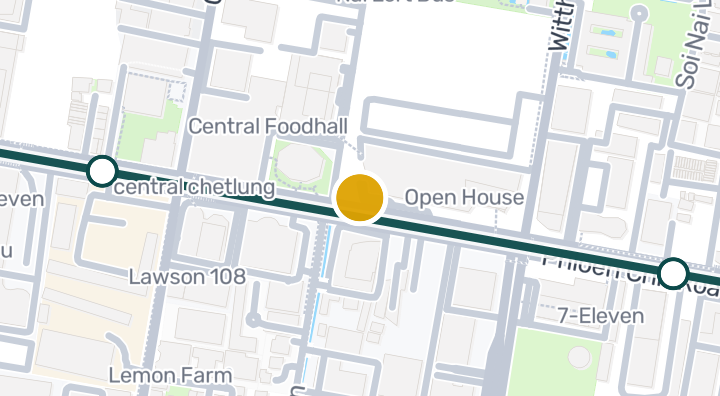
Tonson Tower Condominium in Lumphini, Pathum Wan, Bangkok

Tonson Tower Condominium in Lumphini, Pathum Wan, Bangkok

Condominium
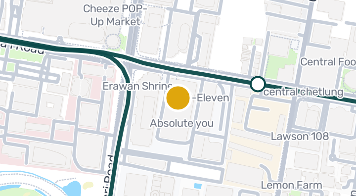
Elite Office

Elite Office

Condominium

Amarin Tower

Amarin Tower

Condominium

Get notified when new units become available in SCOPE Langsuan.

See Available Condos
In SCOPE Langsuan

Explore more

  • Browse Properties

    BaanMe — your trusted platform for property listings, real estate insights, and market intelligence.

  • Explore all 77 provinces of Thailand

    Use the interactive map to move from 77 provinces into 928 districts and 7,425 subdistricts, then compare local homes, prices, projects, and neighborhood guides.

  • Homes near transit, schools and landmarks

    Choose a place that matters to your daily life, then compare live rentals and homes for sale nearby. Every place below has active inventory in its search area.

  • Thailand Property Market Report

    Median asking prices across all active listings in Thailand, in Thai Baht.