เช่าบ้าน

คอนโดให้เช่า

บ้านให้เช่า

วิลล่าให้เช่า

อพาร์ตเมนต์ให้เช่า

ซื้อบ้าน

คอนโดขาย

บ้านขาย

วิลล่าขาย

ที่ดินขาย

สำรวจ

พื้นที่

เลือกพื้นที่บนแผนที่แบบอินเทอร์แอคทีฟ ตั้งแต่ 77 จังหวัด ไปจนถึง 928 อำเภอและเขต และ 7,425 ตำบลและแขวง แล้วเปรียบเทียบบ้าน ราคา โครงการ และคู่มือย่านต่าง ๆ

ค้นหาโครงการ

ค้นหาคอนโด หมู่บ้านจัดสรร และโครงการที่มีประกาศอยู่ในขณะนี้

บ้านใกล้รถไฟฟ้า โรงเรียน และสถานที่สำคัญ

เลือกสถานที่ที่สำคัญต่อชีวิตประจำวัน แล้วเปรียบเทียบบ้านเช่าและบ้านขายใกล้เคียง ทุกสถานที่ด้านล่างมีประกาศที่ยังเปิดอยู่ในพื้นที่ค้นหา

โอกาสขายที่เจ้าของอนุมัติ

สำรวจอสังหาริมทรัพย์ที่เจ้าของยืนยันราคาและพร้อมพูดคุย รวมถึงเจ้าของที่ไม่รีบขาย

ค้นหานายหน้าใกล้คุณ

ค้นหานายหน้าและบริษัทอสังหาริมทรัพย์ที่ผ่านการยืนยันตามจังหวัด พร้อมประกาศที่ใช้งานอยู่และรีวิว

แหล่งข้อมูล

คู่มือและข้อมูลเชิงลึก

รายงานตลาดอสังหาริมทรัพย์ประเทศไทย

จังหวัดที่มีประกาศใช้งานอยู่มากที่สุดบนเครือข่าย คลิกที่จังหวัดเพื่อดูรายงานตลาดฉบับเต็ม

คู่มือแนะนำ

รวมทำเลที่ดีที่สุดสำหรับซื้อ เช่า และอยู่อาศัยในประเทศไทย

วีซ่า

ประเภทวีซ่า การต่ออายุ และการยื่นขอวีซ่าสำหรับประเทศไทย

กฎหมายอสังหาริมทรัพย์ในประเทศไทย

คู่มือกฎหมายอสังหาริมทรัพย์ไทยฉบับเข้าใจง่าย ตรวจสอบกับแหล่งข้อมูลทางการ — สำหรับผู้ซื้อชาวต่างชาติ ผู้ซื้อชาวไทย และผู้เช่า

แผนที่ประวัติน้ำท่วมประเทศไทย

เครื่องมือฟรี: ตรวจสอบว่าที่อยู่ ซอย หรือโครงการคอนโดในประเทศไทยเคยน้ำท่วมหรือไม่ โดยใช้ข้อมูลจากภาพถ่ายดาวเทียมเรดาร์ (SAR) ในอดีต

ข่าวอสังหาริมทรัพย์

ความเคลื่อนไหวล่าสุดด้านวีซ่า ภาษี และกฎหมายอสังหาริมทรัพย์ในไทย ตรวจสอบกับแหล่งข้อมูลทางการแล้ว

บทความทั้งหมด

เคล็ดลับ ข้อมูลตลาด และคู่มืออสังหาริมทรัพย์

เครื่องมือ

เครื่องคำนวณสินเชื่อบ้านในประเทศไทย

ประมาณค่างวดสินเชื่อบ้านรายเดือนจากราคาทรัพย์ เงินดาวน์ อัตราดอกเบี้ยต่อปี และระยะเวลากู้ที่คุณกรอก

คำนวณค่าโอน

ประมาณภาษีและค่าธรรมเนียมสำหรับการโอนอสังหาริมทรัพย์ในไทย

แปลงหน่วย

แปลงหน่วยที่ดินไทยและสากล

  • คอนโดให้เช่า
  • บ้านให้เช่า
  • วิลล่าให้เช่า
  • อพาร์ตเมนต์ให้เช่า
  • คอนโดขาย
  • บ้านขาย
  • วิลล่าขาย
  • ที่ดินขาย
  • พื้นที่
  • ค้นหาโครงการ
  • บ้านใกล้รถไฟฟ้า โรงเรียน และสถานที่สำคัญ
  • โอกาสขายที่เจ้าของอนุมัติ
  • ค้นหานายหน้าใกล้คุณ
  • รายงานตลาดอสังหาริมทรัพย์ประเทศไทย
  • คู่มือแนะนำ
  • วีซ่า
  • กฎหมายอสังหาริมทรัพย์ในประเทศไทย
  • แผนที่ประวัติน้ำท่วมประเทศไทย
  • ข่าวอสังหาริมทรัพย์
  • บทความทั้งหมด
  • เครื่องคำนวณสินเชื่อบ้านในประเทศไทย
  • คำนวณค่าโอน
  • แปลงหน่วย

ทำไมต้อง BaanMe?

เอเจนต์ที่ผ่านการยืนยันตัวตน

ทุกเอเจนต์บน BaanMe ผ่านการยืนยันด้วยบัตรประชาชนไทยที่ออกโดยรัฐก่อนจะลงประกาศได้ คุณจึงมั่นใจได้เสมอว่ากำลังคุยกับใคร และคนที่ทำผิดจะถูกแบนถาวร

แชทในแอปที่ปลอดภัย (เร็ว ๆ นี้)

เรากำลังพัฒนาระบบข้อความในแอป ระหว่างนี้ช่องทางติดต่อขึ้นอยู่กับเอเจนต์และประกาศ

คุ้มครองเงินมัดจำ (เร็วๆ นี้)

เร็วๆ นี้ BaanMe จะเก็บเงินมัดจำของคุณไว้ และตรวจสอบทุกคำร้องการคืนมัดจำเอง — เพื่อให้การหักเงินที่ไม่เป็นธรรมและเจ้าของบ้านที่หายตัวกลายเป็นเรื่องของอดีต

ความช่วยเหลือด้านสัญญา

สอบถามเอเจนต์เรื่องภาษาและเงื่อนไขสัญญาที่มีให้บริการก่อนลงนาม

ผลกระทบต่อสิ่งแวดล้อม

เราใส่ใจสิ่งแวดล้อมของคุณ ของเรา และของทุกคน จึงมุ่งมั่นฟื้นฟูป่าฝนในปาย ประเทศไทย ด้วยความช่วยเหลือจาก Conserve Natural Forests องค์กรท้องถิ่นที่ทุ่มเทเพื่อการฟื้นฟูป่าในและรอบปาย

ภูมิภาค

  • บ้านในกรุงเทพมหานคร
  • บ้านในเชียงใหม่
  • บ้านในสมุทรปราการ
  • บ้านในเพชรบูรณ์
  • บ้านในลำพูน
  • บ้านในนนทบุรี
  • บ้านในเชียงราย
  • บ้านในชลบุรี

ค้นหาอสังหาริมทรัพย์

  • คอนโดให้เช่า กรุงเทพฯ
  • อพาร์ตเมนต์ให้เช่า กรุงเทพฯ
  • บ้านเช่า เชียงใหม่
  • สำนักงานให้เช่า กรุงเทพฯ
  • โกดังให้เช่า กรุงเทพฯ
  • บ้านเช่า เกาะสมุย
  • อสังหาริมทรัพย์ทั้งหมด →

คำถามที่พบบ่อย

  • แนวโน้มตลาดอสังหาริมทรัพย์ไทยปี 2569: ฟื้นตัวแบบเลือกทำเลและระดับราคา
  • เพิ่มเติม →

คู่มือแนะนำ

  • ทำเลซื้อคอนโดที่ดีที่สุดในกรุงเทพ
  • ย่านที่ดีที่สุดสำหรับชาวต่างชาติในประเทศไทย
  • ทำเลเช่าที่ดีที่สุดในเชียงใหม่
  • ทำเลซื้อบ้านที่ดีที่สุดในภูเก็ต
  • ย่านที่ดีที่สุดสำหรับครอบครัวในกรุงเทพ
  • คู่มือทั้งหมด →

BaanMe

  • เกี่ยวกับ BaanMe
  • สอบถามสื่อ
  • แบรนด์แอสเซ็ต
  • นโยบายความเป็นส่วนตัว
  • ข้อกำหนดและเงื่อนไข
  • การระบุแหล่งที่มาของแผนที่
  • ช่วยเหลือ
  • เพิ่ม BaanMe เป็นแหล่งข้อมูลที่ต้องการบน Google
  • ลบบัญชี

© Niklas Benjamin Muegge, 2026

  1. หน้าแรก
  2. …
    1. กรุงเทพมหานคร
    2. วัฒนา
  3. กรุงเทพมหานคร
  4. วัฒนา
  5. เดอะ ล็อฟท์ เอกมัย
ภาพรวมสิ่งอำนวยความสะดวกข้อมูลและสถิติทำเลที่ตั้งผู้พัฒนาโครงการรีวิวคอนโดที่ว่างโครงการที่คล้ายกันโครงการใกล้เคียง

เดอะ ล็อฟท์ เอกมัย

ซื้อ

฿6.5M – ฿24.0M

เช่า

฿19K – ฿112K

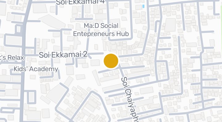
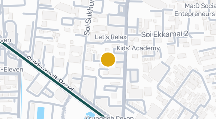
The Lofts Ekkamai: The Loft Ekkamai The Lofts Ekkamai is located between Sukhumvit Soi 63 and Soi 65 on Sukhumvit Road, approximately 150 meters from BTS Ekamai. Sky Lounge and garden, Infinity Edge Pool on 28-storey High Ride Condo with starting price of 4,400,000 Baht. The Lofts Ekkamai High Ride Condo Featured With Location The condo project is adjacent to BTS Ekkamai and Sukhumvit. Expanded from early Sukhumvit. Walking in the car. Public buses (There are bus stops near the front of the project.) Taxi with all the living elements. Close to the city center, saving you travel time. Full of work. Live life, shopping, eating, drinking. Located in the Ekamai area or just one BTS Sky train. The Lofts Ekkamai The Lofts Ekkamai is another project that can meet the life of the city as well. All in all. Of living Whether it is a location. Facilities within the project include Sky Lounge, Gymnasium, Gymnasium, Separate Men's & Women's Swimming Pool, Skyline Swimming Pool. The Lofts Ekkamai has a total of 263 units, with a total of 263 units, divided into two wings, the Ekkamai Wing and the Prakanong Wing, each with a maximum of 15 units. The Lofts Ekkamai is a prime location on Sukhumvit Road, just 150 meters from the Ekamai BTS Skytrain Station. Department store shopping centers Eat and drink school and hospital. Travel Information - The Lofts Ekkamai Project If traveling by car If you drive to the Sukhumvit / Ekkamai Expressway or Expressway can access the project The Lofts Ekkamai is not difficult or if the number of sides. Drive to the U-turn. Then drive a little more. The project itself. But the disadvantages of using a private car on Sukhumvit Road. Must admit Traffic is quite dense. Especially during rush hours. Travel by BTS , this option is very convenient. When leaving Ekamai station Walk out the exit 3 to find the temple. Come on I'll see you at Sukhumvit Hospital. I came a little. I will find the project. The Hang Out Outsite Near The Lofts Ekkamai If you look at The Lofts Ekkamai, you will see the "Ekamai Gate", which is a large mall lifestyle that is right in the middle of the project and has a snowmobile city "Snowtown Gateway Ekamai". Back to the side of Soi Ekamai. Meet with Major Cineplex Sukhumvit (Ekkamai) or if you go to Soi Ekamai, you will find community mall "Park Lane" (Park Lane) Community Mall that includes famous restaurants. Supermarket The hotel also offers a wide range of services, including a spa, boutiques, fashion boutiques and can be connected to Thonglor. There are also community outlets such as Market Place, Seen Space, J Avenue, restaurants, and hang out restaurants such as Audrey, Wine Republic, Arena 10, Funky Villa, Muse, Hobs, Mellow. >> Click to read Review of The Lofts Ekkamai: The Lofts Ekkamai: The Lofts Ekkamai Project Details The Lofts Ekkamai Project details (as of December 9, 2014) • Project Owner: Raimon Land Plc. • Location: Between Sukhumvit Soi 63 and Soi 65, about 150 meters from BTS Ekamai. • Location: Sukhumvit Road, Prakanong Nua, Wattana, Bangkok 10110 • Condo near BTS Ekamai • Central Sukhumvit Soi 4 • Project area: 1-3-83 acres • Project Type: 1 storey building with 2 floors, Ekkamai Wing and Prakanong Wing. • Serviced Apartment: 263 units (7th to 7th floor) • Parking: 158 spaces (60%), 70% from 1st to 6th floor. • Lift: 3 passengers • Lift service: 1 • Room Type Ekkamai Wing (North): - There are 2 types of studios: Type ST-1 [28-29 sq.m.], Type 1B [35 sq.m.] - 1 bedroom with 2 types: Type 1B-G [51 Sq.m., Type 1C [51 Sq.m.] - 2 bedrooms with 2 types: Type 2A [74 sq.m., Type 2B [60-61 sq.m.] - Loft 1 Type Loft 1 [44-45 sq.m.] - Penthouse Type PH 5 [166 sq.m.] Prakanong Wing (South): - 1 bedroom with 2 types: Type 1A [45 sq.m., Type 1AG [51 sq.m.] - 2 bedrooms with 2 types: Type 2A [74 sq.m.], Type 2B [61 sq.m.] - Penthouse with Type PH 2.5 [129-151 sq.m.] • Construction started: under construction. • Completion: Q3 / 201 • Sinking fund: 600 baht / sq.m. • Public fee: 40 baht / sq.m / month • Current start price: 4.4 million baht • Average selling price: 150,000 - 200,000 baht / sq.m. Lobby Facilities: G floor (Ground floor) consists of a corporate office, a mailbox room, a multipurpose room, a key card access system, and a lift. Facility Floor: 28th floor with Sky Lounge and garden, gym room, separate male-female swimming pool, 25m Infinity Edge Pool with children's pool. For those who are interested in The Lofts Ekkamai condo project, please see The Lofts Ekkamai condo listing or The Lofts Ekkamai condo rental list . ---------------------------------------------- --------------- The Lofts Ekkamai Developer: Raimon Land Ekkamai Co., Ltd. Product type: Freehold Residential Condominium Tower: 28 storeys Facilities Roof top resident's garden with BBQ area Infinity edge salt water swimming pool with sun decks In-pool Jacuzzi Sky Lofts Lounge Fully equipped fitness center with panoramic city views M & F saunas M & F changing rooms Residents garden on 7th floor 24-hour security with CCTV Floor specific access card system Covered main lobby drop off area High speed elevators

ดูคอนโดที่ว่าง
ใน เดอะ ล็อฟท์ เอกมัย
สิ่งอำนวยความสะดวก
  • ซาวน่าฟินแลนด์
  • สระว่ายน้ำ
ข้อมูลและสถิติ

2016

ปีที่สร้างเสร็จ

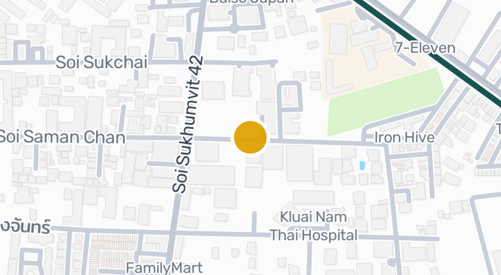
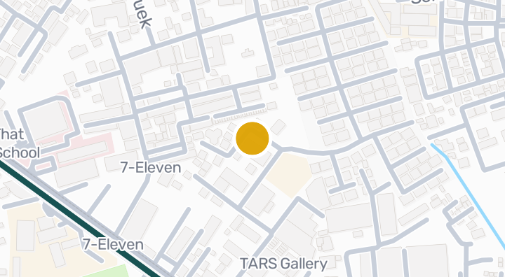
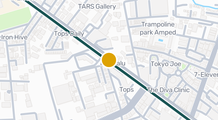
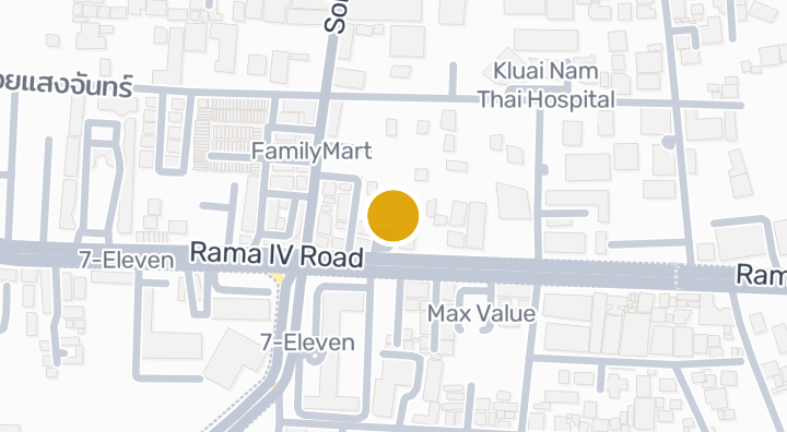
ตำแหน่ง

วัฒนา, กรุงเทพมหานคร

4 นาที

ถึง Ekkamai Station

87 นาที

ถึง Kamphaeng Saen Airport

เวลาเดินทาง

1 นาที

วัฒนา, กรุงเทพมหานคร

ตรวจสอบเวลาเดินทาง

บันทึกสถานที่และเปรียบเทียบเวลาเดินทางจากที่อยู่นี้

ความเสี่ยงและข้อมูลพื้นที่โดยรอบ

น้ำท่วมจากแม่น้ำสูง(จากการประมาณการ)
น้ำท่วมฉับพลันต่ำ(จากการประมาณการ)
ภัยแล้งสูง(อ้างอิงจากพื้นที่โดยรอบ)
คุณภาพอากาศไม่ดีปานกลาง(จากการสังเกตจริง)
ความเสี่ยงไฟป่ายังไม่มีข้อมูลเพียงพอ(ไม่มีข้อมูลที่มา)
อากาศร้อนจัดต่ำ(อ้างอิงจากพื้นที่โดยรอบ)
น้ำท่วมจากแม่น้ำ
ความสูงเหนือทางระบายน้ำที่ใกล้ที่สุด 1.7120649955468252 ม. เป็นตัวชี้วัดคัดกรองทางอ้อม
ขอบเขตข้อมูล: ข้อมูลคัดกรองจากแบบจำลอง · ความเชื่อมั่น: ปานกลาง
น้ำท่วมฉับพลัน
ระดับแนวโน้มจากภูมิประเทศ ต่ำ ไม่ใช่การคาดการณ์ระดับน้ำท่วม
ขอบเขตข้อมูล: ข้อมูลคัดกรองจากแบบจำลอง · ความเชื่อมั่น: สูง
ภัยแล้ง
ปริมาณฝนต่ำกว่าค่าปกติของพื้นที่ใน 23.055555555555557% ของช่วง 10 วันที่วิเคราะห์ การคัดกรองระดับพื้นที่ใช้เกณฑ์ที่โครงการกำหนด
ขอบเขตข้อมูล: บริบทของพื้นที่ · ความเชื่อมั่น: ปานกลาง
คุณภาพอากาศ
ค่าเฉลี่ย PM2.5 รายปี 21.4137936382034 µg/m³ แหล่งข้อมูล OpenAQ ไม่ใช่ค่าคุณภาพอากาศปัจจุบัน
ขอบเขตข้อมูล: บริบทของพื้นที่ · ความเชื่อมั่น: ปานกลาง
ไฟ
ไม่มีข้อมูลที่ใช้วิเคราะห์ได้
ขอบเขตข้อมูล: ข้อมูลไม่เพียงพอ
ความร้อน
ค่าเฉลี่ยรายปีของอุณหภูมิสูงสุดรายเดือน 31.6985529589617 °C การคัดกรองระดับพื้นที่ใช้เกณฑ์ที่โครงการกำหนด ไม่ใช่การคาดการณ์ผลต่อสุขภาพรายบุคคล
ขอบเขตข้อมูล: บริบทของพื้นที่ · ความเชื่อมั่น: ปานกลาง

น้ำท่วม

น้ำท่วมจากแม่น้ำ

ยังไม่มีข้อมูลดาวเทียมครอบคลุมตำแหน่งนี้

ระดับความเสี่ยงน้ำท่วมจากแม่น้ำอ้างอิงจากภาพถ่ายดาวเทียมเหตุการณ์น้ำท่วมปี 2024 เพียงครั้งเดียว ครอบคลุม 4 จังหวัดภาคเหนือ (เชียงใหม่ เชียงราย ลำพูน พะเยา) เท่านั้น สถานะ "ยังไม่มีข้อมูล" นอกพื้นที่ดังกล่าวหมายความว่ายังไม่มีการสำรวจ ไม่ได้แปลว่าพื้นที่นั้นปลอดภัย

น้ำท่วมฉับพลัน

ต่ำ — อยู่ห่างจากลำน้ำหรืออยู่บนพื้นที่สูงพอสมควร

ความเชื่อมั่น: สูง

  • ความสูงเหนือทางระบายน้ำที่ใกล้ที่สุด: 1.7 ม.
  • ระยะห่างจากลำน้ำที่ใกล้ที่สุด: 3464 ม.
  • ความลาดชัน: 0.6%

ข้อมูลภูมิประเทศสำหรับน้ำท่วมฉับพลันมาจากข้อมูลลำน้ำของ OpenStreetMap ดูการอ้างอิงข้อมูล OpenStreetMap

ข้อมูลพื้นที่โดยรอบ

ราคาประเมินค่าก่อสร้างราชการ สูงสุด
12,000 THB/m² — ในจังหวัดกรุงเทพมหานคร
แหล่งข้อมูล: Treasury Department (กรมธนารักษ์) construction cost appraisal · สัญญาอนุญาต: Open Data Common (Treasury Department building valuation catalogue) · 2024-08-15 ถึง 2027-12-31
ราคาประเมินค่าก่อสร้างราชการ ค่ากลาง
7,950 THB/m² — ในจังหวัดกรุงเทพมหานคร
แหล่งข้อมูล: Treasury Department (กรมธนารักษ์) construction cost appraisal · สัญญาอนุญาต: Open Data Common (Treasury Department building valuation catalogue) · 2024-08-15 ถึง 2027-12-31
ราคาประเมินค่าก่อสร้างราชการ ต่ำสุด
400 THB/m² — ในจังหวัดกรุงเทพมหานคร
แหล่งข้อมูล: Treasury Department (กรมธนารักษ์) construction cost appraisal · สัญญาอนุญาต: Open Data Common (Treasury Department building valuation catalogue) · 2024-08-15 ถึง 2027-12-31
เดือนที่แล้งที่สุด
ธันวาคม — ในจังหวัดกรุงเทพมหานคร
แหล่งข้อมูล: Open-Meteo (ERA5 reanalysis, via archive-api.open-meteo.com) · สัญญาอนุญาต: CC BY 4.0 (Attribution 4.0 International) -- https://open-meteo.com/en/licence · 1991-01-01 ถึง 2020-12-31
Climate rainfall annual total mean mm
1,195.3 mm — ในจังหวัดกรุงเทพมหานคร
แหล่งข้อมูล: Open-Meteo (ERA5 reanalysis, via archive-api.open-meteo.com) · สัญญาอนุญาต: CC BY 4.0 (Attribution 4.0 International) -- https://open-meteo.com/en/licence · 1991-01-01 ถึง 2020-12-31
อุณหภูมิสูงสุดเฉลี่ยต่อวัน
31.7 C — ในจังหวัดกรุงเทพมหานคร
แหล่งข้อมูล: Open-Meteo (ERA5 reanalysis, via archive-api.open-meteo.com) · สัญญาอนุญาต: CC BY 4.0 (Attribution 4.0 International) -- https://open-meteo.com/en/licence · 1991-01-01 ถึง 2020-12-31
เดือนที่ฝนตกชุกที่สุด
กันยายน — ในจังหวัดกรุงเทพมหานคร
แหล่งข้อมูล: Open-Meteo (ERA5 reanalysis, via archive-api.open-meteo.com) · สัญญาอนุญาต: CC BY 4.0 (Attribution 4.0 International) -- https://open-meteo.com/en/licence · 1991-01-01 ถึง 2020-12-31
ความสูงเหนือทางระบายน้ำ (ค่ากลาง)
4.1 m — ในตำบล/แขวงพระโขนง
แหล่งข้อมูล: Terrain-derived flash-flood indicators (HAND + slope + OSM drainage proximity; NOT a forecast or probability, not calibrated against observed events) from Copernicus DEM GLO-30 (via Mapterhorn terrain tiles) and OpenStreetMap waterway data. The banded metric flags whether the region CONTAINS terrain susceptible to flash flooding somewhere within it -- not the susceptibility of the region as a whole, and not of any individual property. · สัญญาอนุญาต: Copernicus WorldDEM-30 Licence, commercial use permitted (see ./region-elevation.ts's ELEVATION_SOURCE_LICENSE for the full citation) combined with OpenStreetMap contributors: ODbL 1.0 (https://www.openstreetmap.org/copyright) · 2010-12-12 ถึง 2015-01-07
ความสูงเหนือทางระบายน้ำ (ต่ำสุด 10%)
1.1 m — ในตำบล/แขวงพระโขนง
แหล่งข้อมูล: Terrain-derived flash-flood indicators (HAND + slope + OSM drainage proximity; NOT a forecast or probability, not calibrated against observed events) from Copernicus DEM GLO-30 (via Mapterhorn terrain tiles) and OpenStreetMap waterway data. The banded metric flags whether the region CONTAINS terrain susceptible to flash flooding somewhere within it -- not the susceptibility of the region as a whole, and not of any individual property. · สัญญาอนุญาต: Copernicus WorldDEM-30 Licence, commercial use permitted (see ./region-elevation.ts's ELEVATION_SOURCE_LICENSE for the full citation) combined with OpenStreetMap contributors: ODbL 1.0 (https://www.openstreetmap.org/copyright) · 2010-12-12 ถึง 2015-01-07
ความลาดชันภูมิประเทศ (ค่ากลาง)
0.6% — ในตำบล/แขวงพระโขนง
แหล่งข้อมูล: Terrain-derived flash-flood indicators (HAND + slope + OSM drainage proximity; NOT a forecast or probability, not calibrated against observed events) from Copernicus DEM GLO-30 (via Mapterhorn terrain tiles) and OpenStreetMap waterway data. The banded metric flags whether the region CONTAINS terrain susceptible to flash flooding somewhere within it -- not the susceptibility of the region as a whole, and not of any individual property. · สัญญาอนุญาต: Copernicus WorldDEM-30 Licence, commercial use permitted (see ./region-elevation.ts's ELEVATION_SOURCE_LICENSE for the full citation) combined with OpenStreetMap contributors: ODbL 1.0 (https://www.openstreetmap.org/copyright) · 2010-12-12 ถึง 2015-01-07
ความลาดชันภูมิประเทศ (ชันสุด 10%)
1.9% — ในตำบล/แขวงพระโขนง
แหล่งข้อมูล: Terrain-derived flash-flood indicators (HAND + slope + OSM drainage proximity; NOT a forecast or probability, not calibrated against observed events) from Copernicus DEM GLO-30 (via Mapterhorn terrain tiles) and OpenStreetMap waterway data. The banded metric flags whether the region CONTAINS terrain susceptible to flash flooding somewhere within it -- not the susceptibility of the region as a whole, and not of any individual property. · สัญญาอนุญาต: Copernicus WorldDEM-30 Licence, commercial use permitted (see ./region-elevation.ts's ELEVATION_SOURCE_LICENSE for the full citation) combined with OpenStreetMap contributors: ODbL 1.0 (https://www.openstreetmap.org/copyright) · 2010-12-12 ถึง 2015-01-07
ระยะห่างจากลำน้ำ (ค่ากลาง)
3,746.3 m — ในตำบล/แขวงพระโขนง
แหล่งข้อมูล: Terrain-derived flash-flood indicators (HAND + slope + OSM drainage proximity; NOT a forecast or probability, not calibrated against observed events) from Copernicus DEM GLO-30 (via Mapterhorn terrain tiles) and OpenStreetMap waterway data. The banded metric flags whether the region CONTAINS terrain susceptible to flash flooding somewhere within it -- not the susceptibility of the region as a whole, and not of any individual property. · สัญญาอนุญาต: Copernicus WorldDEM-30 Licence, commercial use permitted (see ./region-elevation.ts's ELEVATION_SOURCE_LICENSE for the full citation) combined with OpenStreetMap contributors: ODbL 1.0 (https://www.openstreetmap.org/copyright) · 2010-12-12 ถึง 2015-01-07
ระยะห่างจากลำน้ำ (ใกล้สุด 10%)
3,280.3 m — ในตำบล/แขวงพระโขนง
แหล่งข้อมูล: Terrain-derived flash-flood indicators (HAND + slope + OSM drainage proximity; NOT a forecast or probability, not calibrated against observed events) from Copernicus DEM GLO-30 (via Mapterhorn terrain tiles) and OpenStreetMap waterway data. The banded metric flags whether the region CONTAINS terrain susceptible to flash flooding somewhere within it -- not the susceptibility of the region as a whole, and not of any individual property. · สัญญาอนุญาต: Copernicus WorldDEM-30 Licence, commercial use permitted (see ./region-elevation.ts's ELEVATION_SOURCE_LICENSE for the full citation) combined with OpenStreetMap contributors: ODbL 1.0 (https://www.openstreetmap.org/copyright) · 2010-12-12 ถึง 2015-01-07
ความเสี่ยงภูมิประเทศต่อน้ำท่วมฉับพลัน
ต่ำ — ในตำบล/แขวงพระโขนง
แหล่งข้อมูล: Terrain-derived flash-flood indicators (HAND + slope + OSM drainage proximity; NOT a forecast or probability, not calibrated against observed events) from Copernicus DEM GLO-30 (via Mapterhorn terrain tiles) and OpenStreetMap waterway data. The banded metric flags whether the region CONTAINS terrain susceptible to flash flooding somewhere within it -- not the susceptibility of the region as a whole, and not of any individual property. · สัญญาอนุญาต: Copernicus WorldDEM-30 Licence, commercial use permitted (see ./region-elevation.ts's ELEVATION_SOURCE_LICENSE for the full citation) combined with OpenStreetMap contributors: ODbL 1.0 (https://www.openstreetmap.org/copyright) · 2010-12-12 ถึง 2015-01-07
ระดับความสูง สูงสุด
12.5 m — ในตำบล/แขวงพระโขนง
แหล่งข้อมูล: Mapterhorn terrain tiles (Copernicus DEM GLO-30 / WorldDEM-30, terrarium encoding, via tiles.mapterhorn.com) · สัญญาอนุญาต: Copernicus WorldDEM-30 Licence (COP-DEM-GLO-30-F, 'Global 30m Full, Free & Open' -- https://documentation.dataspace.copernicus.eu/APIs/SentinelHub/Data/DEM/resources/license/License-COPDEM-30.pdf); free of charge, reproduction/distribution/public-communication/adaptation all granted, commercial use permitted; required notice: "produced using Copernicus WorldDEM-30 © DLR e.V. 2010-2014 and © Airbus Defence and Space GmbH 2014-2018 provided under COPERNICUS by the European Union and ESA; all rights reserved." Tiles served by Mapterhorn (© Mapterhorn, https://mapterhorn.com/attribution) -- both notices required. · 2010-12-12 ถึง 2015-01-07
ระดับความสูง ค่ากลาง
6.3 m — ในตำบล/แขวงพระโขนง
แหล่งข้อมูล: Mapterhorn terrain tiles (Copernicus DEM GLO-30 / WorldDEM-30, terrarium encoding, via tiles.mapterhorn.com) · สัญญาอนุญาต: Copernicus WorldDEM-30 Licence (COP-DEM-GLO-30-F, 'Global 30m Full, Free & Open' -- https://documentation.dataspace.copernicus.eu/APIs/SentinelHub/Data/DEM/resources/license/License-COPDEM-30.pdf); free of charge, reproduction/distribution/public-communication/adaptation all granted, commercial use permitted; required notice: "produced using Copernicus WorldDEM-30 © DLR e.V. 2010-2014 and © Airbus Defence and Space GmbH 2014-2018 provided under COPERNICUS by the European Union and ESA; all rights reserved." Tiles served by Mapterhorn (© Mapterhorn, https://mapterhorn.com/attribution) -- both notices required. · 2010-12-12 ถึง 2015-01-07
ระดับความสูง ต่ำสุด
0.7 m — ในตำบล/แขวงพระโขนง
แหล่งข้อมูล: Mapterhorn terrain tiles (Copernicus DEM GLO-30 / WorldDEM-30, terrarium encoding, via tiles.mapterhorn.com) · สัญญาอนุญาต: Copernicus WorldDEM-30 Licence (COP-DEM-GLO-30-F, 'Global 30m Full, Free & Open' -- https://documentation.dataspace.copernicus.eu/APIs/SentinelHub/Data/DEM/resources/license/License-COPDEM-30.pdf); free of charge, reproduction/distribution/public-communication/adaptation all granted, commercial use permitted; required notice: "produced using Copernicus WorldDEM-30 © DLR e.V. 2010-2014 and © Airbus Defence and Space GmbH 2014-2018 provided under COPERNICUS by the European Union and ESA; all rights reserved." Tiles served by Mapterhorn (© Mapterhorn, https://mapterhorn.com/attribution) -- both notices required. · 2010-12-12 ถึง 2015-01-07
ระดับความสูง ช่วงต่างสุด
11.8 m — ในตำบล/แขวงพระโขนง
แหล่งข้อมูล: Mapterhorn terrain tiles (Copernicus DEM GLO-30 / WorldDEM-30, terrarium encoding, via tiles.mapterhorn.com) · สัญญาอนุญาต: Copernicus WorldDEM-30 Licence (COP-DEM-GLO-30-F, 'Global 30m Full, Free & Open' -- https://documentation.dataspace.copernicus.eu/APIs/SentinelHub/Data/DEM/resources/license/License-COPDEM-30.pdf); free of charge, reproduction/distribution/public-communication/adaptation all granted, commercial use permitted; required notice: "produced using Copernicus WorldDEM-30 © DLR e.V. 2010-2014 and © Airbus Defence and Space GmbH 2014-2018 provided under COPERNICUS by the European Union and ESA; all rights reserved." Tiles served by Mapterhorn (© Mapterhorn, https://mapterhorn.com/attribution) -- both notices required. · 2010-12-12 ถึง 2015-01-07
สัดส่วนช่วง 10 วันที่ฝนขาดแคลน (รอบ 10 ปี)
23.1% — ในเขต/อำเภอคลองเตย
แหล่งข้อมูล: Climate Hazards Center UC Santa Barbara & WFP -- Thailand: Rainfall Indicators at Subnational Level (HDX) · สัญญาอนุญาต: CC BY (Creative Commons Attribution International) · 2016-01-01 ถึง 2025-12-31
การขาดแคลนฝนสูงสุดในรอบ 3 เดือน (รอบ 10 ปี)
25% — ในเขต/อำเภอคลองเตย
แหล่งข้อมูล: Climate Hazards Center UC Santa Barbara & WFP -- Thailand: Rainfall Indicators at Subnational Level (HDX) · สัญญาอนุญาต: CC BY (Creative Commons Attribution International) · 2016-01-01 ถึง 2025-12-31
PM2.5 ค่าเฉลี่ยรายปี (เซนเซอร์ราคาประหยัด)
25 µg/m³ — ในจังหวัดกรุงเทพมหานคร
แหล่งข้อมูล: OpenAQ — Soi Rimthang Rotfai 3-2662388 (low-cost) · สัญญาอนุญาต: CC BY 4.0 (AirGradient via OpenAQ) · 2025-01-01 ถึง 2026-01-01
PM2.5 ค่าเฉลี่ยรายปี
21.4 µg/m³ — ในจังหวัดกรุงเทพมหานคร
แหล่งข้อมูล: OpenAQ — Millennium Residence-2151387 (reference) · สัญญาอนุญาต: CC BY 4.0 (AirGradient via OpenAQ) · 2025-01-01 ถึง 2026-01-01
ปริมาณน้ำฝน 3 เดือนล่าสุดเทียบกับค่าปกติ
104% — ในเขต/อำเภอคลองเตย
แหล่งข้อมูล: Climate Hazards Center UC Santa Barbara & WFP -- Thailand: Rainfall Indicators at Subnational Level (HDX) · สัญญาอนุญาต: CC BY (Creative Commons Attribution International) · 2026-07-01 ถึง 2026-09-21
ดูข้อมูลเพิ่มเติมเกี่ยวกับพื้นที่นี้

ข้อมูลคัดกรองนี้ไม่ใช่การรับรองความปลอดภัย การคาดการณ์ความเสี่ยงในอนาคต หรือการตรวจสอบสถานที่จริง

สถิติตลาด

จากประกาศที่ยังเปิดอยู่ในโครงการนี้

฿186,607/m²

ราคาขายต่อตร.ม.

ข้อมูลยังไม่เพียงพอ

ราคาเช่าต่อตร.ม.

ข้อมูลยังไม่เพียงพอ

ผลตอบแทนจากการเช่า (Gross Yield)

ข้อมูลยังไม่เพียงพอ

ส่วนต่างราคาเช่าเทียบราคาขาย

สัดส่วนประเภทห้อง
สัดส่วนประเภทห้อง
จำนวนห้องนอนประกาศที่เปิดอยู่ราคาขายต่อตร.ม.ราคาเช่าต่อตร.ม.
สตูดิโอ3ข้อมูลยังไม่เพียงพอข้อมูลยังไม่เพียงพอ
1 ห้องนอน18฿11,650,000฿88,000
2 ห้องนอน8฿9,900,000฿96,000

ผู้พัฒนาโครงการ

Raimon Land

รีวิวอสังหาริมทรัพย์

ยังไม่มีรีวิว มาเป็นคนแรกกันเลย

รีวิว

เขียนรีวิว

ต้องเข้าสู่ระบบก่อน เขียนรีวิวได้ 1 ครั้งต่อโครงการ

เข้าสู่ระบบเพื่อเขียนรีวิว

ให้เช่า

35,000 THB/เดือน

111545 m²+12 ด.
The Lofts Ekkamai · Vadhana

35,000 THB/เดือน

111545 m²+12 ด.
The Lofts Ekkamai · Vadhana

55,000 THB/เดือน

231072 m²+12 ด.
The Lofts Ekkamai · Vadhana

55,000 THB/เดือน

231072 m²+12 ด.
The Lofts Ekkamai · Vadhana
ดูประกาศให้เช่าทั้งหมด 19 รายการ

ขาย

35,000 THB/เดือน

111545 m²+12 ด.
The Lofts Ekkamai · Vadhana

35,000 THB/เดือน

111545 m²+12 ด.
The Lofts Ekkamai · Vadhana

9,900,000 THB

222270 m²
The Lofts Ekkamai · Vadhana

9,900,000 THB

222270 m²
The Lofts Ekkamai · Vadhana
ดูประกาศขายทั้งหมด 11 รายการ

โครงการใกล้เคียง

อิสสระ@42 สุขุมวิท

อิสสระ@42 สุขุมวิท

คอนโดมิเนียม

เมซอง บลองช

เมซอง บลองช

คอนโดมิเนียม

ฟิฟตี้ เรสซิเด้นท์

ฟิฟตี้ เรสซิเด้นท์

คอนโดมิเนียม

บอส แมนชั่น

บอส แมนชั่น

คอนโดมิเนียม

พี นายน์ เรสซิเด้นซ์ (ซอยเฉลิมพระเกียรติ 48)

พี นายน์ เรสซิเด้นซ์ (ซอยเฉลิมพระเกียรติ 48)

คอนโดมิเนียม
เมเจอร์ ซีนีเพล็กซ์ สุขุมวิท | คอนโดแขวงคลองตันเหนือ เขตวัฒน

เมเจอร์ ซีนีเพล็กซ์ สุขุมวิท | คอนโดแขวงคลองตันเหนือ เขตวัฒน

คอนโดมิเนียม
เพนท์เฮ้าส์ คอนโดมิเนียม

เพนท์เฮ้าส์ คอนโดมิเนียม

คอนโดมิเนียม
ซัมเมอร์เซ็ต เอกมัย

ซัมเมอร์เซ็ต เอกมัย

คอนโดมิเนียม

เอ.อาร์ อพาร์ทเม้นท์ เอกมัย คอนโด คลองตันเหนือ วัฒนา กรุงเทพ

เอ.อาร์ อพาร์ทเม้นท์ เอกมัย คอนโด คลองตันเหนือ วัฒนา กรุงเทพ

คอนโดมิเนียม
บ้านสุขใจ สุขุมวิท 40 | คอนโดพระโขนง กรุงเทพฯ

บ้านสุขใจ สุขุมวิท 40 | คอนโดพระโขนง กรุงเทพฯ

คอนโดมิเนียม
สเปซเซส ซัมเมอร์ ฮิลล์

สเปซเซส ซัมเมอร์ ฮิลล์

คอนโดมิเนียม

อาคารซัมเมอร์ฮับ คอนโดพระโขนง คลองเตย กรุงเทพฯ

อาคารซัมเมอร์ฮับ คอนโดพระโขนง คลองเตย กรุงเทพฯ

คอนโดมิเนียม

รับการแจ้งเตือนเมื่อมียูนิตใหม่ใน เดอะ ล็อฟท์ เอกมัย

ดูคอนโดที่ว่าง
ใน เดอะ ล็อฟท์ เอกมัย

สำรวจเพิ่มเติม

  • ค้นหาอสังหาริมทรัพย์

    BaanMe — แพลตฟอร์มที่เชื่อถือได้สำหรับรายการอสังหาริมทรัพย์ ข้อมูลเชิงลึก และข่าวสารตลาด

  • สำรวจแผนที่ประเทศไทยครบ 77 จังหวัด

    เลือกพื้นที่บนแผนที่แบบอินเทอร์แอคทีฟ ตั้งแต่ 77 จังหวัด ไปจนถึง 928 อำเภอและเขต และ 7,425 ตำบลและแขวง แล้วเปรียบเทียบบ้าน ราคา โครงการ และคู่มือย่านต่าง ๆ

  • บ้านใกล้รถไฟฟ้า โรงเรียน และสถานที่สำคัญ

    เลือกสถานที่ที่สำคัญต่อชีวิตประจำวัน แล้วเปรียบเทียบบ้านเช่าและบ้านขายใกล้เคียง ทุกสถานที่ด้านล่างมีประกาศที่ยังเปิดอยู่ในพื้นที่ค้นหา

  • รายงานตลาดอสังหาริมทรัพย์ประเทศไทย

    ราคาเสนอขายมัธยฐานจากประกาศที่ใช้งานอยู่ทั้งหมดในประเทศไทย (บาท)